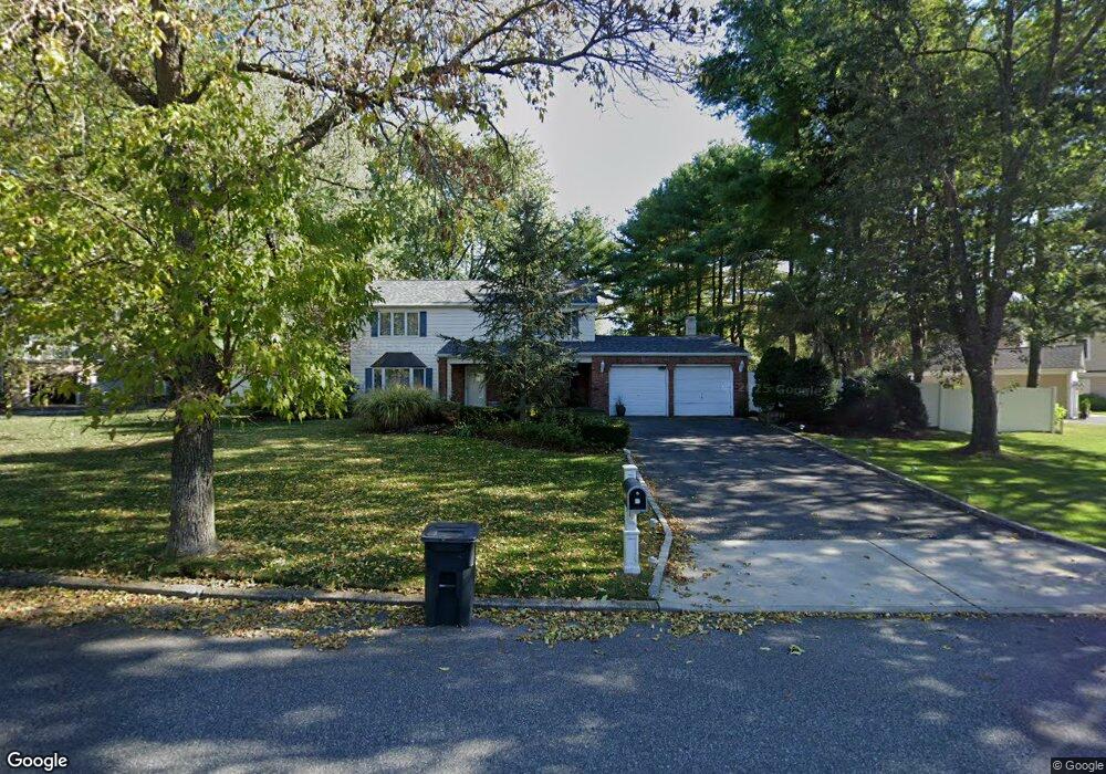
7 Manchester Ln Stony Brook, NY 11790
Estimated Value: $716,000 - $887,000
4
Beds
2
Baths
2,756
Sq Ft
$288/Sq Ft
Est. Value
About This Home
This home is located at 7 Manchester Ln, Stony Brook, NY 11790 and is currently estimated at $794,448, approximately $288 per square foot. 7 Manchester Ln is a home located in Suffolk County with nearby schools including William Sidney Mount School, Robert Cushman Murphy Junior High School, and Ward Melville Senior High School.
Ownership History
Date
Name
Owned For
Owner Type
Purchase Details
Closed on
Jan 23, 2018
Sold by
Whyte Chenee
Bought by
Cruickshank Shirley
Current Estimated Value
Purchase Details
Closed on
Jan 12, 2017
Sold by
Cruickshank Shirley and Estate Of Emerson Cruickshank
Bought by
Cruickshank Shirley
Purchase Details
Closed on
Oct 9, 1998
Sold by
Marino William
Bought by
Cruickshank Emerson
Home Financials for this Owner
Home Financials are based on the most recent Mortgage that was taken out on this home.
Original Mortgage
$247,500
Interest Rate
11.87%
Create a Home Valuation Report for This Property
The Home Valuation Report is an in-depth analysis detailing your home's value as well as a comparison with similar homes in the area
Home Values in the Area
Average Home Value in this Area
Purchase History
| Date | Buyer | Sale Price | Title Company |
|---|---|---|---|
| Cruickshank Shirley | -- | -- | |
| Cruickshank Shirley | -- | None Available | |
| Cruickshank Emerson | $275,000 | -- |
Source: Public Records
Mortgage History
| Date | Status | Borrower | Loan Amount |
|---|---|---|---|
| Previous Owner | Cruickshank Emerson | $247,500 |
Source: Public Records
Tax History Compared to Growth
Tax History
| Year | Tax Paid | Tax Assessment Tax Assessment Total Assessment is a certain percentage of the fair market value that is determined by local assessors to be the total taxable value of land and additions on the property. | Land | Improvement |
|---|---|---|---|---|
| 2024 | $14,436 | $3,745 | $350 | $3,395 |
| 2023 | $14,436 | $3,745 | $350 | $3,395 |
| 2022 | $12,874 | $3,745 | $350 | $3,395 |
| 2021 | $12,874 | $3,745 | $350 | $3,395 |
| 2020 | $13,288 | $3,745 | $350 | $3,395 |
| 2019 | $13,288 | $0 | $0 | $0 |
| 2018 | $13,741 | $3,745 | $350 | $3,395 |
| 2017 | $13,741 | $3,745 | $350 | $3,395 |
| 2016 | $13,507 | $3,745 | $350 | $3,395 |
| 2015 | -- | $3,745 | $350 | $3,395 |
| 2014 | -- | $3,745 | $350 | $3,395 |
Source: Public Records
Map
Nearby Homes
- 37 Malvern Ln
- 4 Mystic Ct
- 419 Elton Ct E
- 51 Glenridge Ave
- 501 Drew Dr
- 6 Freshman Ln
- 107 Fairfield Dr N
- 43 Millbrook Dr
- 7 Pensdale Ct
- 3 Bowen Place
- 1 University Heights Dr
- 914 Fenway Rd
- 908 Fenway Rd
- 39 Pembrook Dr
- 704 Cabot Ct W Unit C704
- 182 Strathmore Gate Dr
- 404 Oxhead Rd
- 607 Cabot Ct E Unit C607
- 106 Cabot Ct W
- 155 Knolls Dr Unit 155