Estimated Value: $358,000 - $429,000
3
Beds
2
Baths
1,498
Sq Ft
$255/Sq Ft
Est. Value
About This Home
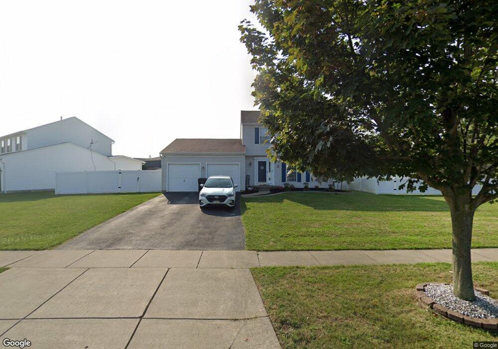
This home is located at 7 Michael Anthony Ln, Depew, NY 14043 and is currently estimated at $382,679, approximately $255 per square foot. 7 Michael Anthony Ln is a home located in Erie County with nearby schools including William Street School, Lancaster Middle School, and Lancaster High School.
Ownership History
Date
Name
Owned For
Owner Type
Purchase Details
Closed on
May 4, 2017
Sold by
Mazuca Carly and The Estate Of Michael E Mazuca
Bought by
Dunn Greegry A and Dunn Jamie M
Current Estimated Value
Purchase Details
Closed on
Sep 29, 1997
Sold by
Nvr Homes Inc
Bought by
Mazuca Michael E and Mazuca Jacquelyn M
Purchase Details
Closed on
Jul 1, 1997
Sold by
M A Tufillaro Bldrs Inc
Bought by
Nvr Homes Ind and D/B/A Ryan Homes
Create a Home Valuation Report for This Property
The Home Valuation Report is an in-depth analysis detailing your home's value as well as a comparison with similar homes in the area
Home Values in the Area
Average Home Value in this Area
Purchase History
| Date | Buyer | Sale Price | Title Company |
|---|---|---|---|
| Dunn Greegry A | $180,000 | None Available | |
| Dunn Greegry A | $180,000 | None Available | |
| Dunn Greegry A | $180,000 | None Available | |
| Mazuca Michael E | $114,300 | -- | |
| Mazuca Michael E | $114,300 | -- | |
| Nvr Homes Ind | $25,000 | -- | |
| Nvr Homes Ind | $25,000 | -- |
Source: Public Records
Tax History
| Year | Tax Paid | Tax Assessment Tax Assessment Total Assessment is a certain percentage of the fair market value that is determined by local assessors to be the total taxable value of land and additions on the property. | Land | Improvement |
|---|---|---|---|---|
| 2024 | $6,407 | $224,000 | $70,000 | $154,000 |
| 2023 | $6,384 | $224,000 | $70,000 | $154,000 |
| 2022 | $6,209 | $224,000 | $70,000 | $154,000 |
| 2021 | $6,134 | $224,000 | $70,000 | $154,000 |
| 2020 | $6,420 | $224,000 | $70,000 | $154,000 |
| 2019 | $5,078 | $186,000 | $35,000 | $151,000 |
| 2018 | $6,618 | $186,000 | $35,000 | $151,000 |
| 2017 | $2,708 | $186,000 | $35,000 | $151,000 |
| 2016 | $5,116 | $186,000 | $35,000 | $151,000 |
| 2015 | -- | $186,000 | $35,000 | $151,000 |
| 2014 | -- | $186,000 | $35,000 | $151,000 |
Source: Public Records
Map
Nearby Homes
- 4830 Transit Rd
- 12 Northwood Dr
- 45 Woodgate Dr
- 11 Cidermill Ct
- 47 Armond Ln
- 23 Woodgate Dr
- 64 Northwood Dr
- 4858 William St
- 30 Willow Ridge Ln
- 1363 Losson Rd
- 43 Old Post Rd
- 0 Wendel St
- 27 Basswood Dr
- 106 Croydon Dr
- 467 Aurora St
- 457 Aurora St
- 16 Oakwood Dr
- 17 Oakwood Dr
- 63 Sprucewood Dr
- 96 Penwood Dr
- 9 Michael Anthony Ln
- 11 Michael Anthony Ln
- 4 Michael Anthony Ln
- 6 Michael Anthony Ln
- 8 Michael Anthony Ln
- 15 Michael Anthony Ln
- 10 Michael Anthony Ln
- 17 Michael Anthony Ln
- 14 Michael Anthony Ln
- 12 Michael Anthony Ln
- 19 Michael Anthony Ln
- 16 Michael Anthony Ln
- 2 Michael Anthony Ln
- 21 Michael Anthony Ln
- 18 Michael Anthony Ln
- 20 Michael Anthony Ln
- 23 Michael Anthony Ln
- 22 Michael Anthony Ln
- 25 Michael Anthony Ln
- 24 Michael Anthony Ln
Your Personal Tour Guide
Ask me questions while you tour the home.