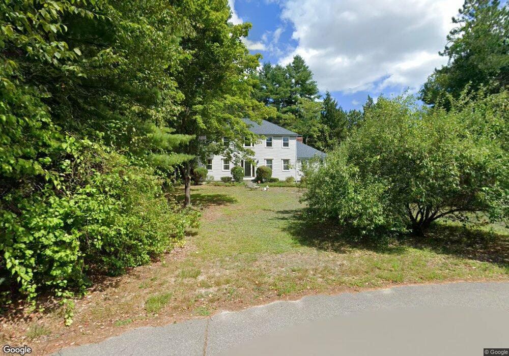
7 Muscatanipus Rd Brookline, NH 03033
Estimated Value: $653,178 - $724,000
3
Beds
3
Baths
2,645
Sq Ft
$261/Sq Ft
Est. Value
About This Home
This home is located at 7 Muscatanipus Rd, Brookline, NH 03033 and is currently estimated at $691,545, approximately $261 per square foot. 7 Muscatanipus Rd is a home with nearby schools including Richard Maghakian Memorial School, Captain Samuel Douglass Academy, and Hollis-Brookline Middle School.
Ownership History
Date
Name
Owned For
Owner Type
Purchase Details
Closed on
Dec 29, 2000
Sold by
Howser Eric M and Howser Bonnie-Lee
Bought by
Hall Thomas R
Current Estimated Value
Home Financials for this Owner
Home Financials are based on the most recent Mortgage that was taken out on this home.
Original Mortgage
$150,000
Interest Rate
7.7%
Purchase Details
Closed on
Jun 12, 1998
Sold by
Martin Dennis J and Martin Patricia L
Bought by
Howser Eric M and Howser Bonnie Lee M
Home Financials for this Owner
Home Financials are based on the most recent Mortgage that was taken out on this home.
Original Mortgage
$143,000
Interest Rate
7.11%
Purchase Details
Closed on
Sep 23, 1996
Sold by
Ross William J and Ross Kathy R
Bought by
Martin Dennis J and Martin Patricia L
Home Financials for this Owner
Home Financials are based on the most recent Mortgage that was taken out on this home.
Original Mortgage
$173,700
Interest Rate
7.89%
Create a Home Valuation Report for This Property
The Home Valuation Report is an in-depth analysis detailing your home's value as well as a comparison with similar homes in the area
Home Values in the Area
Average Home Value in this Area
Purchase History
| Date | Buyer | Sale Price | Title Company |
|---|---|---|---|
| Hall Thomas R | $273,000 | -- | |
| Howser Eric M | $209,500 | -- | |
| Martin Dennis J | $193,000 | -- |
Source: Public Records
Mortgage History
| Date | Status | Borrower | Loan Amount |
|---|---|---|---|
| Open | Martin Dennis J | $111,000 | |
| Closed | Martin Dennis J | $150,000 | |
| Previous Owner | Martin Dennis J | $143,000 | |
| Previous Owner | Martin Dennis J | $173,700 |
Source: Public Records
Tax History Compared to Growth
Tax History
| Year | Tax Paid | Tax Assessment Tax Assessment Total Assessment is a certain percentage of the fair market value that is determined by local assessors to be the total taxable value of land and additions on the property. | Land | Improvement |
|---|---|---|---|---|
| 2024 | $13,075 | $578,300 | $199,500 | $378,800 |
| 2023 | $12,017 | $578,300 | $199,500 | $378,800 |
| 2022 | $10,411 | $350,300 | $120,100 | $230,200 |
| 2021 | $10,012 | $350,300 | $120,100 | $230,200 |
| 2020 | $9,738 | $350,300 | $120,100 | $230,200 |
| 2019 | $10,463 | $350,300 | $120,100 | $230,200 |
| 2018 | $10,355 | $350,300 | $120,100 | $230,200 |
| 2017 | $9,026 | $274,000 | $97,100 | $176,900 |
| 2016 | $8,866 | $272,300 | $97,100 | $175,200 |
| 2015 | $8,455 | $272,300 | $97,100 | $175,200 |
| 2014 | $8,945 | $272,300 | $97,100 | $175,200 |
| 2013 | $8,613 | $272,300 | $97,100 | $175,200 |
Source: Public Records
Map
Nearby Homes
- 7 Winterberry Rd
- 9 Winterberry Rd
- 15 N End Rd
- 46 Oak Hill Rd
- 364 Townsend Hill Rd
- 55 Oak Hill Rd
- 6 High Oaks Path
- 6 Flint Meadow Dr
- 0 Brookline St
- 21 Cranberry St
- 22 Hobart Hill Rd
- 64 Meadow Rd
- 167 Route 13
- 28A Rocky Pond Rd
- 1235 Townsend Rd
- 5 Carons Way
- 110 Haynes Rd
- 179 Brookline St
- 91 Highland St
- 143 Worcester Rd
- 10 Muscatanipus Rd
- 8 Muscatanipus Rd
- 5 Muscatanipus Rd
- 4 Muscatanipus Rd
- 6 Muscatanipus Rd
- 7 Averill Rd
- 5 Averill Rd
- 8 Eastman Dr
- 9 Eastman Dr
- 6 Averill Rd
- 6 Baldwin Ln
- 40 Wildwood Dr
- 21 Averill Rd
- 9 Baldwin Dr
- 3 Averill Rd
- 5 Eastman Dr
- 5 Eastman Dr Unit J-16-6
- 18 Averill Rd
- 6 Eastman Dr
- 5 Barnaby Way