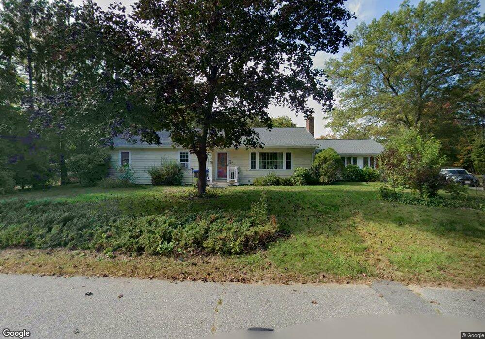
7 Myles Standish Rd Lancaster, MA 01523
Estimated Value: $542,000 - $685,000
3
Beds
2
Baths
1,623
Sq Ft
$366/Sq Ft
Est. Value
About This Home
This home is located at 7 Myles Standish Rd, Lancaster, MA 01523 and is currently estimated at $594,734, approximately $366 per square foot. 7 Myles Standish Rd is a home located in Worcester County with nearby schools including Mary Rowlandson Elementary School, Luther Burbank Middle School, and Nashoba Regional High School.
Ownership History
Date
Name
Owned For
Owner Type
Purchase Details
Closed on
Jun 29, 2011
Sold by
Hyde John D and Hyde Margaret L
Bought by
Sumner Glenn
Current Estimated Value
Home Financials for this Owner
Home Financials are based on the most recent Mortgage that was taken out on this home.
Original Mortgage
$257,655
Outstanding Balance
$178,177
Interest Rate
4.62%
Mortgage Type
Purchase Money Mortgage
Estimated Equity
$416,557
Purchase Details
Closed on
Jul 29, 2004
Sold by
Constantino Paul E
Bought by
Hyde John D and Hyde Margaret L
Home Financials for this Owner
Home Financials are based on the most recent Mortgage that was taken out on this home.
Original Mortgage
$252,800
Interest Rate
6.33%
Mortgage Type
Purchase Money Mortgage
Create a Home Valuation Report for This Property
The Home Valuation Report is an in-depth analysis detailing your home's value as well as a comparison with similar homes in the area
Home Values in the Area
Average Home Value in this Area
Purchase History
| Date | Buyer | Sale Price | Title Company |
|---|---|---|---|
| Sumner Glenn | $267,000 | -- | |
| Hyde John D | $316,000 | -- |
Source: Public Records
Mortgage History
| Date | Status | Borrower | Loan Amount |
|---|---|---|---|
| Open | Sumner Glenn | $257,655 | |
| Previous Owner | Hyde John D | $252,800 |
Source: Public Records
Tax History Compared to Growth
Tax History
| Year | Tax Paid | Tax Assessment Tax Assessment Total Assessment is a certain percentage of the fair market value that is determined by local assessors to be the total taxable value of land and additions on the property. | Land | Improvement |
|---|---|---|---|---|
| 2025 | $8,321 | $514,900 | $104,700 | $410,200 |
| 2024 | $8,372 | $479,500 | $97,400 | $382,100 |
| 2023 | $7,705 | $448,200 | $88,600 | $359,600 |
| 2022 | $7,101 | $365,100 | $91,900 | $273,200 |
| 2021 | $6,891 | $344,900 | $91,900 | $253,000 |
| 2020 | $6,713 | $338,200 | $91,900 | $246,300 |
| 2019 | $6,121 | $309,900 | $91,900 | $218,000 |
| 2018 | $5,696 | $285,100 | $91,900 | $193,200 |
| 2016 | $5,273 | $269,700 | $91,100 | $178,600 |
| 2015 | $5,071 | $270,300 | $91,100 | $179,200 |
| 2014 | $4,977 | $263,200 | $91,100 | $172,100 |
Source: Public Records
Map
Nearby Homes
- 0 Parker Rd
- 19 Magnolia Ave
- 22 Forest Ave
- 201-203 Stone St
- 201 Stone St Unit 203
- 1 Grady St
- 54 S Meadow Rd
- 51 Rigby St
- 1116 George Hill Rd
- 57 Clark St
- 290 Sterling St
- 92 Mill St
- 55 Sterling St Unit 306
- 55 Sterling St Unit 314
- 55 Sterling St Unit 212
- 23 Bennett Ln
- 136 Mill St
- 29 Bennett Ln
- 85 Prescott St
- 132 Kilbourn Rd
- 14 Myles Standish Rd
- 37 Plymouth Dr
- 19 Myles Standish Rd
- 23 Plymouth Dr
- 40 Pilgrim Rd
- 50 Pilgrim Rd
- 62 Pilgrim Rd
- 74 Pilgrim Rd
- 13 Plymouth Dr
- 22 Plymouth Dr
- 1 Myles Standish Rd
- 2 Mayflower Dr
- 32 Mayflower Dr
- 358 Parker Rd
- 426 Parker Rd
- 408 Parker Rd
- 440 Parker Rd
- 344 Parker Rd
- 100 Pilgrim Rd
- 380 Parker Rd