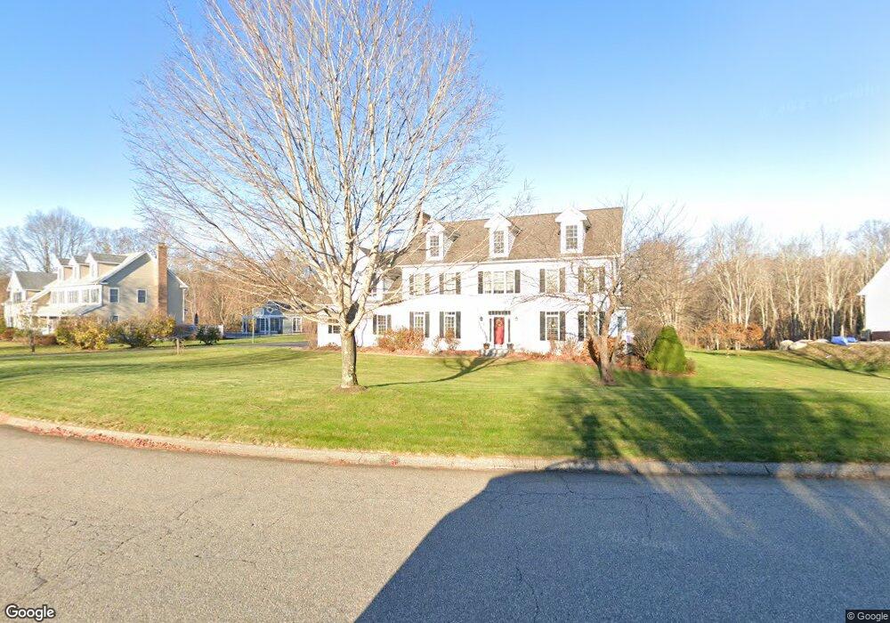
7 Nathan Hale Dr East Lyme, CT 06333
Estimated Value: $691,000 - $975,814
4
Beds
3
Baths
3,447
Sq Ft
$254/Sq Ft
Est. Value
About This Home
This home is located at 7 Nathan Hale Dr, East Lyme, CT 06333 and is currently estimated at $876,954, approximately $254 per square foot. 7 Nathan Hale Dr is a home located in New London County with nearby schools including East Lyme Middle School and East Lyme High School.
Ownership History
Date
Name
Owned For
Owner Type
Purchase Details
Closed on
Feb 27, 2004
Sold by
Custom Lands Llc
Bought by
Hausberger Martin C and Hausberger Angela G
Current Estimated Value
Home Financials for this Owner
Home Financials are based on the most recent Mortgage that was taken out on this home.
Original Mortgage
$495,000
Interest Rate
4.5%
Create a Home Valuation Report for This Property
The Home Valuation Report is an in-depth analysis detailing your home's value as well as a comparison with similar homes in the area
Home Values in the Area
Average Home Value in this Area
Purchase History
| Date | Buyer | Sale Price | Title Company |
|---|---|---|---|
| Hausberger Martin C | $689,900 | -- |
Source: Public Records
Mortgage History
| Date | Status | Borrower | Loan Amount |
|---|---|---|---|
| Open | Hausberger Martin C | $30,000 | |
| Open | Hausberger Martin C | $379,000 | |
| Closed | Hausberger Martin C | $50,000 | |
| Closed | Hausberger Martin C | $495,000 |
Source: Public Records
Tax History Compared to Growth
Tax History
| Year | Tax Paid | Tax Assessment Tax Assessment Total Assessment is a certain percentage of the fair market value that is determined by local assessors to be the total taxable value of land and additions on the property. | Land | Improvement |
|---|---|---|---|---|
| 2025 | $13,560 | $484,120 | $140,000 | $344,120 |
| 2024 | $12,757 | $484,120 | $140,000 | $344,120 |
| 2023 | $12,045 | $484,120 | $140,000 | $344,120 |
| 2022 | $11,541 | $484,120 | $140,000 | $344,120 |
| 2021 | $11,254 | $394,730 | $145,110 | $249,620 |
| 2020 | $11,433 | $403,130 | $145,110 | $258,020 |
| 2019 | $11,364 | $403,130 | $145,110 | $258,020 |
| 2018 | $11,026 | $403,130 | $145,110 | $258,020 |
| 2017 | $10,546 | $403,130 | $145,110 | $258,020 |
| 2016 | $9,936 | $391,790 | $134,820 | $256,970 |
| 2015 | $9,681 | $391,790 | $134,820 | $256,970 |
| 2014 | $9,415 | $391,790 | $134,820 | $256,970 |
Source: Public Records
Map
Nearby Homes
- 270 N Bride Brook Rd
- 6 Marion Dr
- 13 Willow Ln
- 223 N Bride Brook Rd
- 25 Marion Dr
- 496 Boston Post Rd
- 28 Alexander Dr
- 5 Pumpkin Grove
- 11 Pumpkin Grove
- 20 Sunrise Trail
- 14 Pumpkin Grove
- 33 Arbor Crossing
- 72 Society Rd
- 57 Spring Rock Rd
- Waramaug Plan at Riverside Reserve
- Highland Plan at Riverside Reserve
- Hayward Plan at Riverside Reserve
- Ashford Plan at Riverside Reserve
- Lillinonah Plan at Riverside Reserve
- 16 Twin Valley Rd
- 9 Nathan Hale Dr
- 3(lot 15) Nathan Hale Dr Unit Lot 15
- 3 Nathan Hale Dr
- 10 Nathan Hale Dr
- 4 Nathan Hale Dr
- 16 Nathan Hale Dr
- 11 Nathan Hale Dr Unit Lot 12
- 11 Nathan Hale Dr
- 14 Nathan Hale Dr
- 26 Nathan Hale Dr
- 25 Dean Rd
- 31 Dean Rd
- 2 Nathan Hale Dr
- 18 Nathan Hale Dr
- 12 Nathan Hale Dr
- 15 Nathan Hale Dr
- 20 Nathan Hale Dr
- 6 Nathan Hale Dr Unit Lot 2
- 6 Nathan Hale Dr
- 8 Nathan Hale Dr Unit Lot 3