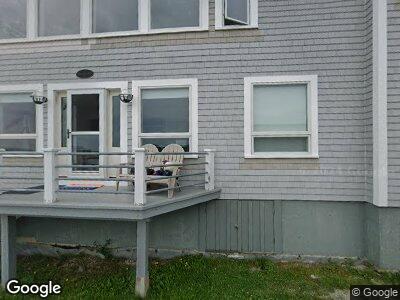
7 Ocean St Stonington, ME 04681
Estimated Value: $495,000 - $870,000
3
Beds
2
Baths
1,782
Sq Ft
$429/Sq Ft
Est. Value
About This Home
This home is located at 7 Ocean St, Stonington, ME 04681 and is currently estimated at $764,551, approximately $429 per square foot. 7 Ocean St is a home located in Hancock County with nearby schools including Deer Isle-Stonington Elementary School, Deer Isle-Stonington High School, and The Heritage School.
Ownership History
Date
Name
Owned For
Owner Type
Purchase Details
Closed on
Sep 24, 2021
Sold by
Eremita Ret
Bought by
Hartman Mark S
Current Estimated Value
Home Financials for this Owner
Home Financials are based on the most recent Mortgage that was taken out on this home.
Original Mortgage
$470,000
Outstanding Balance
$432,299
Interest Rate
2.8%
Mortgage Type
Purchase Money Mortgage
Estimated Equity
$332,252
Create a Home Valuation Report for This Property
The Home Valuation Report is an in-depth analysis detailing your home's value as well as a comparison with similar homes in the area
Home Values in the Area
Average Home Value in this Area
Purchase History
| Date | Buyer | Sale Price | Title Company |
|---|---|---|---|
| Hartman Mark S | -- | None Available |
Source: Public Records
Mortgage History
| Date | Status | Borrower | Loan Amount |
|---|---|---|---|
| Open | Hartman Mark S | $470,000 |
Source: Public Records
Tax History Compared to Growth
Tax History
| Year | Tax Paid | Tax Assessment Tax Assessment Total Assessment is a certain percentage of the fair market value that is determined by local assessors to be the total taxable value of land and additions on the property. | Land | Improvement |
|---|---|---|---|---|
| 2024 | $6,323 | $623,000 | $364,900 | $258,100 |
| 2023 | $5,622 | $361,300 | $243,300 | $118,000 |
| 2022 | $5,622 | $361,300 | $243,300 | $118,000 |
| 2021 | $5,672 | $361,300 | $243,300 | $118,000 |
| 2020 | $5,672 | $361,300 | $243,300 | $118,000 |
| 2019 | $5,745 | $361,300 | $243,300 | $118,000 |
| 2018 | $5,817 | $361,300 | $243,300 | $118,000 |
| 2017 | $5,821 | $361,300 | $243,300 | $118,000 |
| 2016 | $6,809 | $402,900 | $243,300 | $159,600 |
| 2015 | $6,910 | $402,900 | $243,300 | $159,600 |
| 2014 | $6,084 | $402,900 | $243,300 | $159,600 |
| 2013 | $5,713 | $402,900 | $243,300 | $159,600 |
Source: Public Records
Map
Nearby Homes
- 36 Green Head Rd
- 68 Main St Unit 3
- 11 Larrabee Rd
- 41 Thurlows Hill Rd
- 7 N Main St
- 12-6 S Burnt Cove Rd
- 12-4 S Burnt Cove Rd
- 12-2 S Burnt Cove Rd
- 12-1 S Burnt Cove Rd
- 12-3 S Burnt Cove Rd
- 18 Evergreen Ct
- 176 N Main St
- 37 Walker Point Rd
- 32 Burnt Cove Rd
- 18 Davids Way
- 17 Barbour Farm Rd
- M4 L31 Stanley Field Rd
- 145 Stanley Field Rd
- 92 Spruce Harbor Trail
- 22 Warren Point Unit Lot 1