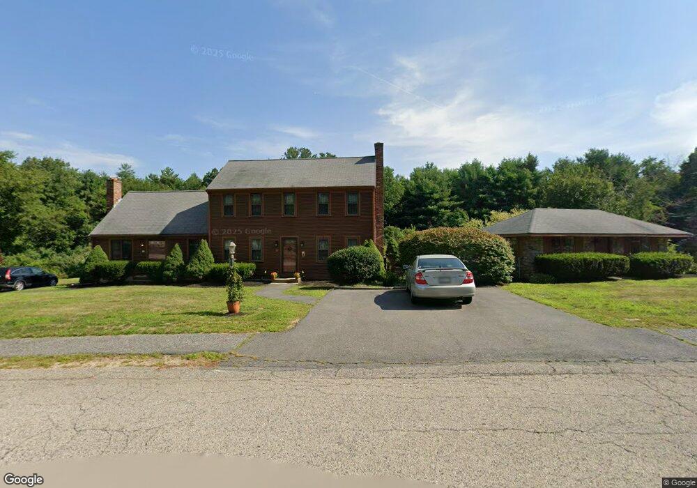
7 Packet Landing Unit A Pembroke, MA 02359
Estimated Value: $508,400 - $546,000
2
Beds
2
Baths
1,490
Sq Ft
$349/Sq Ft
Est. Value
About This Home
This home is located at 7 Packet Landing Unit A, Pembroke, MA 02359 and is currently estimated at $519,350, approximately $348 per square foot. 7 Packet Landing Unit A is a home located in Plymouth County with nearby schools including Pembroke High School, Cadence Academy Preschool - Hanover, and Cardinal Cushing Centers.
Ownership History
Date
Name
Owned For
Owner Type
Purchase Details
Closed on
Apr 1, 2002
Sold by
Mitchell Thomas S and Mitchell Ellen A
Bought by
Lotti Carol L
Current Estimated Value
Home Financials for this Owner
Home Financials are based on the most recent Mortgage that was taken out on this home.
Original Mortgage
$121,000
Interest Rate
6.88%
Mortgage Type
Purchase Money Mortgage
Purchase Details
Closed on
Jul 29, 1999
Sold by
Keegan Thomas S and Keegan Sean P
Bought by
Mitchell Thoma S and Gorham Ellen
Home Financials for this Owner
Home Financials are based on the most recent Mortgage that was taken out on this home.
Original Mortgage
$152,000
Interest Rate
7.61%
Mortgage Type
Purchase Money Mortgage
Purchase Details
Closed on
Jul 18, 1994
Sold by
Iag Fcu
Bought by
Powers Suzanne B
Home Financials for this Owner
Home Financials are based on the most recent Mortgage that was taken out on this home.
Original Mortgage
$104,400
Interest Rate
8.51%
Mortgage Type
Purchase Money Mortgage
Create a Home Valuation Report for This Property
The Home Valuation Report is an in-depth analysis detailing your home's value as well as a comparison with similar homes in the area
Home Values in the Area
Average Home Value in this Area
Purchase History
| Date | Buyer | Sale Price | Title Company |
|---|---|---|---|
| Lotti Carol L | $245,900 | -- | |
| Mitchell Thoma S | $160,000 | -- | |
| Powers Suzanne B | $116,000 | -- |
Source: Public Records
Mortgage History
| Date | Status | Borrower | Loan Amount |
|---|---|---|---|
| Open | Powers Suzanne B | $100,000 | |
| Closed | Powers Suzanne B | $121,000 | |
| Previous Owner | Powers Suzanne B | $152,000 | |
| Previous Owner | Powers Suzanne B | $104,400 |
Source: Public Records
Tax History Compared to Growth
Tax History
| Year | Tax Paid | Tax Assessment Tax Assessment Total Assessment is a certain percentage of the fair market value that is determined by local assessors to be the total taxable value of land and additions on the property. | Land | Improvement |
|---|---|---|---|---|
| 2025 | $5,252 | $436,900 | $0 | $436,900 |
| 2024 | $5,029 | $418,000 | $0 | $418,000 |
| 2023 | $4,771 | $375,100 | $0 | $375,100 |
| 2022 | $4,708 | $332,700 | $0 | $332,700 |
| 2021 | $4,317 | $296,100 | $0 | $296,100 |
| 2020 | $4,624 | $319,100 | $0 | $319,100 |
| 2019 | $4,405 | $301,700 | $0 | $301,700 |
| 2018 | $4,107 | $275,800 | $0 | $275,800 |
| 2017 | $4,027 | $266,700 | $0 | $266,700 |
| 2016 | $3,533 | $231,500 | $0 | $231,500 |
| 2015 | $3,429 | $232,600 | $0 | $232,600 |
Source: Public Records
Map
Nearby Homes
- 21 Union St
- 21 Chowdermarch St
- 218 Schoosett St
- 5 Royal Dane Dr Unit 46
- 5 Royal Dane Dr Unit 45
- 10 Penstock Ln
- 451 School St Unit 5-2
- 451 School St Unit 3-4
- 55 Shipyard Ln
- 34 Canonchet Trail
- 172 Washington St
- 261 Washington St
- 10 Shrine Rd
- 20 Meadow Brook Rd
- 26 Church St
- 56 Wiltshire Ln
- 899 Old Main Street Extension
- 33 Barker Square Dr Unit 33
- 2 Proprietors Dr Unit 23
- 1 Valley Path
- 7 Packet Landing Unit B
- 3 Packet Landing Unit B
- 3 Packet Landing Unit A
- 3 Packet Landing Unit 3B
- 3 Packet Landing
- 13 Packet Landing Unit B
- 13 Packet Landing Unit A
- 8 Packet Landing Unit B
- 8 Packet Landing Unit A
- 8 Packet Landing
- 19 Packet Landing Unit B
- 19 Packet Landing Unit A
- 19 Packet Landing
- 19 Packet Landing Unit 19A
- 16 Packet Landing Unit B
- 16 Packet Landing Unit A
- 16 Packet Landing Unit 16B
- 22 Packet Landing Unit B
- 22 Packet Landing Unit A
- 22 Packet Landing Unit 6