Estimated Value: $799,150 - $930,000
4
Beds
2
Baths
1,846
Sq Ft
$472/Sq Ft
Est. Value
About This Home
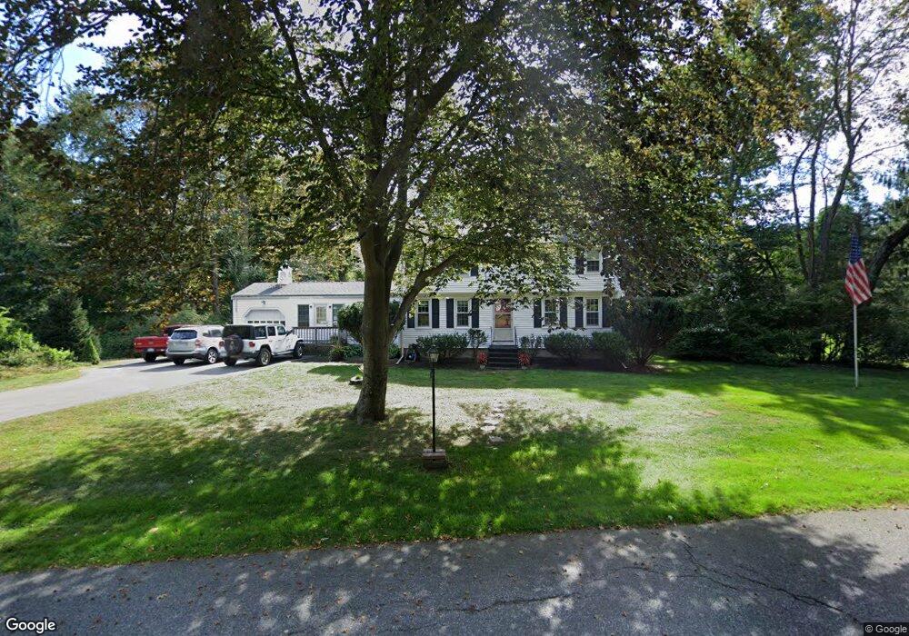
This home is located at 7 Paul Revere Rd, Acton, MA 01720 and is currently estimated at $870,788, approximately $471 per square foot. 7 Paul Revere Rd is a home located in Middlesex County with nearby schools including Acton-Boxborough Regional High School.
Ownership History
Date
Name
Owned For
Owner Type
Purchase Details
Closed on
Feb 26, 1987
Sold by
Sanford Gerald L
Bought by
Holmes Richard B
Current Estimated Value
Home Financials for this Owner
Home Financials are based on the most recent Mortgage that was taken out on this home.
Original Mortgage
$100,000
Interest Rate
9.19%
Mortgage Type
Purchase Money Mortgage
Create a Home Valuation Report for This Property
The Home Valuation Report is an in-depth analysis detailing your home's value as well as a comparison with similar homes in the area
Home Values in the Area
Average Home Value in this Area
Purchase History
| Date | Buyer | Sale Price | Title Company |
|---|---|---|---|
| Holmes Richard B | $213,500 | -- |
Source: Public Records
Mortgage History
| Date | Status | Borrower | Loan Amount |
|---|---|---|---|
| Open | Holmes Richard B | $190,000 | |
| Closed | Holmes Richard B | $100,000 |
Source: Public Records
Tax History Compared to Growth
Tax History
| Year | Tax Paid | Tax Assessment Tax Assessment Total Assessment is a certain percentage of the fair market value that is determined by local assessors to be the total taxable value of land and additions on the property. | Land | Improvement |
|---|---|---|---|---|
| 2025 | $12,137 | $707,700 | $343,800 | $363,900 |
| 2024 | $11,409 | $684,400 | $343,800 | $340,600 |
| 2023 | $11,093 | $631,700 | $312,600 | $319,100 |
| 2022 | $10,517 | $540,700 | $271,800 | $268,900 |
| 2021 | $10,388 | $513,500 | $251,400 | $262,100 |
| 2020 | $10,805 | $561,600 | $251,400 | $310,200 |
| 2019 | $10,355 | $534,600 | $251,400 | $283,200 |
| 2018 | $10,186 | $525,600 | $251,400 | $274,200 |
| 2017 | $9,930 | $521,000 | $251,400 | $269,600 |
| 2016 | $9,759 | $507,500 | $251,400 | $256,100 |
| 2015 | $9,723 | $510,400 | $251,400 | $259,000 |
| 2014 | $9,429 | $484,800 | $251,400 | $233,400 |
Source: Public Records
Map
Nearby Homes
- 12 Olde Lantern Rd
- 92 Willow St Unit 3
- 92 Willow St Unit 2
- 90 Willow St Unit 1
- 68 Macintosh Ln
- 96 Cedarwood Rd
- 3 Heather Hill Rd
- 134 Russet Ln
- 89 Windsor Ave
- 285 Central St Unit 285
- 4,7,8 Crestwood Ln
- 5 Elm St Unit 1
- 9 Elm St Unit 1
- 31 Mohawk Dr
- 207 Boxboro Rd
- 777 Depot Rd
- 169 Main St
- 220 Red Acre Rd
- 19 Railroad St Unit C2
- 30-6 Taylor Rd
- 9 Paul Revere Rd
- 5 Paul Revere Rd
- 25 Paul Revere Rd
- 8 Paul Revere Rd
- 27 Paul Revere Rd
- 11 Paul Revere Rd
- 6 Paul Revere Rd
- 23 Paul Revere Rd
- 3 Paul Revere Rd
- 10 Paul Revere Rd
- 29 Paul Revere Rd
- 13 Paul Revere Rd
- 28 Paul Revere Rd
- 12 Paul Revere Rd
- 4 Paul Revere Rd
- 26 Paul Revere Rd
- 3 Betsy Ross Cir
- 19 Paul Revere Rd
- 21 Paul Revere Rd
- 1 Paul Revere Rd