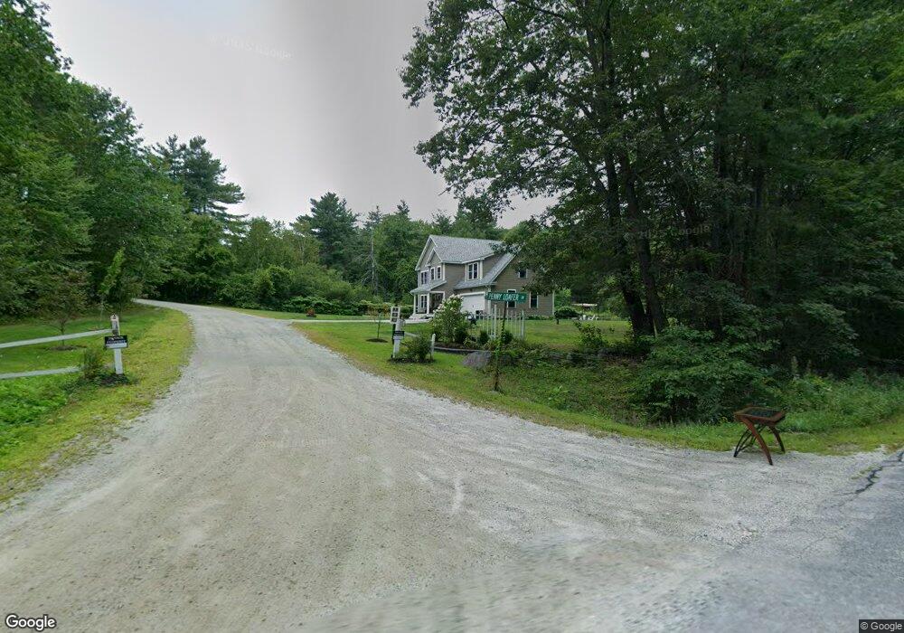
7 Penny Loafer Ln Wilton, NH 03086
Estimated Value: $440,000 - $570,118
3
Beds
3
Baths
1,374
Sq Ft
$378/Sq Ft
Est. Value
About This Home
This home is located at 7 Penny Loafer Ln, Wilton, NH 03086 and is currently estimated at $518,780, approximately $377 per square foot. 7 Penny Loafer Ln is a home with nearby schools including Florence Rideout Elementary School, Wilton-Lyndeborough Cooperative Middle School, and Wilton-Lyndeborough Cooperative High School.
Ownership History
Date
Name
Owned For
Owner Type
Purchase Details
Closed on
Mar 7, 1997
Sold by
Gibbons William J
Bought by
Shoemaker Land Assoc L
Current Estimated Value
Home Financials for this Owner
Home Financials are based on the most recent Mortgage that was taken out on this home.
Original Mortgage
$250,000
Outstanding Balance
$30,397
Interest Rate
7.77%
Mortgage Type
Purchase Money Mortgage
Estimated Equity
$488,383
Create a Home Valuation Report for This Property
The Home Valuation Report is an in-depth analysis detailing your home's value as well as a comparison with similar homes in the area
Home Values in the Area
Average Home Value in this Area
Purchase History
| Date | Buyer | Sale Price | Title Company |
|---|---|---|---|
| Shoemaker Land Assoc L | $125,000 | -- |
Source: Public Records
Mortgage History
| Date | Status | Borrower | Loan Amount |
|---|---|---|---|
| Open | Shoemaker Land Assoc L | $250,000 |
Source: Public Records
Tax History Compared to Growth
Tax History
| Year | Tax Paid | Tax Assessment Tax Assessment Total Assessment is a certain percentage of the fair market value that is determined by local assessors to be the total taxable value of land and additions on the property. | Land | Improvement |
|---|---|---|---|---|
| 2024 | $10,219 | $410,900 | $114,800 | $296,100 |
| 2023 | $9,122 | $410,900 | $114,800 | $296,100 |
| 2022 | $8,489 | $410,900 | $114,800 | $296,100 |
| 2021 | $7,963 | $414,300 | $114,800 | $299,500 |
| 2020 | $7,606 | $258,800 | $87,400 | $171,400 |
| 2019 | $2,117 | $72,900 | $72,900 | $0 |
| 2018 | $2,238 | $77,800 | $77,800 | $0 |
| 2017 | $2,114 | $77,800 | $77,800 | $0 |
| 2016 | $2,049 | $77,800 | $77,800 | $0 |
Source: Public Records
Map
Nearby Homes
- 415 Savage Rd
- Lot F-88-9 Aria Hill Dr
- F-88-10 Aria Hill Dr
- F-88-11 Aria Hill Dr
- F-88-12 Aria Hill Dr
- F-88-7 Aria Hill Dr
- 18 Richfield Way
- 30 Robbins Rd
- 134 Falcon Ridge Rd Unit 23
- 8 Maple St
- 294 Mason Rd
- 44 Burns Hill Rd
- 25 Burns Hill Rd
- F/88-5 McGettigan Rd
- F/88-4 McGettigan Rd
- 21 Ledgewood Rd
- 361 Captain Clark Hwy
- 43 Boxwood Cir
- 131 Badger Hill Dr
- 32 Larch Rd
- 107 McGettigan Rd
- 119 McGettigan Rd
- 97 McGettigan Rd
- 95 McGettigan Rd
- 127 McGettigan Rd
- 26 Penny Loafer Ln
- 90 McGettigan Rd
- 133 McGettigan Rd
- 34 Penny Loafer Ln
- 397 Savage Rd
- 421 Savage Rd
- 429 Savage Rd
- 21 Isaac Frye Hwy
- 149 McGettigan Rd
- 435 Savage Rd
- 155 McGettigan Rd
- 5 Isaac Frye Hwy
- 5 Isaac Frye Hwy
- 441 Savage Rd
- 387 Savage Rd