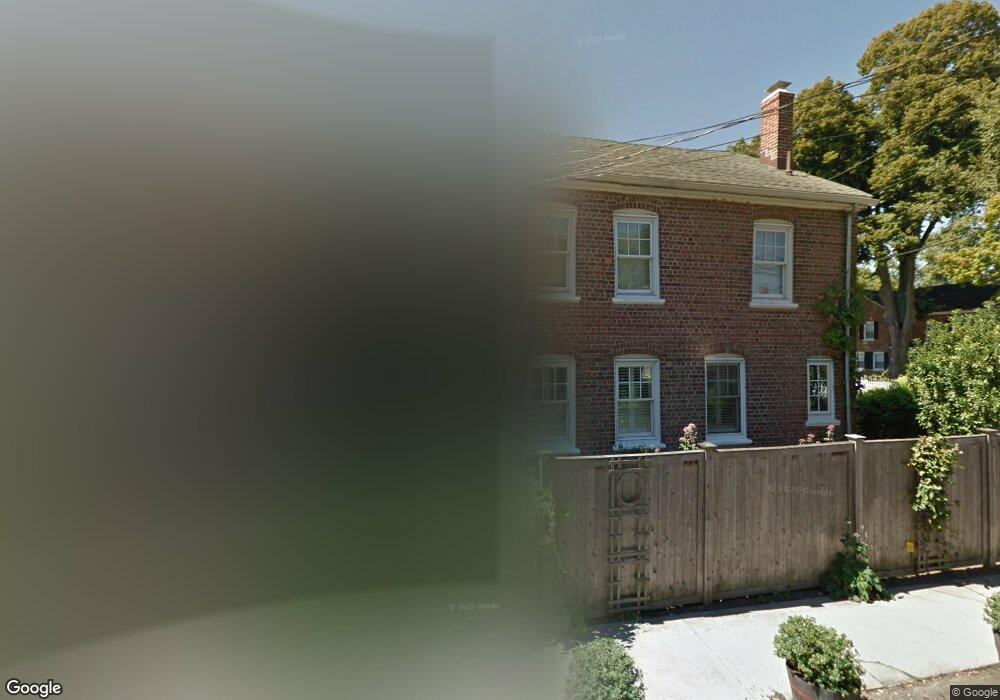
7 Plum St Fairfield, CT 06824
Fairfield Beach NeighborhoodEstimated Value: $524,000 - $572,000
3
Beds
1
Bath
1,300
Sq Ft
$416/Sq Ft
Est. Value
About This Home
This home is located at 7 Plum St, Fairfield, CT 06824 and is currently estimated at $541,395, approximately $416 per square foot. 7 Plum St is a home located in Fairfield County with nearby schools including Holland Hill Elementary, Fairfield Woods Middle School, and Fairfield Ludlowe High School.
Ownership History
Date
Name
Owned For
Owner Type
Purchase Details
Closed on
Jun 26, 2009
Sold by
Hanralian James and Hanralian Deborah
Bought by
Chase Gawry M
Current Estimated Value
Home Financials for this Owner
Home Financials are based on the most recent Mortgage that was taken out on this home.
Original Mortgage
$208,000
Interest Rate
4.92%
Purchase Details
Closed on
Dec 27, 2007
Sold by
Watson Tr Tony A and Watson Laurie E
Bought by
Hanrahan James and Hanrahan Deborah
Create a Home Valuation Report for This Property
The Home Valuation Report is an in-depth analysis detailing your home's value as well as a comparison with similar homes in the area
Home Values in the Area
Average Home Value in this Area
Purchase History
| Date | Buyer | Sale Price | Title Company |
|---|---|---|---|
| Chase Gawry M | $260,000 | -- | |
| Chase Gawry M | $260,000 | -- | |
| Hanrahan James | $160,000 | -- | |
| Hanrahan James | $160,000 | -- |
Source: Public Records
Mortgage History
| Date | Status | Borrower | Loan Amount |
|---|---|---|---|
| Open | Hanrahan James | $167,700 | |
| Closed | Hanrahan James | $208,000 |
Source: Public Records
Tax History
| Year | Tax Paid | Tax Assessment Tax Assessment Total Assessment is a certain percentage of the fair market value that is determined by local assessors to be the total taxable value of land and additions on the property. | Land | Improvement |
|---|---|---|---|---|
| 2025 | $5,429 | $191,240 | $126,910 | $64,330 |
| 2024 | $5,336 | $191,240 | $126,910 | $64,330 |
| 2023 | $5,261 | $191,240 | $126,910 | $64,330 |
| 2022 | $5,209 | $191,240 | $126,910 | $64,330 |
| 2021 | $5,160 | $191,240 | $126,910 | $64,330 |
| 2020 | $4,617 | $172,340 | $110,110 | $62,230 |
| 2019 | $4,617 | $172,340 | $110,110 | $62,230 |
| 2018 | $4,543 | $172,340 | $110,110 | $62,230 |
| 2017 | $4,450 | $172,340 | $110,110 | $62,230 |
| 2016 | $4,386 | $172,340 | $110,110 | $62,230 |
| 2015 | $4,241 | $171,080 | $116,550 | $54,530 |
| 2014 | $4,174 | $171,080 | $116,550 | $54,530 |
Source: Public Records
Map
Nearby Homes
- 77 Meadowbrook Rd
- 3250 Fairfield Ave Unit 302
- 70 Meadow Ridge Rd
- 15 Barton Rd
- 90 Clarkson St
- 315 Seaside Ave
- 165 Bennett St
- 98 Cambridge St
- 132 Gilman St
- 164 Wakeman Rd
- 377 Midland St
- 8 Jetland Place Unit 10
- 855 Brewster St Unit 857
- 274 High St
- 148 Alfred St
- 341 Crestwood Rd
- 97 Fayerweather Terrace
- 1478 Jennings Rd
- 855 Riverside Dr
- 554 Brewster St Unit 4
- 159 Grasmere Ave
- 13 Plum St
- 17 Plum St
- 23 Plum St
- 145 Grasmere Ave
- 8 Plum St
- 172 Grasmere Ave
- 27 Plum St
- 166 Grasmere Ave
- 156 Grasmere Ave
- 46 Plum St
- 135 Grasmere Ave
- 186 Grasmere Ave Unit 3
- 186 Grasmere Ave Unit 2
- 186 Grasmere Ave Unit 1
- 26 Plum St
- 150 Grasmere Ave
- 14 Plum St
- 92 Roanoke Ave
- 18 Plum St
Your Personal Tour Guide
Ask me questions while you tour the home.