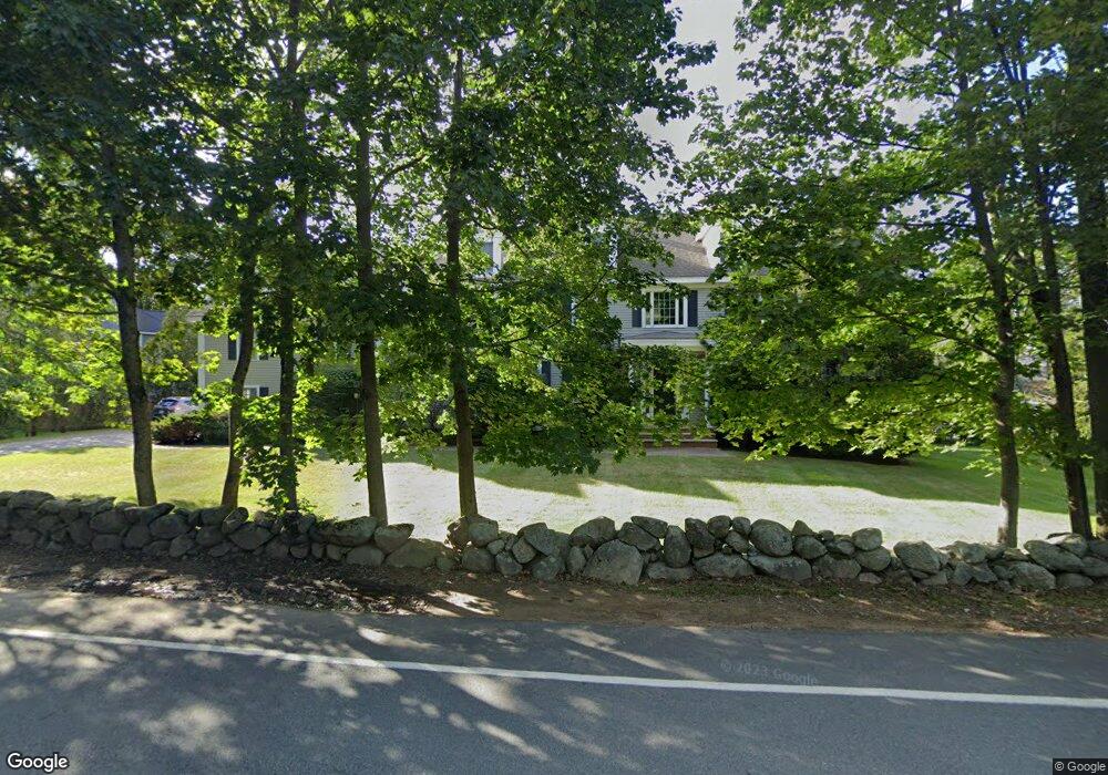
7 Porter Rd Andover, MA 01810
Southern Andover NeighborhoodEstimated Value: $2,292,265 - $3,009,000
5
Beds
5
Baths
6,560
Sq Ft
$412/Sq Ft
Est. Value
About This Home
This home is located at 7 Porter Rd, Andover, MA 01810 and is currently estimated at $2,701,816, approximately $411 per square foot. 7 Porter Rd is a home located in Essex County with nearby schools including South Elementary School, Doherty Middle School, and Andover High School.
Ownership History
Date
Name
Owned For
Owner Type
Purchase Details
Closed on
Jun 20, 2023
Sold by
Smith 2018 Funding T and Smith
Bought by
Caro-Mehta Ft and Del Dastillo
Current Estimated Value
Purchase Details
Closed on
Nov 2, 2018
Sold by
Smith Ann C and Smith Charles L
Bought by
Smith 2018 Funding T and Smith
Purchase Details
Closed on
Sep 15, 1998
Sold by
Nelson Robert G
Bought by
Boches Brian
Purchase Details
Closed on
Sep 5, 1997
Sold by
Maltzman Moses
Bought by
Nelson Robert G
Purchase Details
Closed on
Sep 18, 1990
Sold by
Orrison Anne E
Bought by
Shulimson Gina
Purchase Details
Closed on
Aug 29, 1990
Sold by
Kennedy Helen F
Bought by
Delorenzo Tr Paul F
Purchase Details
Closed on
Dec 28, 1989
Sold by
Mercaldi William
Bought by
Atlantic Bldg Contract
Purchase Details
Closed on
Jun 28, 1989
Sold by
Krause Maria
Bought by
Moorhead Corp
Purchase Details
Closed on
Dec 19, 1988
Sold by
Mercaldi William
Bought by
476 Street Rt
Home Financials for this Owner
Home Financials are based on the most recent Mortgage that was taken out on this home.
Original Mortgage
$170,000
Interest Rate
10.07%
Mortgage Type
Purchase Money Mortgage
Purchase Details
Closed on
Sep 22, 1987
Sold by
Grotto Kenneth M
Bought by
Archer Stephen C
Create a Home Valuation Report for This Property
The Home Valuation Report is an in-depth analysis detailing your home's value as well as a comparison with similar homes in the area
Home Values in the Area
Average Home Value in this Area
Purchase History
| Date | Buyer | Sale Price | Title Company |
|---|---|---|---|
| Caro-Mehta Ft | $2,600,000 | None Available | |
| Smith 2018 Funding T | -- | -- | |
| Smith 2018 Funding T | -- | -- | |
| Boches Brian | $55,000 | -- | |
| Boches Brian | $55,000 | -- | |
| Nelson Robert G | $25,000 | -- | |
| Nelson Robert G | $25,000 | -- | |
| Shulimson Gina | $155,000 | -- | |
| Shulimson Gina | $155,000 | -- | |
| Delorenzo Tr Paul F | $55,500 | -- | |
| Delorenzo Tr Paul F | $55,500 | -- | |
| Atlantic Bldg Contract | $265,000 | -- | |
| Atlantic Bldg Contract | $265,000 | -- | |
| Moorhead Corp | $30,000 | -- | |
| Moorhead Corp | $30,000 | -- | |
| 476 Street Rt | $385,000 | -- | |
| Archer Stephen C | $137,500 | -- |
Source: Public Records
Mortgage History
| Date | Status | Borrower | Loan Amount |
|---|---|---|---|
| Previous Owner | Archer Stephen C | $900,000 | |
| Previous Owner | Archer Stephen C | $170,000 |
Source: Public Records
Tax History Compared to Growth
Tax History
| Year | Tax Paid | Tax Assessment Tax Assessment Total Assessment is a certain percentage of the fair market value that is determined by local assessors to be the total taxable value of land and additions on the property. | Land | Improvement |
|---|---|---|---|---|
| 2024 | $26,122 | $2,028,100 | $536,700 | $1,491,400 |
| 2023 | $25,148 | $1,841,000 | $483,400 | $1,357,600 |
| 2022 | $23,833 | $1,632,400 | $420,500 | $1,211,900 |
| 2021 | $22,985 | $1,503,300 | $382,200 | $1,121,100 |
| 2020 | $22,179 | $1,477,600 | $373,100 | $1,104,500 |
| 2019 | $21,822 | $1,429,100 | $340,800 | $1,088,300 |
| 2018 | $20,909 | $1,336,900 | $327,700 | $1,009,200 |
| 2017 | $20,170 | $1,328,700 | $321,300 | $1,007,400 |
| 2016 | $19,795 | $1,335,700 | $321,300 | $1,014,400 |
| 2015 | $19,043 | $1,272,100 | $309,000 | $963,100 |
Source: Public Records
Map
Nearby Homes
- 4 Hammond Way
- 31 Porter Rd
- 50 Hidden Rd
- 25 Timothy Dr
- 53 Salem St
- 104 Salem St
- 331 S Main St
- 47 Abbot St
- 3 West Hollow
- 56 Sunset Rock Rd
- 133B Salem
- 9 Chapman Ave
- 103 Central St
- 105 Central St
- 40 Ballardvale Rd
- 18 Bryan Ln Unit 18
- Lot 7 Weeping Willow Dr
- 61 Elm St Unit 61
- 10 Maple Ave Unit 3
- 204 Chestnut St
- 4 Porter Rd
- 9 Porter Rd
- 5 Porter Rd Unit 302
- 5 Porter Rd Unit 301
- 5 Porter Rd Unit 203
- 5 Porter Rd Unit 202
- 5 Porter Rd Unit 201
- 5 Porter Rd Unit 107
- 5 Porter Rd Unit 106
- 5 Porter Rd Unit 104
- 5 Porter Rd Unit 103
- 5 Porter Rd Unit 102
- 5 Porter Rd Unit A3
- 5 Porter Rd Unit A2
- 5 Porter Rd Unit A1
- 6 Porter Rd
- 6 Porter Rd Unit N/A
- 15 Porter Rd
- 2 Forbes Ln
- 4 Forbes Ln