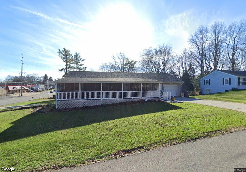
7 Rambleside Dr Mansfield, OH 44907
Estimated Value: $132,000 - $159,541
3
Beds
1
Bath
1,144
Sq Ft
$130/Sq Ft
Est. Value
About This Home
This home is located at 7 Rambleside Dr, Mansfield, OH 44907 and is currently estimated at $148,385, approximately $129 per square foot. 7 Rambleside Dr is a home located in Richland County with nearby schools including Madison High School, St. Peter's Elementary/Montessori School, and Mansfield Christian School.
Ownership History
Date
Name
Owned For
Owner Type
Purchase Details
Closed on
Sep 21, 2012
Sold by
Mabry Judy and Mabry Victor
Bought by
Abrams Marsha and Abrams Gary
Current Estimated Value
Home Financials for this Owner
Home Financials are based on the most recent Mortgage that was taken out on this home.
Original Mortgage
$44,184
Interest Rate
4.4%
Mortgage Type
FHA
Purchase Details
Closed on
Jul 13, 2007
Sold by
Abrams Mark M
Bought by
Mabry Judy
Purchase Details
Closed on
Jun 19, 2007
Sold by
Estate Of Kenneth Abrams
Bought by
Mabry Judy and Abrams Mark M
Purchase Details
Closed on
Apr 15, 1998
Sold by
Abrams Gary L
Bought by
Leedy James B and Leedy Mary Kay
Purchase Details
Closed on
May 3, 1993
Sold by
Davis Shirley M
Bought by
Abrams Gary L
Create a Home Valuation Report for This Property
The Home Valuation Report is an in-depth analysis detailing your home's value as well as a comparison with similar homes in the area
Home Values in the Area
Average Home Value in this Area
Purchase History
| Date | Buyer | Sale Price | Title Company |
|---|---|---|---|
| Abrams Marsha | $45,000 | Chicago Title | |
| Mabry Judy | -- | Attorney | |
| Mabry Judy | -- | None Available | |
| Leedy James B | $130,000 | -- | |
| Abrams Gary L | $800 | -- |
Source: Public Records
Mortgage History
| Date | Status | Borrower | Loan Amount |
|---|---|---|---|
| Previous Owner | Abrams Marsha | $44,184 |
Source: Public Records
Tax History
| Year | Tax Paid | Tax Assessment Tax Assessment Total Assessment is a certain percentage of the fair market value that is determined by local assessors to be the total taxable value of land and additions on the property. | Land | Improvement |
|---|---|---|---|---|
| 2024 | $1,476 | $42,630 | $6,780 | $35,850 |
| 2023 | $1,537 | $42,630 | $6,780 | $35,850 |
| 2022 | $1,122 | $28,840 | $5,810 | $23,030 |
| 2021 | $1,130 | $28,840 | $5,810 | $23,030 |
| 2020 | $1,156 | $28,840 | $5,810 | $23,030 |
| 2019 | $1,001 | $24,450 | $4,930 | $19,520 |
| 2018 | $987 | $24,450 | $4,930 | $19,520 |
| 2017 | $691 | $24,450 | $4,930 | $19,520 |
| 2016 | $422 | $15,280 | $4,780 | $10,500 |
| 2015 | $403 | $15,280 | $4,780 | $10,500 |
| 2014 | $397 | $15,280 | $4,780 | $10,500 |
| 2012 | $1,093 | $15,760 | $4,930 | $10,830 |
Source: Public Records
Map
Nearby Homes
- 33 Rambleside Dr
- 138 Cliffbrook Dr
- 83 Mccullough Blvd Unit 52
- 104 Elmridge Rd
- 86 Sherbrook Rd
- 1200 S Main St
- 34 W Raleigh Ave
- 1066 Burkwood Rd
- 571 Luther St
- 178 Chilton Ave
- 470 Lexington Ave
- 466 Lexington Ave
- 575 Crescent Rd
- 0 Lexington Ave Unit 224009661
- 469 Crescent Rd
- 0 George Ave
- 394 S Main St
- 794 Mansfield Washington Rd
- 710 Lexington Ave
- 530 Wood St
- 934 S Main St
- 21 Rambleside Dr
- 895 S Main St
- 27 Rambleside Dr
- 907 S Main St
- 889 S Main St
- 911 S Main St
- 26 Rambleside Dr
- 28 W Cook Rd
- 877 S Main St
- 39 Rambleside Dr
- 919 S Main St
- 32 Rambleside Dr
- 0 W Cook Rd Unit 747293
- 0 W Cook Rd Unit 3938819
- 0 W Cook Rd Unit 225001803
- 0 W Cook Rd Unit 502368
- 0 W Cook Rd Unit 500540
- 0 W Cook Rd Unit 9038166
- 0 W Cook Rd Unit 9044734
Your Personal Tour Guide
Ask me questions while you tour the home.