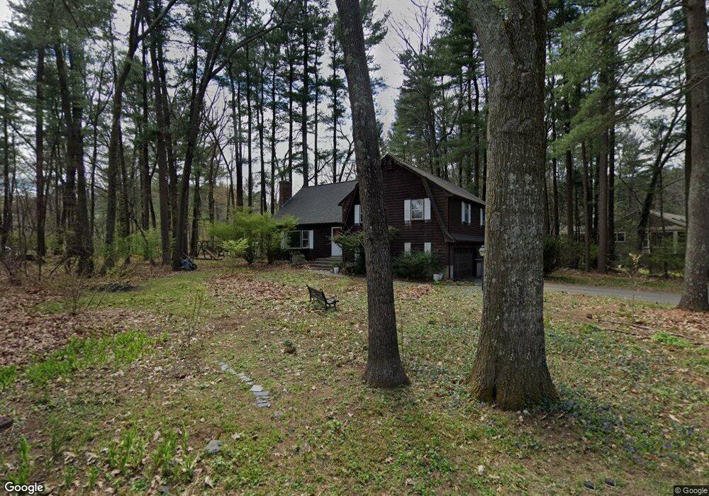
7 Rambling Rd Sudbury, MA 01776
Estimated Value: $996,000 - $1,477,000
5
Beds
3
Baths
2,766
Sq Ft
$435/Sq Ft
Est. Value
About This Home
This home is located at 7 Rambling Rd, Sudbury, MA 01776 and is currently estimated at $1,203,733, approximately $435 per square foot. 7 Rambling Rd is a home located in Middlesex County with nearby schools including Israel Loring Elementary School, Ephraim Curtis Middle School, and Lincoln-Sudbury Regional High School.
Ownership History
Date
Name
Owned For
Owner Type
Purchase Details
Closed on
Jun 2, 2025
Sold by
Sternberg Lawrence I and Abramovitz Sara
Bought by
Abramovitz Sternberg Ft and Sternberg
Current Estimated Value
Purchase Details
Closed on
Jul 16, 1993
Sold by
Dekis Jeffrey and Dekis Dianne
Bought by
Sternberg Lawrence and Abramovitz Sara
Home Financials for this Owner
Home Financials are based on the most recent Mortgage that was taken out on this home.
Original Mortgage
$100,000
Interest Rate
7.4%
Mortgage Type
Purchase Money Mortgage
Purchase Details
Closed on
Sep 30, 1991
Sold by
Burtoft Edgar R and Burtoft Jeanne
Bought by
Dekis Jeffrey J and Dekis Dianne
Create a Home Valuation Report for This Property
The Home Valuation Report is an in-depth analysis detailing your home's value as well as a comparison with similar homes in the area
Home Values in the Area
Average Home Value in this Area
Purchase History
| Date | Buyer | Sale Price | Title Company |
|---|---|---|---|
| Abramovitz Sternberg Ft | -- | None Available | |
| Abramovitz Sternberg Ft | -- | None Available | |
| Sternberg Lawrence | $295,000 | -- | |
| Sternberg Lawrence | $295,000 | -- | |
| Dekis Jeffrey J | $280,000 | -- | |
| Dekis Jeffrey J | $280,000 | -- |
Source: Public Records
Mortgage History
| Date | Status | Borrower | Loan Amount |
|---|---|---|---|
| Previous Owner | Dekis Jeffrey J | $325,000 | |
| Previous Owner | Dekis Jeffrey J | $273,000 | |
| Previous Owner | Dekis Jeffrey J | $100,000 |
Source: Public Records
Tax History
| Year | Tax Paid | Tax Assessment Tax Assessment Total Assessment is a certain percentage of the fair market value that is determined by local assessors to be the total taxable value of land and additions on the property. | Land | Improvement |
|---|---|---|---|---|
| 2025 | $14,646 | $1,000,400 | $474,800 | $525,600 |
| 2024 | $14,154 | $968,800 | $461,200 | $507,600 |
| 2023 | $13,822 | $876,500 | $411,900 | $464,600 |
| 2022 | $12,908 | $715,100 | $377,700 | $337,400 |
| 2021 | $12,343 | $655,500 | $377,700 | $277,800 |
| 2020 | $12,094 | $655,500 | $377,700 | $277,800 |
| 2019 | $11,740 | $655,500 | $377,700 | $277,800 |
| 2018 | $11,337 | $632,300 | $402,000 | $230,300 |
| 2017 | $10,859 | $612,100 | $398,600 | $213,500 |
| 2016 | $10,575 | $594,100 | $383,400 | $210,700 |
| 2015 | $9,969 | $566,400 | $372,400 | $194,000 |
| 2014 | $9,913 | $549,800 | $361,400 | $188,400 |
Source: Public Records
Map
Nearby Homes
- 472 Potter Rd
- 19 Rolling Ln
- 10 Rolling Ln
- 0 Wagonwheel Rd
- 38 Bradford Rd
- 63 Landham Rd
- 19 Nob Hill Dr
- 87 Landham Rd
- 32 Eaton Rd W
- 4 Tartufi Cir
- 11 Edith Rd
- 10 Brookside Farm Ln
- 216 Landham Rd
- 106 Baldwin Ave
- 2 Hemenway Rd
- 19 Park Ave
- 1011 Boston Post Rd
- 226 Stonebridge Rd
- 227 Water St
- 34 Christopher Ln
Your Personal Tour Guide
Ask me questions while you tour the home.