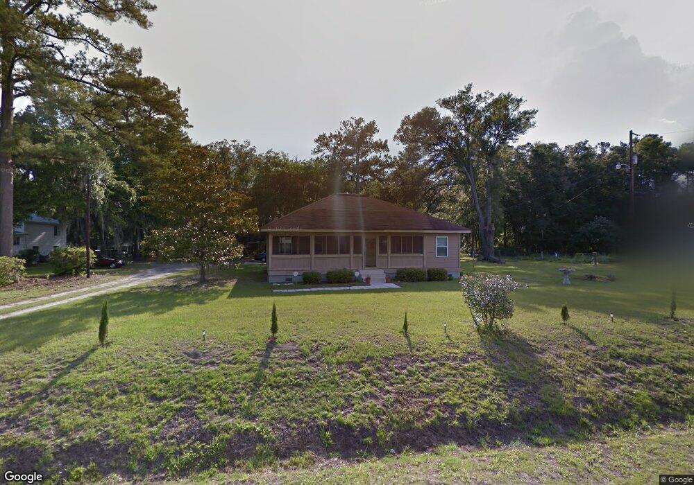
7 Ramsey Rd Beaufort, SC 29906
Estimated Value: $270,097 - $304,000
4
Beds
1
Bath
1,645
Sq Ft
$179/Sq Ft
Est. Value
About This Home
This home is located at 7 Ramsey Rd, Beaufort, SC 29906 and is currently estimated at $293,774, approximately $178 per square foot. 7 Ramsey Rd is a home located in Beaufort County with nearby schools including Robert Smalls International Academy, Battery Creek High School, and Bridges Preparatory School.
Ownership History
Date
Name
Owned For
Owner Type
Purchase Details
Closed on
Feb 9, 2021
Sold by
Allen Margie M
Bought by
Allen Margie M and Nicholson Eric Shea
Current Estimated Value
Purchase Details
Closed on
Dec 27, 2007
Sold by
Foy Dora A and Allen Woodrow
Bought by
Allen Margie M
Home Financials for this Owner
Home Financials are based on the most recent Mortgage that was taken out on this home.
Original Mortgage
$54,500
Outstanding Balance
$10,073
Interest Rate
5.85%
Mortgage Type
New Conventional
Estimated Equity
$283,701
Purchase Details
Closed on
Aug 8, 2006
Sold by
Foy Dora A
Bought by
Foy Dora A and Allen Woodrow
Create a Home Valuation Report for This Property
The Home Valuation Report is an in-depth analysis detailing your home's value as well as a comparison with similar homes in the area
Home Values in the Area
Average Home Value in this Area
Purchase History
| Date | Buyer | Sale Price | Title Company |
|---|---|---|---|
| Allen Margie M | -- | None Available | |
| Allen Margie M | -- | Service Link | |
| Foy Dora A | -- | None Available |
Source: Public Records
Mortgage History
| Date | Status | Borrower | Loan Amount |
|---|---|---|---|
| Open | Allen Margie M | $54,500 |
Source: Public Records
Tax History Compared to Growth
Tax History
| Year | Tax Paid | Tax Assessment Tax Assessment Total Assessment is a certain percentage of the fair market value that is determined by local assessors to be the total taxable value of land and additions on the property. | Land | Improvement |
|---|---|---|---|---|
| 2024 | $817 | $4,040 | $0 | $0 |
| 2023 | $817 | $4,040 | $0 | $0 |
| 2022 | $1,704 | $5,270 | $0 | $0 |
| 2021 | $368 | $4,436 | $708 | $3,728 |
| 2020 | $367 | $4,436 | $708 | $3,728 |
| 2019 | $362 | $4,436 | $708 | $3,728 |
| 2018 | $343 | $3,520 | $0 | $0 |
| 2017 | $262 | $3,060 | $0 | $0 |
| 2016 | $257 | $3,060 | $0 | $0 |
| 2014 | $410 | $3,060 | $0 | $0 |
Source: Public Records
Map
Nearby Homes
- 38 Ramsey Rd
- 32 Glaze Dr
- 34 Glaze Dr
- 8 Ramblin Rd
- 138 Parris Island Gateway
- 125 Parris Island
- 32 Applemint Ln
- Tbd Corner of Laurel Bay
- 51 Spearmint Cir
- 40 Wintergreen Dr
- 9 Horton Trail
- 0 Tbd Broad River Blvd
- 1 Taft St Unit 107
- 40 County Shed Rd
- Tbd Goethe Hill Rd
- Lot 3 Goethe Hill Rd
- 3113 Westwood Cir
- Tbd Laurel Bay Rd
- 40 Mamie Frazier Ln
- 0 Pine Grove Rd
- 6 Milledge Village Rd
- 2 Delta Ln
- 10 Milledge Village Rd
- 16 Milledge Village Rd
- 21 Ramsey Rd
- 13 Milledge Village Rd
- 22 Milledge Village Rd
- 30 Ramsey Loop
- 195 Broad River Blvd
- 24 Milledge Village Rd
- 224 Broad River Blvd
- 189 Broad River Blvd
- 28 Milledge Village Rd
- 190 Broad River Blvd
- 10 Angel Ln
- 18 Ramsey Loop
- 185 Broad River Blvd
- 236 Broad River Blvd
- 25 Milledge Village Rd
- 184 Broad River Blvd