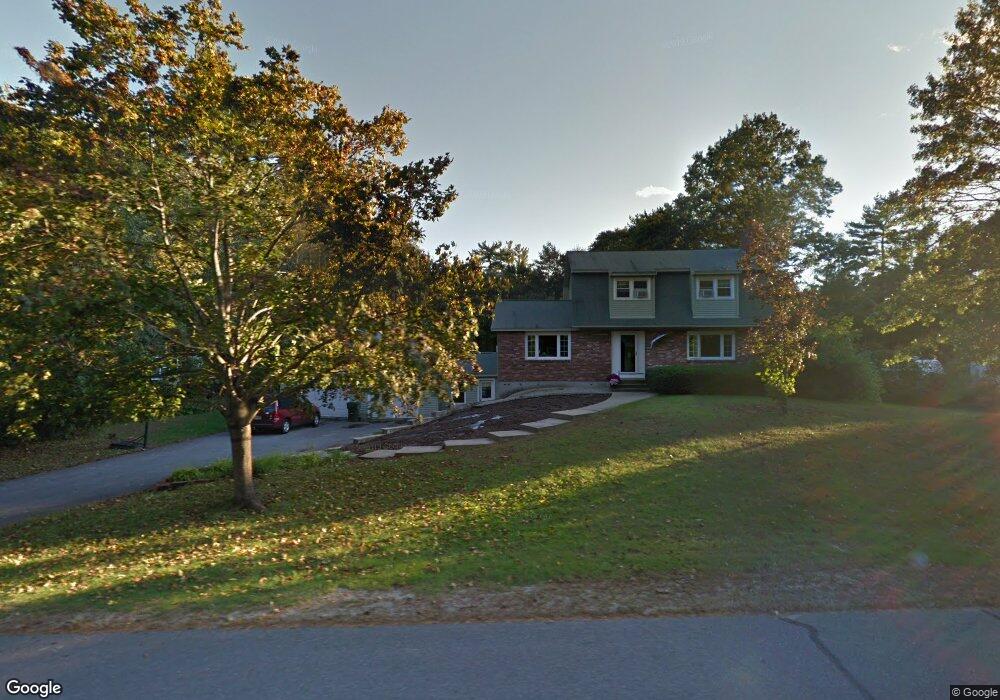
7 Rolling Ridge Rd Londonderry, NH 03053
Estimated Value: $572,000 - $619,871
3
Beds
2
Baths
1,984
Sq Ft
$302/Sq Ft
Est. Value
About This Home
This home is located at 7 Rolling Ridge Rd, Londonderry, NH 03053 and is currently estimated at $598,218, approximately $301 per square foot. 7 Rolling Ridge Rd is a home with nearby schools including North Londonderry Elementary School, Londonderry Middle School, and Londonderry Senior High School.
Ownership History
Date
Name
Owned For
Owner Type
Purchase Details
Closed on
Dec 13, 2019
Sold by
Williams Patricia F
Bought by
Newton Susan A
Current Estimated Value
Purchase Details
Closed on
Aug 14, 2006
Sold by
Weichert Relocation Re
Bought by
Whitley Kevin W and Whitley Jennifer L
Home Financials for this Owner
Home Financials are based on the most recent Mortgage that was taken out on this home.
Original Mortgage
$53,850
Interest Rate
6.8%
Create a Home Valuation Report for This Property
The Home Valuation Report is an in-depth analysis detailing your home's value as well as a comparison with similar homes in the area
Home Values in the Area
Average Home Value in this Area
Purchase History
| Date | Buyer | Sale Price | Title Company |
|---|---|---|---|
| Newton Susan A | $170,000 | None Available | |
| Whitley Kevin W | $359,000 | -- |
Source: Public Records
Mortgage History
| Date | Status | Borrower | Loan Amount |
|---|---|---|---|
| Previous Owner | Whitley Kevin W | $278,441 | |
| Previous Owner | Whitley Kevin W | $53,850 |
Source: Public Records
Tax History Compared to Growth
Tax History
| Year | Tax Paid | Tax Assessment Tax Assessment Total Assessment is a certain percentage of the fair market value that is determined by local assessors to be the total taxable value of land and additions on the property. | Land | Improvement |
|---|---|---|---|---|
| 2024 | $8,101 | $501,900 | $200,900 | $301,000 |
| 2023 | $7,924 | $506,300 | $200,900 | $305,400 |
| 2022 | $7,320 | $396,100 | $150,600 | $245,500 |
| 2021 | $7,280 | $396,100 | $150,600 | $245,500 |
| 2020 | $7,151 | $355,600 | $121,600 | $234,000 |
| 2019 | $6,895 | $355,600 | $121,600 | $234,000 |
| 2018 | $6,370 | $292,200 | $100,700 | $191,500 |
| 2017 | $6,314 | $292,200 | $100,700 | $191,500 |
| 2016 | $6,282 | $292,200 | $100,700 | $191,500 |
| 2015 | $6,142 | $292,200 | $100,700 | $191,500 |
| 2014 | $6,162 | $292,200 | $100,700 | $191,500 |
| 2011 | -- | $293,500 | $100,700 | $192,800 |
Source: Public Records
Map
Nearby Homes
- 224 High Range Rd
- 35 Red Deer Rd
- 193 Fieldstone Dr
- 193 Fieldstone Dr Unit 193
- 11 Elise Ave Unit Lot 91
- 169 Fieldstone Dr
- 118 Fieldstone Dr Unit 118
- 3 Chandler Dr
- 15 Harvey Rd
- 8 Iroquois Cir
- 27 Buckingham Dr
- 57 Hardy Rd
- 17 Welch Rd
- 90 High Range Rd
- 88 High Range Rd
- 12 Wiley Hill Rd
- 6 Wiley Hill Rd
- 38 Bartley Hill Rd
- 10 Judy Dr
- 15 Tamarack Ct
- 9 Rolling Ridge Rd
- 5 Rolling Ridge Rd
- 10 Rolling Ridge Rd
- 12 Rolling Ridge Rd
- 8 Rolling Ridge Rd
- 25 Pine Hollow Dr
- 18 Pine Hollow Dr
- 13 Rolling Ridge Rd
- 14 Rolling Ridge Rd
- 4 Pine Hollow Dr
- 6 Rolling Ridge Rd
- 23 Pine Hollow Dr
- 16 Pine Hollow Dr
- 12 Pine Hollow Dr
- 4 Rolling Ridge Rd
- 14 Pine Hollow Dr
- 4 Boundary Dr
- 18 Justin Cir
- 6 Pine Hollow Dr
- 15 Rolling Ridge Rd