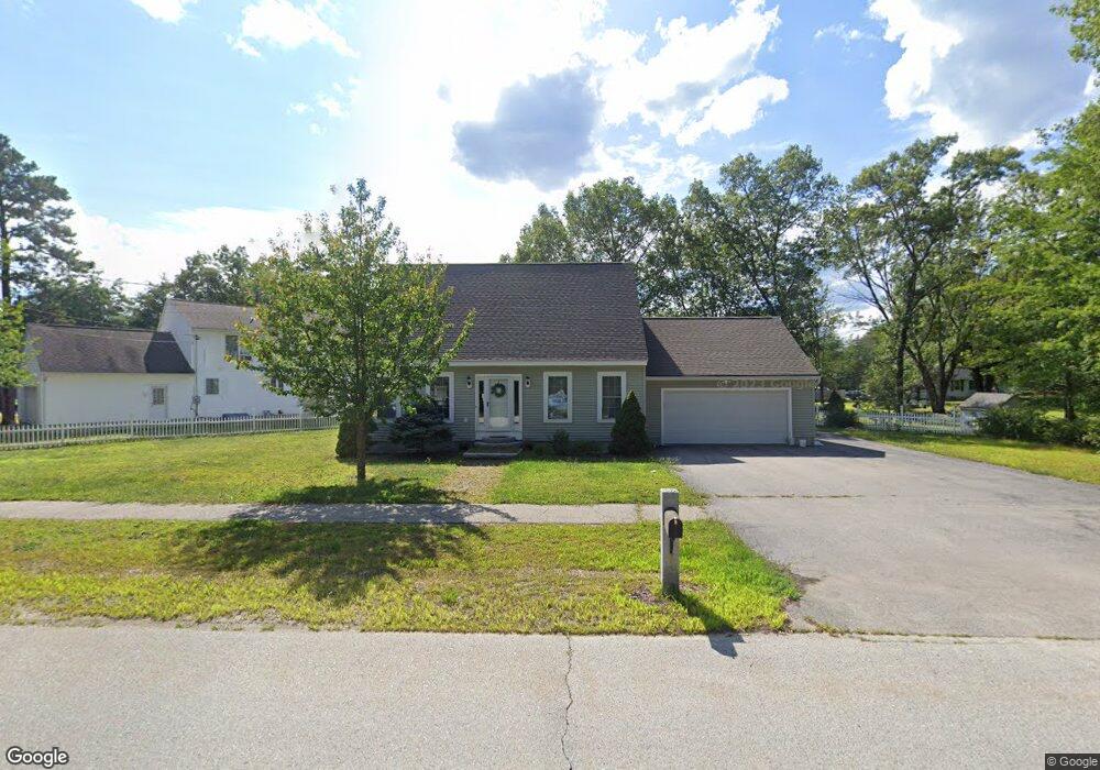
7 S Curtisville Rd Concord, NH 03301
East Concord NeighborhoodEstimated Value: $488,000
3
Beds
2
Baths
2,214
Sq Ft
$220/Sq Ft
Est. Value
About This Home
This home is located at 7 S Curtisville Rd, Concord, NH 03301 and is currently priced at $488,000, approximately $220 per square foot. 7 S Curtisville Rd is a home located in Merrimack County with nearby schools including Broken Ground School, Rundlett Middle School, and Concord High School.
Ownership History
Date
Name
Owned For
Owner Type
Purchase Details
Closed on
Feb 14, 2022
Sold by
Beaulieu Family Prop Llc
Bought by
Mcgrath Timothy P and Wright Melissa
Current Estimated Value
Home Financials for this Owner
Home Financials are based on the most recent Mortgage that was taken out on this home.
Original Mortgage
$306,400
Outstanding Balance
$284,550
Interest Rate
3.56%
Mortgage Type
Purchase Money Mortgage
Purchase Details
Closed on
May 27, 2011
Sold by
New York Community Ban
Bought by
Beaulieu Family Props
Home Financials for this Owner
Home Financials are based on the most recent Mortgage that was taken out on this home.
Original Mortgage
$135,000
Interest Rate
4.94%
Mortgage Type
Purchase Money Mortgage
Purchase Details
Closed on
Dec 2, 2010
Sold by
Young Robert B
Bought by
New York Community Ban
Purchase Details
Closed on
Jan 9, 2003
Sold by
Newell & Crathern Llc
Bought by
Young Robert B and Young Krystal A
Purchase Details
Closed on
Aug 21, 2002
Sold by
Tilton Russell F and Tilton Florette R
Bought by
Newell & Crathern Llc
Create a Home Valuation Report for This Property
The Home Valuation Report is an in-depth analysis detailing your home's value as well as a comparison with similar homes in the area
Home Values in the Area
Average Home Value in this Area
Purchase History
| Date | Buyer | Sale Price | Title Company |
|---|---|---|---|
| Mcgrath Timothy P | $383,000 | None Available | |
| Beaulieu Family Props | $204,900 | -- | |
| New York Community Ban | $186,300 | -- | |
| Young Robert B | $250,000 | -- | |
| Newell & Crathern Llc | $51,000 | -- |
Source: Public Records
Mortgage History
| Date | Status | Borrower | Loan Amount |
|---|---|---|---|
| Open | Mcgrath Timothy P | $306,400 | |
| Previous Owner | Newell & Crathern Llc | $135,000 | |
| Previous Owner | Newell & Crathern Llc | $135,000 | |
| Previous Owner | Newell & Crathern Llc | $279,500 |
Source: Public Records
Tax History Compared to Growth
Tax History
| Year | Tax Paid | Tax Assessment Tax Assessment Total Assessment is a certain percentage of the fair market value that is determined by local assessors to be the total taxable value of land and additions on the property. | Land | Improvement |
|---|---|---|---|---|
| 2021 | $9,661 | $384,600 | $102,700 | $281,900 |
| 2020 | $9,131 | $341,800 | $75,400 | $266,400 |
| 2019 | $8,246 | $314,900 | $72,100 | $242,800 |
| 2018 | $7,899 | $289,800 | $72,100 | $217,700 |
| 2017 | $7,862 | $278,400 | $68,800 | $209,600 |
| 2016 | $7,714 | $278,800 | $68,800 | $210,000 |
| 2015 | $7,638 | $254,500 | $61,800 | $192,700 |
| 2014 | $6,795 | $254,500 | $61,800 | $192,700 |
| 2013 | -- | $250,700 | $61,800 | $188,900 |
| 2012 | -- | $252,600 | $61,800 | $190,800 |
Source: Public Records
Map
Nearby Homes
- 32 E Side Dr
- 12 E Side Dr Unit 4-13
- 8 NE Village Rd
- 17 Burns Ave Unit 2
- 13 Ellsworth St
- 59 Branch Turnpike
- 43 Branch Turnpike
- 50 Branch Turnpike
- 294 Portsmouth St
- 58 Branch Turnpike Unit 26
- 24 Cricket Ln
- 6 Heights Rd
- 1 Guay St
- 11 Eastman St
- 19 Grappone Dr
- 6 Lawrence Street Extension
- 2 Shaker Rd
- 61 Mountain Rd
- 6 Irving Dr
- 20 Prospect St
- 114 E Side Dr
- 118 E Side Dr
- 12 S Curtisville Rd
- 17 S Curtisville Rd
- 124 E Side Dr
- 14 S Curtisville Rd
- 126 E Side Dr
- 11 Tara Dr
- 104 E Side Dr
- 128 E Side Dr
- 3 Broken Ground Dr
- 12 Tara Dr
- 13 Tara Dr
- 5 Broken Ground Dr
- 27 S Curtisville Rd
- 7 Broken Ground Dr
- 24 S Curtisville Rd
- 14 Tara Dr
- 4 Broken Ground Dr
- 2 Broken Ground Dr