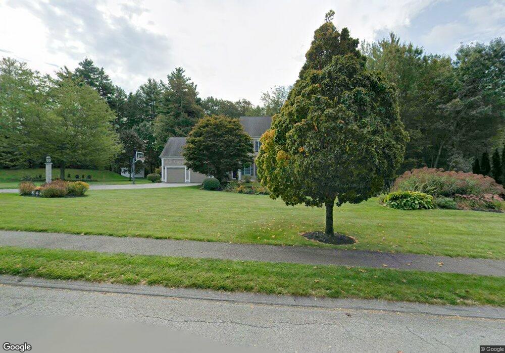
7 Sandy Ridge Rd Sterling, MA 01564
Estimated Value: $916,000 - $1,338,192
4
Beds
4
Baths
2,670
Sq Ft
$404/Sq Ft
Est. Value
About This Home
This home is located at 7 Sandy Ridge Rd, Sterling, MA 01564 and is currently estimated at $1,078,397, approximately $403 per square foot. 7 Sandy Ridge Rd is a home located in Worcester County with nearby schools including Wachusett Regional High School and South Lancaster Academy.
Ownership History
Date
Name
Owned For
Owner Type
Purchase Details
Closed on
Jun 2, 2021
Sold by
Young Scott
Bought by
Waterhouse Derek and Waterhouse Tamara L
Current Estimated Value
Purchase Details
Closed on
May 27, 2011
Sold by
Mcgrail Patrick A and Drum Jennifer L
Bought by
Mcgrail Jennifer L and Mcgrail Patrick A
Home Financials for this Owner
Home Financials are based on the most recent Mortgage that was taken out on this home.
Original Mortgage
$405,000
Interest Rate
4.94%
Mortgage Type
Purchase Money Mortgage
Purchase Details
Closed on
Nov 14, 2002
Sold by
Sandy Ridge Rt and Plante Curtis
Bought by
Mcgrail Patrick A and Drum Jennifer L
Home Financials for this Owner
Home Financials are based on the most recent Mortgage that was taken out on this home.
Original Mortgage
$399,650
Interest Rate
6.07%
Create a Home Valuation Report for This Property
The Home Valuation Report is an in-depth analysis detailing your home's value as well as a comparison with similar homes in the area
Home Values in the Area
Average Home Value in this Area
Purchase History
| Date | Buyer | Sale Price | Title Company |
|---|---|---|---|
| Waterhouse Derek | $1,119,000 | None Available | |
| Mcgrail Jennifer L | -- | -- | |
| Mcgrail Patrick A | $501,290 | -- |
Source: Public Records
Mortgage History
| Date | Status | Borrower | Loan Amount |
|---|---|---|---|
| Previous Owner | Mcgrail Jennifer L | $405,000 | |
| Previous Owner | Mcgrail Patrick A | $399,650 | |
| Previous Owner | Mcgrail Patrick A | $399,650 | |
| Previous Owner | Mcgrail Patrick A | $375,000 |
Source: Public Records
Tax History Compared to Growth
Tax History
| Year | Tax Paid | Tax Assessment Tax Assessment Total Assessment is a certain percentage of the fair market value that is determined by local assessors to be the total taxable value of land and additions on the property. | Land | Improvement |
|---|---|---|---|---|
| 2025 | $10,336 | $802,500 | $181,900 | $620,600 |
| 2024 | $10,302 | $774,000 | $181,900 | $592,100 |
| 2023 | $9,099 | $636,300 | $174,500 | $461,800 |
| 2022 | $8,616 | $565,000 | $171,100 | $393,900 |
| 2021 | $8,972 | $543,100 | $171,100 | $372,000 |
| 2020 | $9,348 | $556,100 | $183,300 | $372,800 |
| 2019 | $9,067 | $525,000 | $189,400 | $335,600 |
| 2018 | $8,905 | $507,700 | $179,600 | $328,100 |
| 2017 | $8,606 | $477,300 | $182,700 | $294,600 |
| 2016 | $8,483 | $462,800 | $182,700 | $280,100 |
| 2015 | $7,748 | $448,100 | $178,000 | $270,100 |
| 2014 | $7,463 | $440,800 | $178,000 | $262,800 |
Source: Public Records
Map
Nearby Homes
- 28 Sandy Ridge Rd
- 0 Brockelman Rd Unit 73424117
- 121 &125 Flanagan Hill Rd
- 96 Clinton Rd
- 765 Brockelman Road Lot C
- 765 Brockelman Rd
- 2 Stuart Rd
- 25 N Row Rd
- 4 Redstone Hill Rd
- 45 Meetinghouse Hill Rd
- 41 Meetinghouse Hill Rd
- 54 S Meadow Rd
- 6 Ashton Ln
- 271 Sterling St
- 121 Sylvan Rd
- 136 Narrow Ln
- 25 North Row
- 5 Leo's Way Unit 1
- 7 Leo's Way Unit 1
- 164 Sterling Rd
- 5 Sandy Ridge Rd
- 9 Sandy Ridge Rd
- Lot 9 (Golf Frontage) Sandy Ridge Rd
- 4 Sandy Ridge Rd
- 2 Sandy Ridge Rd
- 6 Sandy Ridge Rd
- 1 Sandy Ridge Rd
- 3 Sandy Ridge Rd
- 8 Sandy Ridge Rd
- 11 Sandy Ridge Rd
- 76 Albright Rd
- 27 Albright Rd
- 10 Sandy Ridge Rd
- 64 Albright Rd
- 1 Village Ln
- 12 Sandy Ridge Rd
- 13 Sandy Ridge Rd
- 0 Sandy Ridge Rd
- 2 Village Ln
- 51 Sandy Ridge Rd