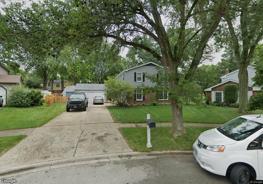
7 Sioux Ct Naperville, IL 60563
Indian Hill NeighborhoodEstimated Value: $546,214 - $659,000
Studio
1
Bath
2,450
Sq Ft
$251/Sq Ft
Est. Value
About This Home
This home is located at 7 Sioux Ct, Naperville, IL 60563 and is currently estimated at $616,054, approximately $251 per square foot. 7 Sioux Ct is a home located in DuPage County with nearby schools including Mill Street Elementary School, Jefferson Jr High School, and Naperville North High School.
Ownership History
Date
Name
Owned For
Owner Type
Purchase Details
Closed on
Sep 24, 1998
Sold by
Kwait Conrad W and Kwait Nora L
Bought by
Martyn Christopher P and Martyn Lisa M
Current Estimated Value
Home Financials for this Owner
Home Financials are based on the most recent Mortgage that was taken out on this home.
Original Mortgage
$176,000
Outstanding Balance
$37,824
Interest Rate
6.97%
Estimated Equity
$578,230
Create a Home Valuation Report for This Property
The Home Valuation Report is an in-depth analysis detailing your home's value as well as a comparison with similar homes in the area
Home Values in the Area
Average Home Value in this Area
Purchase History
| Date | Buyer | Sale Price | Title Company |
|---|---|---|---|
| Martyn Christopher P | $220,000 | -- |
Source: Public Records
Mortgage History
| Date | Status | Borrower | Loan Amount |
|---|---|---|---|
| Open | Martyn Christopher P | $176,000 |
Source: Public Records
Tax History Compared to Growth
Tax History
| Year | Tax Paid | Tax Assessment Tax Assessment Total Assessment is a certain percentage of the fair market value that is determined by local assessors to be the total taxable value of land and additions on the property. | Land | Improvement |
|---|---|---|---|---|
| 2024 | $9,364 | $160,859 | $69,708 | $91,151 |
| 2023 | $9,020 | $146,810 | $63,620 | $83,190 |
| 2022 | $8,711 | $140,600 | $60,930 | $79,670 |
| 2021 | $8,392 | $135,290 | $58,630 | $76,660 |
| 2020 | $8,213 | $132,860 | $57,580 | $75,280 |
| 2019 | $7,972 | $127,110 | $55,090 | $72,020 |
| 2018 | $7,974 | $127,110 | $55,090 | $72,020 |
| 2017 | $7,812 | $122,820 | $53,230 | $69,590 |
| 2016 | $7,655 | $118,380 | $51,310 | $67,070 |
| 2015 | $7,604 | $111,480 | $48,320 | $63,160 |
| 2014 | $7,344 | $104,670 | $45,370 | $59,300 |
| 2013 | $7,234 | $104,920 | $45,480 | $59,440 |
Source: Public Records
Map
Nearby Homes
- 27W141 48th St
- 1314 N Eagle St
- 1310 Eagle St
- 1221 N Loomis St
- 1142 N Webster St
- 1427 Cress Creek Ct
- 1405 N West St
- 1104 N Mill St Unit 205
- 26W250 Case St
- 1105 N Mill St Unit 117
- 1016 N Mill St Unit 5
- 905 N Webster St
- 609 Bowling Green Ct
- 930 N Loomis St
- 1004 N Mill St Unit 312
- 1004 N Mill St Unit 302
- 837 N Loomis St
- 5S365 Vest Ave
- 1437 N Charles Ave
- 719 N Brainard St