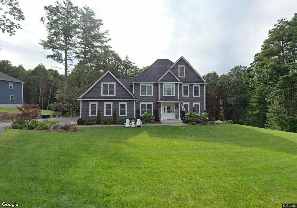
7 Squire Dr Wilbraham, MA 01095
Estimated Value: $822,000 - $1,018,000
4
Beds
2
Baths
2,716
Sq Ft
$328/Sq Ft
Est. Value
About This Home
This home is located at 7 Squire Dr, Wilbraham, MA 01095 and is currently estimated at $889,952, approximately $327 per square foot. 7 Squire Dr is a home located in Hampden County with nearby schools including Minnechaug Regional High School.
Ownership History
Date
Name
Owned For
Owner Type
Purchase Details
Closed on
Aug 27, 2021
Sold by
Biela John M and Biela Eileen M
Bought by
Breglio David J and Breglio Sara N
Current Estimated Value
Home Financials for this Owner
Home Financials are based on the most recent Mortgage that was taken out on this home.
Original Mortgage
$235,000
Outstanding Balance
$211,016
Interest Rate
2.8%
Mortgage Type
Purchase Money Mortgage
Estimated Equity
$678,936
Purchase Details
Closed on
Mar 19, 2021
Sold by
Loos Mark E and Carney-Loos Tara
Bought by
Biela John M and Biela Eileen M
Purchase Details
Closed on
Aug 12, 2019
Sold by
Boston Road Properties
Bought by
Loos Mark E and Loos Mark E
Home Financials for this Owner
Home Financials are based on the most recent Mortgage that was taken out on this home.
Original Mortgage
$460,000
Interest Rate
3.7%
Mortgage Type
New Conventional
Create a Home Valuation Report for This Property
The Home Valuation Report is an in-depth analysis detailing your home's value as well as a comparison with similar homes in the area
Home Values in the Area
Average Home Value in this Area
Purchase History
| Date | Buyer | Sale Price | Title Company |
|---|---|---|---|
| Breglio David J | $670,000 | None Available | |
| Biela John M | $670,000 | None Available | |
| Loos Mark E | $575,000 | -- |
Source: Public Records
Mortgage History
| Date | Status | Borrower | Loan Amount |
|---|---|---|---|
| Open | Breglio David J | $235,000 | |
| Previous Owner | Loos Mark E | $460,000 |
Source: Public Records
Tax History
| Year | Tax Paid | Tax Assessment Tax Assessment Total Assessment is a certain percentage of the fair market value that is determined by local assessors to be the total taxable value of land and additions on the property. | Land | Improvement |
|---|---|---|---|---|
| 2025 | $13,673 | $764,700 | $120,700 | $644,000 |
| 2024 | $14,099 | $762,100 | $120,700 | $641,400 |
| 2023 | $12,753 | $682,800 | $120,700 | $562,100 |
| 2022 | $12,753 | $622,400 | $120,700 | $501,700 |
| 2021 | $13,053 | $568,500 | $121,400 | $447,100 |
| 2020 | $12,114 | $541,300 | $121,400 | $419,900 |
| 2019 | $10,889 | $499,500 | $121,400 | $378,100 |
| 2018 | $2,748 | $121,400 | $121,400 | $0 |
| 2017 | $2,671 | $121,400 | $121,400 | $0 |
| 2016 | $3,236 | $149,800 | $149,800 | $0 |
| 2015 | $3,128 | $149,800 | $149,800 | $0 |
Source: Public Records
Map
Nearby Homes
- 5 Silver St
- 474-480 Mountain Rd
- 745 Glendale Rd
- 474 Mountain Rd
- 36 Maple St
- 20 Old Orchard Rd
- 172 Main St
- 16 Maple St
- 38 King Dr
- 1 Aspen Dr
- 8 High Pine Cir
- 6 Hilltop Park
- 104 High Pine Cir
- 35 Lake Dr
- 80 Elizabeth Dr
- 37 Balsam Hill Rd
- 44 Balsam Hill Rd
- 4 Hillcrest Dr
- Lot 88 Turning Leaf Equinox Pass
- L16 Wilbraham St
Your Personal Tour Guide
Ask me questions while you tour the home.