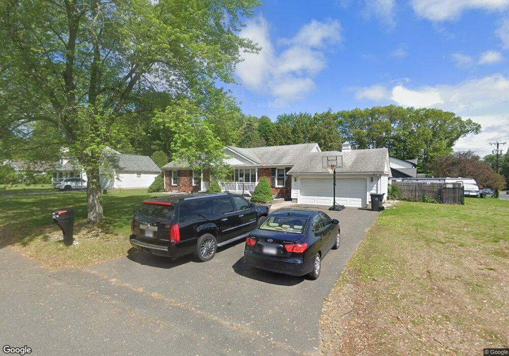
7 Tow Path Ln Westfield, MA 01085
Estimated Value: $405,000 - $471,000
3
Beds
2
Baths
1,512
Sq Ft
$288/Sq Ft
Est. Value
About This Home
This home is located at 7 Tow Path Ln, Westfield, MA 01085 and is currently estimated at $434,991, approximately $287 per square foot. 7 Tow Path Ln is a home located in Hampden County with nearby schools including Westfield High School and Saint Mary High School.
Ownership History
Date
Name
Owned For
Owner Type
Purchase Details
Closed on
Dec 22, 2016
Sold by
Ford Anthony and Ford Megan
Bought by
Valezquez Brian E and Ramos Christina M
Current Estimated Value
Home Financials for this Owner
Home Financials are based on the most recent Mortgage that was taken out on this home.
Original Mortgage
$234,572
Outstanding Balance
$191,886
Interest Rate
4.12%
Mortgage Type
FHA
Estimated Equity
$243,105
Purchase Details
Closed on
Sep 12, 2014
Sold by
Nardacci Josephine and Nardacci Albert
Bought by
Ford Anthony and Ford Megan
Home Financials for this Owner
Home Financials are based on the most recent Mortgage that was taken out on this home.
Original Mortgage
$219,622
Interest Rate
4.12%
Mortgage Type
New Conventional
Create a Home Valuation Report for This Property
The Home Valuation Report is an in-depth analysis detailing your home's value as well as a comparison with similar homes in the area
Home Values in the Area
Average Home Value in this Area
Purchase History
| Date | Buyer | Sale Price | Title Company |
|---|---|---|---|
| Valezquez Brian E | $238,900 | -- | |
| Ford Anthony | $215,000 | -- |
Source: Public Records
Mortgage History
| Date | Status | Borrower | Loan Amount |
|---|---|---|---|
| Open | Valezquez Brian E | $234,572 | |
| Previous Owner | Ford Anthony | $219,622 |
Source: Public Records
Tax History
| Year | Tax Paid | Tax Assessment Tax Assessment Total Assessment is a certain percentage of the fair market value that is determined by local assessors to be the total taxable value of land and additions on the property. | Land | Improvement |
|---|---|---|---|---|
| 2025 | $5,324 | $350,700 | $115,400 | $235,300 |
| 2024 | $5,433 | $340,200 | $104,900 | $235,300 |
| 2023 | $5,218 | $307,300 | $99,900 | $207,400 |
| 2022 | $5,044 | $272,800 | $89,000 | $183,800 |
| 2021 | $2,616 | $259,200 | $84,000 | $175,200 |
| 2020 | $4,741 | $246,300 | $84,000 | $162,300 |
| 2019 | $4,642 | $236,000 | $80,100 | $155,900 |
| 2018 | $3,013 | $236,000 | $80,100 | $155,900 |
| 2017 | $4,480 | $230,700 | $81,200 | $149,500 |
| 2016 | $4,143 | $213,100 | $81,200 | $131,900 |
| 2015 | $3,951 | $213,100 | $81,200 | $131,900 |
| 2014 | $3,874 | $213,100 | $81,200 | $131,900 |
Source: Public Records
Map
Nearby Homes
- 0 E Mountain Rd
- 189 Springfield Rd Unit 23
- 0 Feeding Hills Rd
- 120 Woodcliff Dr
- 242 Eastwood Dr
- 76 Cardinal Ln
- 5 Bancroft St
- 18 Noble St
- 103 Woodcliff Dr
- 57 Falley Dr
- 2 Cycle St
- 161 Wildflower Cir
- 63 George St
- 33 George St
- 25 Dubois St
- 24 Francis St
- 12 Laro Rd
- 24 Sunflower Ln Unit B
- 929 Shaker Rd Unit 18
- 16 Squawfield Rd
- 49 Little River Rd
- 9 Tow Path Ln
- 2 Tow Path Ln
- 6 Tow Path Ln
- 11 Tow Path Ln
- 10 Tow Path Ln
- 0 Tow Path Ln
- 80 Little River Rd
- 15 Tow Path Ln
- 16 Tow Path Ln
- 50 Little River Rd
- 28 Tow Path Ln
- 93 Little River Rd
- 92 Little River Rd
- 32 Tow Path Ln
- 22 Little River Rd
- 107 Little River Rd
- 23 Tow Path Ln
- 109 Little River Rd
- 110 Little River Rd
Your Personal Tour Guide
Ask me questions while you tour the home.