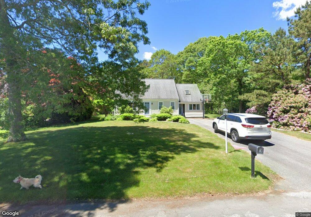
7 Triangle Cir Sandwich, MA 02563
Estimated Value: $545,000 - $672,000
3
Beds
2
Baths
1,501
Sq Ft
$408/Sq Ft
Est. Value
About This Home
This home is located at 7 Triangle Cir, Sandwich, MA 02563 and is currently estimated at $613,118, approximately $408 per square foot. 7 Triangle Cir is a home located in Barnstable County with nearby schools including Sandwich Middle High School, Sandwich Montessori School, and Riverview School.
Ownership History
Date
Name
Owned For
Owner Type
Purchase Details
Closed on
Oct 15, 1998
Sold by
Prendergast Steven J and Prendergast Jeanne G
Bought by
Ganley Andrew P and Ganley Tara L
Current Estimated Value
Home Financials for this Owner
Home Financials are based on the most recent Mortgage that was taken out on this home.
Original Mortgage
$139,400
Outstanding Balance
$27,282
Interest Rate
6.8%
Mortgage Type
Purchase Money Mortgage
Estimated Equity
$585,836
Purchase Details
Closed on
Dec 31, 1996
Sold by
Grady James T
Bought by
Prendergast Steven J
Home Financials for this Owner
Home Financials are based on the most recent Mortgage that was taken out on this home.
Original Mortgage
$96,000
Interest Rate
7.55%
Mortgage Type
Purchase Money Mortgage
Purchase Details
Closed on
Jun 30, 1994
Sold by
Piver James C and Piver Sandra L
Bought by
Grady James T
Purchase Details
Closed on
Aug 30, 1990
Sold by
Bates Earl S
Bought by
River James C
Create a Home Valuation Report for This Property
The Home Valuation Report is an in-depth analysis detailing your home's value as well as a comparison with similar homes in the area
Purchase History
| Date | Buyer | Sale Price | Title Company |
|---|---|---|---|
| Ganley Andrew P | $154,900 | -- | |
| Prendergast Steven J | $120,000 | -- | |
| Grady James T | $120,000 | -- | |
| River James C | $128,000 | -- |
Source: Public Records
Mortgage History
| Date | Status | Borrower | Loan Amount |
|---|---|---|---|
| Open | Ganley Andrew P | $139,400 | |
| Previous Owner | River James C | $100,000 | |
| Previous Owner | Prendergast Steven J | $96,000 |
Source: Public Records
Tax History
| Year | Tax Paid | Tax Assessment Tax Assessment Total Assessment is a certain percentage of the fair market value that is determined by local assessors to be the total taxable value of land and additions on the property. | Land | Improvement |
|---|---|---|---|---|
| 2025 | $5,377 | $508,700 | $179,700 | $329,000 |
| 2024 | $5,087 | $471,000 | $160,500 | $310,500 |
| 2023 | $4,970 | $432,200 | $145,900 | $286,300 |
| 2022 | $4,756 | $361,400 | $130,300 | $231,100 |
| 2021 | $4,559 | $331,100 | $125,300 | $205,800 |
| 2020 | $4,543 | $317,500 | $122,300 | $195,200 |
| 2019 | $4,339 | $303,000 | $120,100 | $182,900 |
| 2018 | $4,504 | $285,000 | $116,000 | $169,000 |
| 2017 | $4,030 | $269,900 | $112,200 | $157,700 |
| 2016 | $3,835 | $265,000 | $111,200 | $153,800 |
| 2015 | $3,720 | $251,000 | $100,100 | $150,900 |
Source: Public Records
Map
Nearby Homes
- 33 Easterly Dr
- 17 Kensington Dr
- 46 Kensington Dr
- 86 Greenville Dr
- 28 Spinnaker St
- 185 Cotuit Rd Unit JP1
- 185 Cotuit Rd Unit C5 Aspen
- 5 Bluestone Terrace
- 93 Deerfield Rd
- 13 Checkerberry Ln
- 99 Route 130
- 113 Farmersville Rd
- 58 Southpoint Dr Unit J
- 9 Viking Ln
- 24 East Rd
- 363 Service Rd
- 32 Pimlico Pond Rd
- 24 Surrey Ln
- 7 Horseshoe Cir
- 20 Anchor Dr
- 5 Triangle Cir
- 9 Triangle Cir
- 3 Triangle Cir
- 11 Triangle Cir
- 8 Triangle Cir
- 6 Triangle Cir
- 5 Rectangle Way
- 12 Triangle Cir
- 4 Triangle Cir
- 304 Cotuit Rd
- 2 Triangle Cir
- 13 Triangle Cir
- 300 Cotuit Rd
- 308 Cotuit Rd
- 72 Triangle Cir
- 6 Rectangle Way
- 15 Triangle Cir
- 312 Cotuit Rd
- 20 Triangle Cir
- 70 Triangle Cir
Your Personal Tour Guide
Ask me questions while you tour the home.