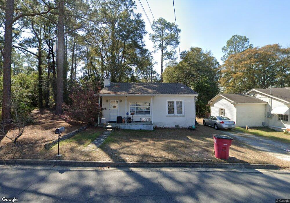
7 W Brewton St Mc Rae, GA 31055
Estimated Value: $68,000 - $127,000
--
Bed
2
Baths
1,426
Sq Ft
$68/Sq Ft
Est. Value
About This Home
This home is located at 7 W Brewton St, Mc Rae, GA 31055 and is currently estimated at $96,474, approximately $67 per square foot. 7 W Brewton St is a home located in Telfair County with nearby schools including Telfair County Elementary School, Telfair County Middle School, and Telfair County High School.
Ownership History
Date
Name
Owned For
Owner Type
Purchase Details
Closed on
Jul 18, 2023
Sold by
Hutcheson Charles
Bought by
Hutcheson Chuck
Current Estimated Value
Purchase Details
Closed on
Jul 11, 2019
Sold by
Blizzard Lena H
Bought by
Blizzard Hill Marguerite
Purchase Details
Closed on
Feb 22, 2018
Sold by
Thames Alice Powell
Bought by
Hutcheson Mary Karen
Home Financials for this Owner
Home Financials are based on the most recent Mortgage that was taken out on this home.
Original Mortgage
$26,870
Interest Rate
4.15%
Mortgage Type
New Conventional
Create a Home Valuation Report for This Property
The Home Valuation Report is an in-depth analysis detailing your home's value as well as a comparison with similar homes in the area
Home Values in the Area
Average Home Value in this Area
Purchase History
| Date | Buyer | Sale Price | Title Company |
|---|---|---|---|
| Hutcheson Chuck | -- | -- | |
| Blizzard Hill Marguerite | -- | -- | |
| Hutcheson Mary Karen | $26,500 | -- |
Source: Public Records
Mortgage History
| Date | Status | Borrower | Loan Amount |
|---|---|---|---|
| Previous Owner | Hutcheson Mary Karen | $26,870 |
Source: Public Records
Tax History Compared to Growth
Tax History
| Year | Tax Paid | Tax Assessment Tax Assessment Total Assessment is a certain percentage of the fair market value that is determined by local assessors to be the total taxable value of land and additions on the property. | Land | Improvement |
|---|---|---|---|---|
| 2024 | $1,177 | $29,160 | $966 | $28,194 |
| 2023 | $1,146 | $28,309 | $966 | $27,343 |
| 2022 | $843 | $28,309 | $966 | $27,343 |
| 2021 | $602 | $19,232 | $966 | $18,266 |
| 2020 | $519 | $16,328 | $966 | $15,362 |
| 2019 | $339 | $16,328 | $966 | $15,362 |
| 2018 | $728 | $16,892 | $966 | $15,926 |
| 2017 | $354 | $18,022 | $966 | $17,056 |
| 2016 | $354 | $18,022 | $966 | $17,056 |
| 2015 | -- | $18,022 | $966 | $17,056 |
| 2014 | -- | $18,215 | $966 | $17,249 |
| 2013 | -- | $18,214 | $966 | $17,248 |
Source: Public Records
Map
Nearby Homes
- 78 S Second Ave
- 125 Fifth Ave
- 47 S First Ave
- 141 S First Ave
- 0 Ll350 & 398 7th District Unit 30490
- 27 E Bruce St
- 15 Ben Ave
- 210 W Graham St
- 36 Strozier St
- 0 Bonaire St Unit 10647239
- 160 E Willow Creek Ln
- 76 E Grant St
- 427 3rd Ave
- 17 2nd St
- 22 Spring Ave
- Lot 126 Pansy Ln
- 0 Jackson Ave Unit 10548102
- 00 U S 341
- 0 U S 23
- 0 Concord Dr Unit 10542376
- 107 3rd Ave
- 107 S Third Ave
- 100 S Third Ave
- 100 S Third Ave
- 706 S Third Ave
- 01 Us-441 S
- 00 U S Highway 319
- 014 U S Highway 319
- 2962 Us-441 S
- N 3rd Ave
- S 3rd Ave
- 99 S Third Ave
- 110 S Third Ave
- 113 S Third Ave
- 94 S Third Ave
- 41 W Liberty St
- 68 W Brewton St
- 97 S Fourth Ave
- 33 W Liberty St
- 700 S Third Ave