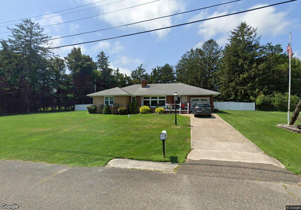
7 W Curran Dr Absecon, NJ 08201
Estimated Value: $305,916 - $377,000
--
Bed
--
Bath
1,612
Sq Ft
$222/Sq Ft
Est. Value
About This Home
This home is located at 7 W Curran Dr, Absecon, NJ 08201 and is currently estimated at $357,479, approximately $221 per square foot. 7 W Curran Dr is a home located in Atlantic County with nearby schools including Emma C. Attales Middle School, Champion Baptist Academy, and Assumption Regional Catholic School.
Ownership History
Date
Name
Owned For
Owner Type
Purchase Details
Closed on
Feb 23, 2015
Sold by
Haines Andrew M
Bought by
Hanies Andrew M and Hanies Linda A
Current Estimated Value
Purchase Details
Closed on
Jan 14, 2015
Sold by
Haines Andrew M and Rankin Charlotte A
Bought by
Haines Andrew M
Purchase Details
Closed on
Aug 10, 2001
Sold by
Haines Andrew M
Bought by
Andrew M Haines Trust and Haines Andrew M
Purchase Details
Closed on
Feb 24, 1995
Sold by
Haines Aksel and Haines Marie G
Bought by
Haines Andrew M and Haines Joan C
Create a Home Valuation Report for This Property
The Home Valuation Report is an in-depth analysis detailing your home's value as well as a comparison with similar homes in the area
Home Values in the Area
Average Home Value in this Area
Purchase History
| Date | Buyer | Sale Price | Title Company |
|---|---|---|---|
| Hanies Andrew M | -- | None Available | |
| Haines Andrew M | -- | None Available | |
| Andrew M Haines Trust | -- | -- | |
| Haines Andrew M | -- | Citizens Title Ins Agency In |
Source: Public Records
Tax History Compared to Growth
Tax History
| Year | Tax Paid | Tax Assessment Tax Assessment Total Assessment is a certain percentage of the fair market value that is determined by local assessors to be the total taxable value of land and additions on the property. | Land | Improvement |
|---|---|---|---|---|
| 2025 | $6,074 | $189,000 | $94,700 | $94,300 |
| 2024 | $6,074 | $189,000 | $94,700 | $94,300 |
| 2023 | $5,998 | $189,000 | $94,700 | $94,300 |
| 2022 | $5,998 | $189,000 | $94,700 | $94,300 |
| 2021 | $5,979 | $189,000 | $94,700 | $94,300 |
| 2020 | $5,991 | $189,000 | $94,700 | $94,300 |
| 2019 | $5,945 | $189,000 | $94,700 | $94,300 |
| 2018 | $5,972 | $189,000 | $94,700 | $94,300 |
| 2017 | $5,927 | $189,000 | $94,700 | $94,300 |
| 2016 | $6,750 | $220,400 | $94,700 | $125,700 |
| 2015 | $6,910 | $220,400 | $94,700 | $125,700 |
| 2014 | $6,565 | $220,400 | $94,700 | $125,700 |
Source: Public Records
Map
Nearby Homes
- 4 E Curran Dr
- 743 N Shore Rd
- 505 Sooy Ln
- 621 S New York Rd
- 625 N Shore Rd
- 613 S New York Rd
- 506 Lazy Ln
- 117 E Wyoming Ave
- 210 Coolidge Ave
- 0 E Dickinson Ave
- 00 California Ave
- 243 Pennsylvania Ave
- 506 E Forestbrook Dr
- 539 E Pennsylvania Ave
- 244 E Wyoming Ave
- 90 E Woodland Ave Unit E90
- 47 E Woodland Ave Unit C47
- 710 E Chip Shot Ln
- 709 E Chip Shot Ln
- 194 N Shore Rd