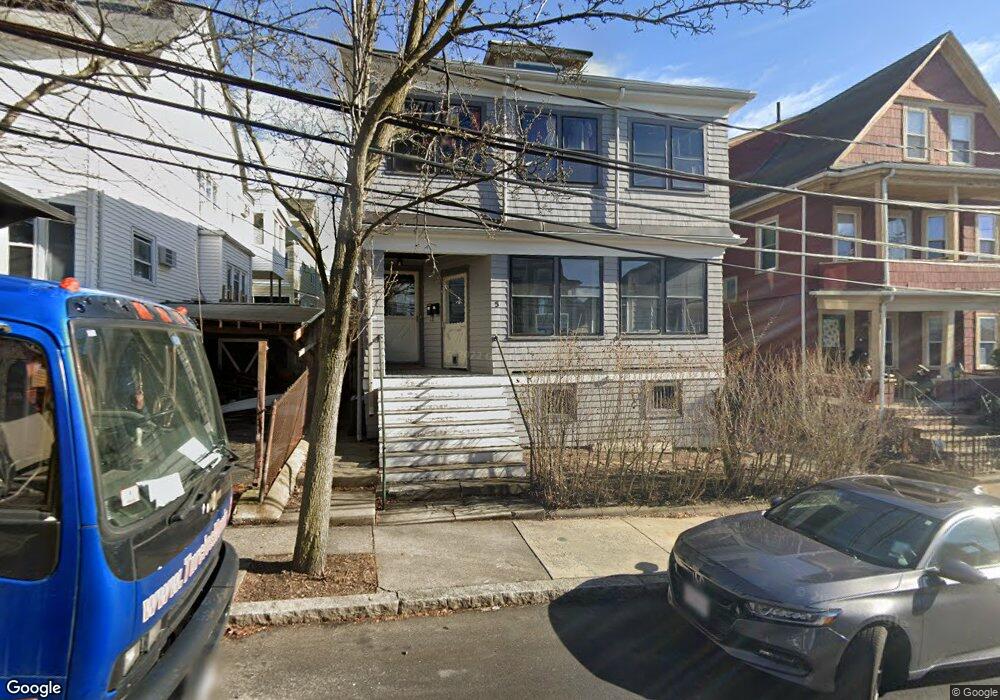
7 Watson St Somerville, MA 02144
Teele Square NeighborhoodEstimated Value: $1,149,000 - $1,424,158
5
Beds
2
Baths
2,164
Sq Ft
$594/Sq Ft
Est. Value
About This Home
This home is located at 7 Watson St, Somerville, MA 02144 and is currently estimated at $1,284,790, approximately $593 per square foot. 7 Watson St is a home located in Middlesex County with nearby schools including Somerville High School, International School of Boston, and Lesley Ellis School.
Ownership History
Date
Name
Owned For
Owner Type
Purchase Details
Closed on
Aug 20, 2008
Sold by
Higgins-Smith Barbara and Smith Steven H
Bought by
Smith Barbara H
Current Estimated Value
Purchase Details
Closed on
Jun 20, 1989
Sold by
Gioiosa Nancy
Bought by
Smith Steven H
Home Financials for this Owner
Home Financials are based on the most recent Mortgage that was taken out on this home.
Original Mortgage
$172,000
Interest Rate
10.87%
Mortgage Type
Purchase Money Mortgage
Create a Home Valuation Report for This Property
The Home Valuation Report is an in-depth analysis detailing your home's value as well as a comparison with similar homes in the area
Home Values in the Area
Average Home Value in this Area
Purchase History
| Date | Buyer | Sale Price | Title Company |
|---|---|---|---|
| Smith Barbara H | -- | -- | |
| Smith Steven H | $215,000 | -- |
Source: Public Records
Mortgage History
| Date | Status | Borrower | Loan Amount |
|---|---|---|---|
| Previous Owner | Smith Steven H | $172,000 |
Source: Public Records
Tax History
| Year | Tax Paid | Tax Assessment Tax Assessment Total Assessment is a certain percentage of the fair market value that is determined by local assessors to be the total taxable value of land and additions on the property. | Land | Improvement |
|---|---|---|---|---|
| 2025 | $11,507 | $1,054,700 | $643,500 | $411,200 |
| 2024 | $10,867 | $1,033,000 | $643,500 | $389,500 |
| 2023 | $10,815 | $1,045,900 | $643,500 | $402,400 |
| 2022 | $9,988 | $981,100 | $612,800 | $368,300 |
| 2021 | $9,745 | $956,300 | $608,400 | $347,900 |
| 2020 | $9,583 | $949,800 | $608,800 | $341,000 |
| 2019 | $9,021 | $838,400 | $554,200 | $284,200 |
| 2018 | $8,565 | $757,300 | $503,800 | $253,500 |
| 2017 | $8,252 | $707,100 | $475,300 | $231,800 |
| 2016 | $8,386 | $669,300 | $424,500 | $244,800 |
| 2015 | $7,975 | $632,400 | $391,900 | $240,500 |
Source: Public Records
Map
Nearby Homes
- 14 Farragut Ave Unit 1
- 1188 Broadway Unit 403
- 202 Powder House Blvd Unit 1
- 202 Powder House Blvd Unit 2
- 106 Electric Ave Unit 3
- 30 Clarendon Ave
- 183 Powder House Blvd
- 6 Hamilton Rd Unit 6
- 233 Powder House Blvd
- 69 Electric Ave Unit 3
- 42 Packard Ave Unit 42
- 83 Conwell Ave Unit 1
- 55 Packard Ave Unit 1
- 123 W Adams St Unit 1
- 2 Gold Star Ct
- 1004 Broadway Unit 3
- 34 Elmwood St Unit 2
- 12 Upland Rd
- 138 North St
- 45 Teel St
- 7 Watson St
- 7 Watson St Unit 1
- 3 Watson St
- 3 Watson St Unit 1
- 11 Watson St
- 11 Watson St Unit 1
- 11 Watson St Unit 2
- 10 Dickson St
- 14 Dickson St
- 1 Watson St
- 1 Watson St Unit 1A
- 6 Dickson St Unit 1
- 6 Dickson St
- 6-8 Dickson St
- 8 Dickson St Unit 2
- 42 Fairmount Ave
- 40 Fairmount Ave Unit 40
- 38 Fairmount Ave
- 38 Fairmount Ave Unit 1
- 38 Fairmount Ave Unit 3
Your Personal Tour Guide
Ask me questions while you tour the home.