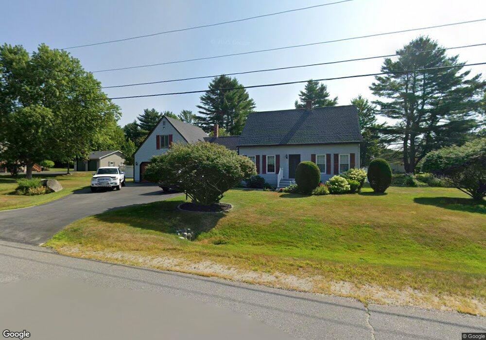
7 West St Manchester, ME 04351
Estimated Value: $368,000 - $431,000
2
Beds
2
Baths
792
Sq Ft
$488/Sq Ft
Est. Value
About This Home
This home is located at 7 West St, Manchester, ME 04351 and is currently estimated at $386,711, approximately $488 per square foot. 7 West St is a home with nearby schools including St. Michael School.
Create a Home Valuation Report for This Property
The Home Valuation Report is an in-depth analysis detailing your home's value as well as a comparison with similar homes in the area
Home Values in the Area
Average Home Value in this Area
Tax History Compared to Growth
Tax History
| Year | Tax Paid | Tax Assessment Tax Assessment Total Assessment is a certain percentage of the fair market value that is determined by local assessors to be the total taxable value of land and additions on the property. | Land | Improvement |
|---|---|---|---|---|
| 2024 | $3,124 | $188,200 | $44,700 | $143,500 |
| 2023 | $3,124 | $188,200 | $44,700 | $143,500 |
| 2022 | $2,964 | $188,200 | $44,700 | $143,500 |
| 2021 | $3,011 | $188,200 | $44,700 | $143,500 |
| 2020 | $3,238 | $185,000 | $44,700 | $140,300 |
| 2019 | $3,256 | $185,000 | $44,700 | $140,300 |
| 2018 | $3,210 | $185,000 | $44,700 | $140,300 |
| 2017 | $3,127 | $185,000 | $44,700 | $140,300 |
| 2016 | $3,034 | $185,000 | $44,700 | $140,300 |
| 2015 | $2,951 | $185,000 | $44,700 | $140,300 |
| 2013 | $2,766 | $185,000 | $44,700 | $140,300 |
Source: Public Records
Map
Nearby Homes
- 0 Cross St
- 0 Ingraham St
- 33 Woodridge Dr
- 43 Estates Dr Unit 1
- 35 Estates Dr Unit 3
- 26 Peggy Ln
- 693- B Western Ave
- 2549 US Route 202
- 226 Pond Rd
- 0 Allen Hill Ln
- 424 Winthrop St
- TBD Pond Rd
- 19 Windy Meadows Dr
- 252 Meadowhill Rd
- 165 Wade Rd
- Lot 55 S Birchwood Ln
- 3 Tallwood Rd
- 11 Sunrise Dr
- 772 Prescott Rd
- 13 Tibbetts St