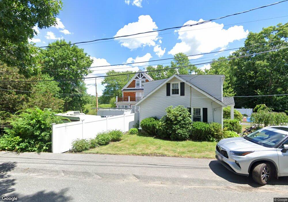
70 Berkeley Rd Dedham, MA 02026
Riverdale NeighborhoodEstimated Value: $575,000 - $626,000
1
Bed
4
Baths
1,053
Sq Ft
$569/Sq Ft
Est. Value
About This Home
This home is located at 70 Berkeley Rd, Dedham, MA 02026 and is currently estimated at $599,383, approximately $569 per square foot. 70 Berkeley Rd is a home located in Norfolk County with nearby schools including Riverdale Elementary School, Dedham Middle School, and Dedham High School.
Ownership History
Date
Name
Owned For
Owner Type
Purchase Details
Closed on
Dec 3, 2002
Sold by
Stott Margaret
Bought by
Rampans Edward and Rampans Lisa A
Current Estimated Value
Home Financials for this Owner
Home Financials are based on the most recent Mortgage that was taken out on this home.
Original Mortgage
$175,900
Outstanding Balance
$70,946
Interest Rate
6.16%
Mortgage Type
Purchase Money Mortgage
Estimated Equity
$528,437
Create a Home Valuation Report for This Property
The Home Valuation Report is an in-depth analysis detailing your home's value as well as a comparison with similar homes in the area
Home Values in the Area
Average Home Value in this Area
Purchase History
| Date | Buyer | Sale Price | Title Company |
|---|---|---|---|
| Rampans Edward | $219,900 | -- |
Source: Public Records
Mortgage History
| Date | Status | Borrower | Loan Amount |
|---|---|---|---|
| Open | Rampans Edward | $175,900 |
Source: Public Records
Tax History
| Year | Tax Paid | Tax Assessment Tax Assessment Total Assessment is a certain percentage of the fair market value that is determined by local assessors to be the total taxable value of land and additions on the property. | Land | Improvement |
|---|---|---|---|---|
| 2025 | $6,628 | $525,200 | $340,500 | $184,700 |
| 2024 | $6,110 | $488,800 | $308,900 | $179,900 |
| 2023 | $5,850 | $455,600 | $279,700 | $175,900 |
| 2022 | $5,551 | $415,800 | $262,600 | $153,200 |
| 2021 | $5,110 | $373,800 | $243,200 | $130,600 |
| 2020 | $5,127 | $373,700 | $243,200 | $130,500 |
| 2019 | $4,798 | $339,100 | $211,500 | $127,600 |
| 2018 | $4,607 | $316,600 | $185,100 | $131,500 |
| 2017 | $4,413 | $299,000 | $173,300 | $125,700 |
| 2016 | $4,522 | $291,900 | $160,400 | $131,500 |
| 2015 | $5,034 | $317,200 | $159,300 | $157,900 |
| 2014 | $5,015 | $311,900 | $156,400 | $155,500 |
Source: Public Records
Map
Nearby Homes
- 75 Bingham Ave
- 27 Pine St
- 147 Pine St
- 27 Clough Rd
- 45 Commonwealth Ave
- 56 Riverview St
- 1515 Vfw Pkwy Unit M19
- 41 Vogel St
- 63 Dixon Ave
- 570 Bridge St
- 17 Vogel St
- 15 Vogel St
- 8 Sumner St
- 160 Glenellen Rd
- 800 High St
- 18 Hemlock Rd
- 69 Keystone St Unit 1
- 5257 Washington St Unit 2
- 42 Churchill Place
- 25 Rockland St Unit 5
- 58 Arlington Rd
- 68 Berkeley Rd
- 64 Berkeley Rd
- 65 Arlington Rd
- 55 Arlington Rd
- 48 Arlington Rd
- 73 Berkeley Rd
- 73 Berkeley Rd Unit 73
- 49 Arlington Rd
- 67 Berkeley Rd
- 40 Arlington Rd
- 47 Berkeley Rd
- 38 Farrington Ave
- 34 Farrington Ave
- 43 Arlington Rd
- 48 Farrington Ave
- 32 Arlington Rd
- 48 Berkeley Rd
- 26 Farrington Ave
- 39 Berkeley Rd
Your Personal Tour Guide
Ask me questions while you tour the home.