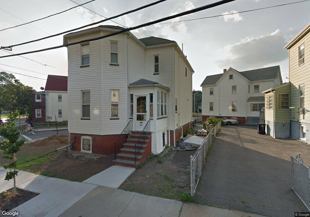
70 Bradford St Everett, MA 02149
West Everett NeighborhoodEstimated Value: $625,000 - $690,000
3
Beds
2
Baths
1,526
Sq Ft
$428/Sq Ft
Est. Value
About This Home
This home is located at 70 Bradford St, Everett, MA 02149 and is currently estimated at $653,643, approximately $428 per square foot. 70 Bradford St is a home located in Middlesex County with nearby schools including Everett High School, Pioneer Charter School of Science, and St Anthony School.
Ownership History
Date
Name
Owned For
Owner Type
Purchase Details
Closed on
Jun 6, 2018
Sold by
Gentile Tiffany A
Bought by
70 Bradford Street Rt and Gentile
Current Estimated Value
Purchase Details
Closed on
Jul 13, 2012
Sold by
Gentile Ft and Gentile
Bought by
Gentile Tiffany A
Home Financials for this Owner
Home Financials are based on the most recent Mortgage that was taken out on this home.
Original Mortgage
$160,000
Interest Rate
3.76%
Mortgage Type
New Conventional
Create a Home Valuation Report for This Property
The Home Valuation Report is an in-depth analysis detailing your home's value as well as a comparison with similar homes in the area
Home Values in the Area
Average Home Value in this Area
Purchase History
| Date | Buyer | Sale Price | Title Company |
|---|---|---|---|
| 70 Bradford Street Rt | -- | -- | |
| Gentile Tiffany A | $200,000 | -- | |
| Gentile Tiffany A | $200,000 | -- |
Source: Public Records
Mortgage History
| Date | Status | Borrower | Loan Amount |
|---|---|---|---|
| Previous Owner | Gentile Tiffany A | $160,000 | |
| Previous Owner | Gentile Tiffany A | $50,000 |
Source: Public Records
Tax History
| Year | Tax Paid | Tax Assessment Tax Assessment Total Assessment is a certain percentage of the fair market value that is determined by local assessors to be the total taxable value of land and additions on the property. | Land | Improvement |
|---|---|---|---|---|
| 2025 | $6,790 | $596,100 | $245,100 | $351,000 |
| 2024 | $6,176 | $538,900 | $214,700 | $324,200 |
| 2023 | $6,034 | $512,200 | $205,400 | $306,800 |
| 2022 | $4,983 | $481,000 | $196,000 | $285,000 |
| 2021 | $4,373 | $443,100 | $175,500 | $267,600 |
| 2020 | $4,668 | $438,700 | $175,500 | $263,200 |
| 2019 | $4,915 | $397,000 | $167,100 | $229,900 |
| 2018 | $4,771 | $346,200 | $144,100 | $202,100 |
| 2017 | $4,154 | $287,700 | $110,900 | $176,800 |
| 2016 | $4,059 | $280,900 | $110,900 | $170,000 |
| 2015 | $3,832 | $262,300 | $103,900 | $158,400 |
Source: Public Records
Map
Nearby Homes
- 210 Hancock St
- 139 Bucknam St
- 21 Central Ave Unit 10
- 21 Staples Ave Unit 26
- 48 Cleveland Ave
- 15 Staples Ave Unit 45
- 15 Staples Ave Unit 31
- 340 Main St
- 44 Walnut St
- 68 Linden St Unit 49
- 80 Main St Unit 9
- 80 Main St Unit 4
- 56 Valley St
- 132 Vernal St
- 171 Bell Rock St Unit 171
- 89 Judson St
- 67 Converse Ave Unit 69
- 19 Mills St
- 13 Coolidge St
- 120 Wyllis Ave Unit 401
- 72 Bradford St
- 78 Bradford St
- 76 Bradford St
- 79 Kinsman St
- 74 Bradford St
- 71 Bradford St
- 75 Bradford St
- 67 Bradford St
- 85 Kinsman St
- 83 Kinsman St
- 65 Bradford St
- 79 Bradford St
- 79 Bradford St Unit 2
- 58 Bradford St
- 80 Kinsman St
- 87 Kinsman St
- 87 Kinsman St Unit 2
- 82 Bradford St
- 86 Bradford St
- 82 Kinsman St Unit 82
Your Personal Tour Guide
Ask me questions while you tour the home.