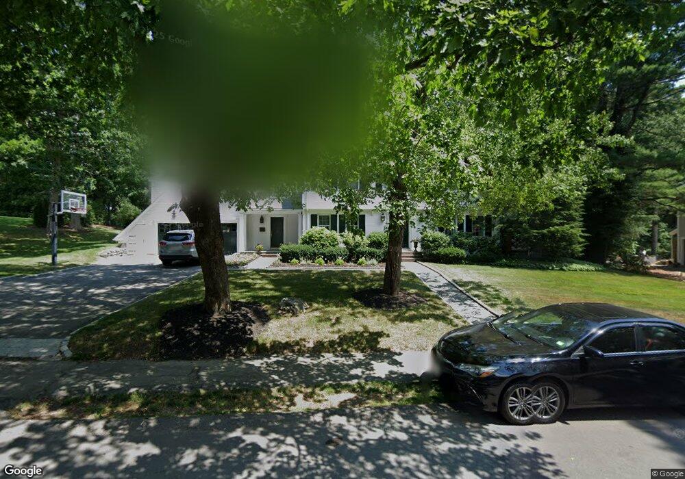
70 Bristol Rd Wellesley Hills, MA 02481
Cliff Estates NeighborhoodEstimated Value: $2,454,208 - $3,172,000
5
Beds
4
Baths
3,254
Sq Ft
$876/Sq Ft
Est. Value
About This Home
This home is located at 70 Bristol Rd, Wellesley Hills, MA 02481 and is currently estimated at $2,852,052, approximately $876 per square foot. 70 Bristol Rd is a home located in Norfolk County with nearby schools including Ernest F. Upham Elementary School, Wellesley Middle School, and Wellesley Sr High School.
Ownership History
Date
Name
Owned For
Owner Type
Purchase Details
Closed on
Apr 28, 2005
Sold by
Somerville Kurt F and Somerville Ruth W
Bought by
Burstein Harold J and Mullen Mary P
Current Estimated Value
Home Financials for this Owner
Home Financials are based on the most recent Mortgage that was taken out on this home.
Original Mortgage
$850,000
Outstanding Balance
$446,323
Interest Rate
5.95%
Mortgage Type
Purchase Money Mortgage
Estimated Equity
$2,405,729
Purchase Details
Closed on
Nov 4, 1991
Sold by
Somerville Janice H
Bought by
Somerville Kurt F and Ruth W Somerville
Home Financials for this Owner
Home Financials are based on the most recent Mortgage that was taken out on this home.
Original Mortgage
$125,000
Interest Rate
8.9%
Mortgage Type
Purchase Money Mortgage
Create a Home Valuation Report for This Property
The Home Valuation Report is an in-depth analysis detailing your home's value as well as a comparison with similar homes in the area
Home Values in the Area
Average Home Value in this Area
Purchase History
| Date | Buyer | Sale Price | Title Company |
|---|---|---|---|
| Burstein Harold J | $1,600,000 | -- | |
| Somerville Kurt F | $400,000 | -- |
Source: Public Records
Mortgage History
| Date | Status | Borrower | Loan Amount |
|---|---|---|---|
| Open | Burstein Harold J | $850,000 | |
| Previous Owner | Somerville Kurt F | $150,000 | |
| Previous Owner | Somerville Kurt F | $125,000 |
Source: Public Records
Tax History Compared to Growth
Tax History
| Year | Tax Paid | Tax Assessment Tax Assessment Total Assessment is a certain percentage of the fair market value that is determined by local assessors to be the total taxable value of land and additions on the property. | Land | Improvement |
|---|---|---|---|---|
| 2025 | $20,704 | $2,014,000 | $1,247,000 | $767,000 |
| 2024 | $20,674 | $1,986,000 | $1,247,000 | $739,000 |
| 2023 | $20,301 | $1,773,000 | $1,089,000 | $684,000 |
| 2022 | $18,127 | $1,552,000 | $863,000 | $689,000 |
| 2021 | $18,236 | $1,552,000 | $863,000 | $689,000 |
| 2020 | $17,941 | $1,552,000 | $863,000 | $689,000 |
| 2019 | $17,957 | $1,552,000 | $863,000 | $689,000 |
| 2018 | $19,550 | $1,636,000 | $880,000 | $756,000 |
| 2017 | $19,288 | $1,636,000 | $880,000 | $756,000 |
| 2016 | $18,999 | $1,606,000 | $865,000 | $741,000 |
| 2015 | $18,635 | $1,612,000 | $865,000 | $747,000 |
Source: Public Records
Map
Nearby Homes
- 15 Essex Rd
- 39 Audubon Rd
- 7 Mountview Rd
- 99 Old Colony Rd
- 201 Lowell Rd
- 18 Sprague Rd
- 6 Nantucket Rd
- 42 Edmunds Rd
- 209 Bristol Rd
- 35 Albion Rd
- 26 Edmunds Rd
- 16 Stearns Rd Unit 101
- 16 Stearns Rd Unit 302
- 16 Stearns Rd Unit 207
- 16 Stearns Rd Unit 301
- 16 Stearns Rd Unit 103
- 16 Stearns Rd Unit 202
- 16 Stearns Rd Unit 304
- 16 Stearns Rd Unit 104
- 16 Stearns Rd Unit 108
- 00 Bristol Circle (Off Hill St) Unit 43
- 00 Bristol Circle (Off Hill St) Unit 38
- 115 Lowell Rd
- 76 Bristol Rd
- 64 Bristol Rd
- 73 Bristol Rd
- 121 Lowell Rd
- 107 Lowell Rd
- 65 Bristol Rd
- 82 Bristol Rd
- 58 Bristol Rd
- 112 Lowell Rd
- 81 Bristol Rd
- 127 Lowell Rd
- 122 Lowell Rd
- 61 Bristol Rd
- 69 Hampshire Rd
- 45 Hampshire Rd
- 39 Hampshire Rd
- 46 Sagamore Rd