Estimated Value: $162,036 - $239,000
About This Home
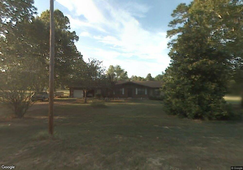
This home is located at 70 Bryant St, Ward, AR 72176 and is currently estimated at $203,259, approximately $114 per square foot. 70 Bryant St is a home located in Lonoke County with nearby schools including Ward Central Elementary School, Cabot Middle School North, and Cabot Junior High North.
Ownership History
We collect this data history from publicly available records. To have your information removed, we recommend requesting removal directly through your county’s website.
Purchase Details
Purchase Details
Purchase Details
Purchase Details
Purchase Details
Purchase Details
Home Values in the Area
Average Home Value in this Area
Purchase History
We collect this data history from publicly available records. To have your information removed, we recommend requesting removal directly through your county’s website.
| Date | Buyer | Sale Price | Title Company |
|---|---|---|---|
| -- | -- | ||
| $72,000 | -- | ||
| $72,000 | -- | ||
| -- | -- | ||
| $70,000 | -- | ||
| -- | -- | ||
| -- | -- | ||
| $87,200 | -- |
Tax History
We collect this data history from publicly available records. To have your information removed, we recommend requesting removal directly through your county’s website.
| Year | Tax Paid | Tax Assessment Tax Assessment Total Assessment is a certain percentage of the fair market value that is determined by local assessors to be the total taxable value of land and additions on the property. | Land | Improvement |
|---|---|---|---|---|
| 2025 | $672 | $21,820 | $2,000 | $19,820 |
| 2024 | $672 | $21,820 | $2,000 | $19,820 |
| 2023 | $672 | $21,820 | $2,000 | $19,820 |
| 2022 | $722 | $21,820 | $2,000 | $19,820 |
| 2021 | $722 | $21,820 | $2,000 | $19,820 |
| 2020 | $722 | $21,560 | $2,000 | $19,560 |
| 2019 | $722 | $21,560 | $2,000 | $19,560 |
| 2018 | $747 | $21,560 | $2,000 | $19,560 |
| 2017 | $966 | $21,560 | $2,000 | $19,560 |
| 2016 | $688 | $21,560 | $2,000 | $19,560 |
| 2015 | $921 | $19,420 | $2,000 | $17,420 |
| 2014 | $638 | $19,420 | $2,000 | $17,420 |
Map
- 8 Shady Grove Cove
- 80 Bryson Dr
- 2 Shady Grove Ln
- 00 Moon Rd
- 716 Moon Rd
- 2 Moon Rd
- 0 Sweetwater
- 26 Huntington Dr
- 62 Grand Stand Dr
- 252 Trailwood Dr
- 52 Grand Stand Dr
- 1175 Stagecoach Blvd
- 1167 Stagecoach Blvd
- 1159 Stagecoach Blvd
- 212 Sierra Cove
- 1172 Stagecoach Blvd
- 1166 Stagecoach Blvd
- 1144 Stagecoach Blvd
- 251 Trailwood Dr
- 1136 Stagecoach Blvd
Ask me questions while you tour the home.