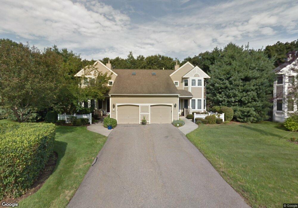
70 Cannon Forge Dr Foxboro, MA 02035
Estimated Value: $566,000 - $601,000
2
Beds
3
Baths
1,674
Sq Ft
$349/Sq Ft
Est. Value
About This Home
This home is located at 70 Cannon Forge Dr, Foxboro, MA 02035 and is currently estimated at $584,011, approximately $348 per square foot. 70 Cannon Forge Dr is a home located in Norfolk County with nearby schools including Foxborough High School, Foxborough Regional Charter School, and The Sage School.
Ownership History
Date
Name
Owned For
Owner Type
Purchase Details
Closed on
Jun 1, 2018
Sold by
Feinberg Robert E and Feinberg Janice R
Bought by
Feinberg Ft
Current Estimated Value
Purchase Details
Closed on
Aug 27, 1999
Sold by
Adamic Hazel K
Bought by
Feinberg Robert E and Feinberg Janice R
Home Financials for this Owner
Home Financials are based on the most recent Mortgage that was taken out on this home.
Original Mortgage
$165,000
Interest Rate
7.53%
Mortgage Type
Purchase Money Mortgage
Purchase Details
Closed on
Jul 19, 1993
Sold by
Skanco Sharon Foxb Dev
Bought by
Adamic Hazel K
Create a Home Valuation Report for This Property
The Home Valuation Report is an in-depth analysis detailing your home's value as well as a comparison with similar homes in the area
Home Values in the Area
Average Home Value in this Area
Purchase History
| Date | Buyer | Sale Price | Title Company |
|---|---|---|---|
| Feinberg Ft | -- | -- | |
| Feinberg Robert E | $275,000 | -- | |
| Adamic Hazel K | $189,000 | -- |
Source: Public Records
Mortgage History
| Date | Status | Borrower | Loan Amount |
|---|---|---|---|
| Previous Owner | Adamic Hazel K | $144,000 | |
| Previous Owner | Adamic Hazel K | $165,000 |
Source: Public Records
Tax History Compared to Growth
Tax History
| Year | Tax Paid | Tax Assessment Tax Assessment Total Assessment is a certain percentage of the fair market value that is determined by local assessors to be the total taxable value of land and additions on the property. | Land | Improvement |
|---|---|---|---|---|
| 2025 | $6,363 | $481,300 | $0 | $481,300 |
| 2024 | $6,385 | $472,600 | $0 | $472,600 |
| 2023 | $5,859 | $412,300 | $0 | $412,300 |
| 2022 | $5,997 | $413,000 | $0 | $413,000 |
| 2021 | $5,906 | $400,700 | $0 | $400,700 |
| 2020 | $5,175 | $355,200 | $0 | $355,200 |
| 2019 | $5,241 | $356,500 | $0 | $356,500 |
| 2018 | $4,971 | $341,200 | $0 | $341,200 |
| 2017 | $5,494 | $365,300 | $0 | $365,300 |
| 2016 | $5,180 | $349,500 | $0 | $349,500 |
| 2015 | $4,824 | $317,600 | $0 | $317,600 |
| 2014 | $4,539 | $302,800 | $0 | $302,800 |
Source: Public Records
Map
Nearby Homes
- 132 Cannon Forge Dr
- 9 Independence Dr Unit 9
- 35 Independence Dr Unit 35
- 170 Cannon Forge Dr
- 12 Community Way
- 89 Oak St
- 67 Morse St
- 14 Winter St Unit B
- 18 Winter St Unit E
- 5 Lauren Ln
- 3 Maura Elizabeth Ln
- 261 East St
- Lot One Old Wolomolopoag St
- Lot Two Old Wolomolopoag St
- 84 Cocasset St Unit A6
- 19 Fuller Rd Unit 7
- 2 Red Fox Run
- 186 Mechanic St
- 3 Wampanoag Rd
- 5 Chase Dr
- 58 Cannon Forge Dr
- 82 Cannon Forge Dr
- 84 Cannon Forge Dr
- 60 Cannon Forge Dr
- 52 Cannon Forge Dr
- 46 Cannon Forge Dr
- 50 Cannon Forge Dr
- 54 Cannon Forge Dr
- 78 Cannon Forge Dr
- 86 Cannon Forge Dr
- 68 Cannon Forge Dr
- 66 Cannon Forge Dr
- 64 Cannon Forge Dr
- 62 Cannon Forge Dr
- 56 Cannon Forge Dr
- 80 Cannon Forge Dr
- 76 Cannon Forge Dr
- 74 Cannon Forge Dr
- 76 Cannon Forge Dr Unit 76 B
- 64 Cannon Forge Dr Unit B64