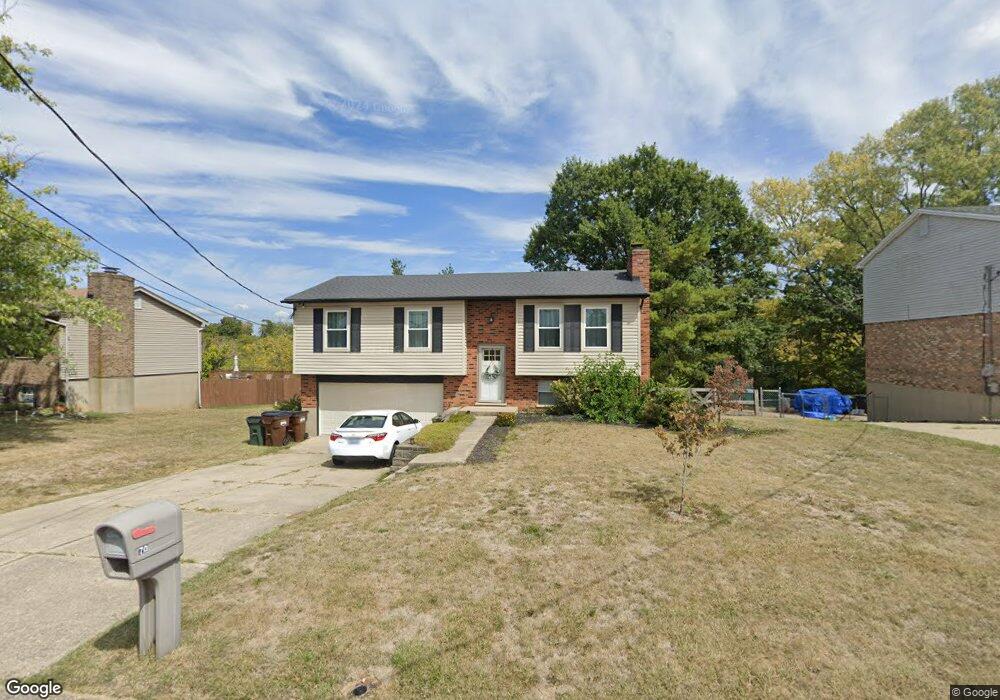
70 Carrie Way Dr Independence, KY 41051
Estimated Value: $271,000 - $289,000
4
Beds
3
Baths
1,000
Sq Ft
$282/Sq Ft
Est. Value
About This Home
This home is located at 70 Carrie Way Dr, Independence, KY 41051 and is currently estimated at $281,904, approximately $281 per square foot. 70 Carrie Way Dr is a home located in Kenton County with nearby schools including Kenton Elementary School, Simon Kenton High School, and St. Cecilia Catholic School.
Ownership History
Date
Name
Owned For
Owner Type
Purchase Details
Closed on
May 23, 2025
Sold by
Weddington Isaac Thomas and Weddington Haley
Bought by
Plancarte Andres
Current Estimated Value
Home Financials for this Owner
Home Financials are based on the most recent Mortgage that was taken out on this home.
Original Mortgage
$280,819
Outstanding Balance
$279,859
Interest Rate
6.83%
Mortgage Type
FHA
Estimated Equity
$2,045
Purchase Details
Closed on
Jan 12, 2022
Sold by
Stone Jason R
Bought by
Weddington Isaac Thomas
Home Financials for this Owner
Home Financials are based on the most recent Mortgage that was taken out on this home.
Original Mortgage
$214,750
Interest Rate
3.05%
Mortgage Type
New Conventional
Purchase Details
Closed on
Feb 28, 2011
Sold by
Stone Theresa Lynn
Bought by
Stone Jason R
Home Financials for this Owner
Home Financials are based on the most recent Mortgage that was taken out on this home.
Original Mortgage
$88,500
Interest Rate
4.71%
Mortgage Type
New Conventional
Create a Home Valuation Report for This Property
The Home Valuation Report is an in-depth analysis detailing your home's value as well as a comparison with similar homes in the area
Home Values in the Area
Average Home Value in this Area
Purchase History
| Date | Buyer | Sale Price | Title Company |
|---|---|---|---|
| Plancarte Andres | $286,000 | 360 American Title | |
| Plancarte Andres | $286,000 | 360 American Title | |
| Weddington Isaac Thomas | $228,000 | 360 American Title | |
| Stone Jason R | $120,000 | 360 American Title Svcs Llc |
Source: Public Records
Mortgage History
| Date | Status | Borrower | Loan Amount |
|---|---|---|---|
| Open | Plancarte Andres | $280,819 | |
| Closed | Plancarte Andres | $280,819 | |
| Previous Owner | Weddington Isaac Thomas | $214,750 | |
| Previous Owner | Stone Jason R | $88,500 |
Source: Public Records
Tax History Compared to Growth
Tax History
| Year | Tax Paid | Tax Assessment Tax Assessment Total Assessment is a certain percentage of the fair market value that is determined by local assessors to be the total taxable value of land and additions on the property. | Land | Improvement |
|---|---|---|---|---|
| 2024 | $2,793 | $228,000 | $30,000 | $198,000 |
| 2023 | $2,877 | $228,000 | $30,000 | $198,000 |
| 2022 | $2,835 | $220,000 | $30,000 | $190,000 |
| 2021 | $1,945 | $146,800 | $30,000 | $116,800 |
| 2020 | $1,636 | $120,000 | $25,000 | $95,000 |
| 2019 | $1,641 | $120,000 | $25,000 | $95,000 |
| 2018 | $1,649 | $120,000 | $25,000 | $95,000 |
| 2017 | $1,605 | $120,000 | $25,000 | $95,000 |
| 2015 | $1,554 | $120,000 | $25,000 | $95,000 |
| 2014 | $1,533 | $120,000 | $25,000 | $95,000 |
Source: Public Records
Map
Nearby Homes
- 5234 Madison Pike
- 5151 Noble Ct
- 84 Sherwood Dr
- 64 Sylvan Dr
- 5238 Belle Dr
- 5118 Dana Harvey Ln
- 10347 Petersburg Ct
- 1365 Cairns Ct
- 5359 Fawnview Ct
- 9947 Meadow Glen Dr
- 10363 Canberra Dr
- 1199 Hatcher Ct
- 9972 Meadow Glen Dr
- 1228 Bull Run
- 5383 Valleycreek Dr
- 10323 Manassas Ct
- 1253 Shiloh Ct
- 10448 Canberra Dr
- 57 Walnut Hall Dr
- 10447 Canberra Dr
- 74 Carrie Way Dr
- 74 Carrie Way
- 66 Carrie
- 66 Carrie Way Dr
- 78 Carrie Way Dr
- 62 Carrie Way
- 78 Carrie Way
- 62 Carrie Way Dr
- 75 Carrie Way Dr
- 71 Carrie Way Dr
- 82 Carrie Way
- 82 Carrie Way Dr
- 58 Carrie Way Dr
- 67 Carrie Way Dr
- 79 Carrie Way Dr
- 61 Carrie Way
- 61 Carrie Way Dr
- 83 Carrie Way
- 86 Carrie Way Dr
- 54 Carrie Way Dr