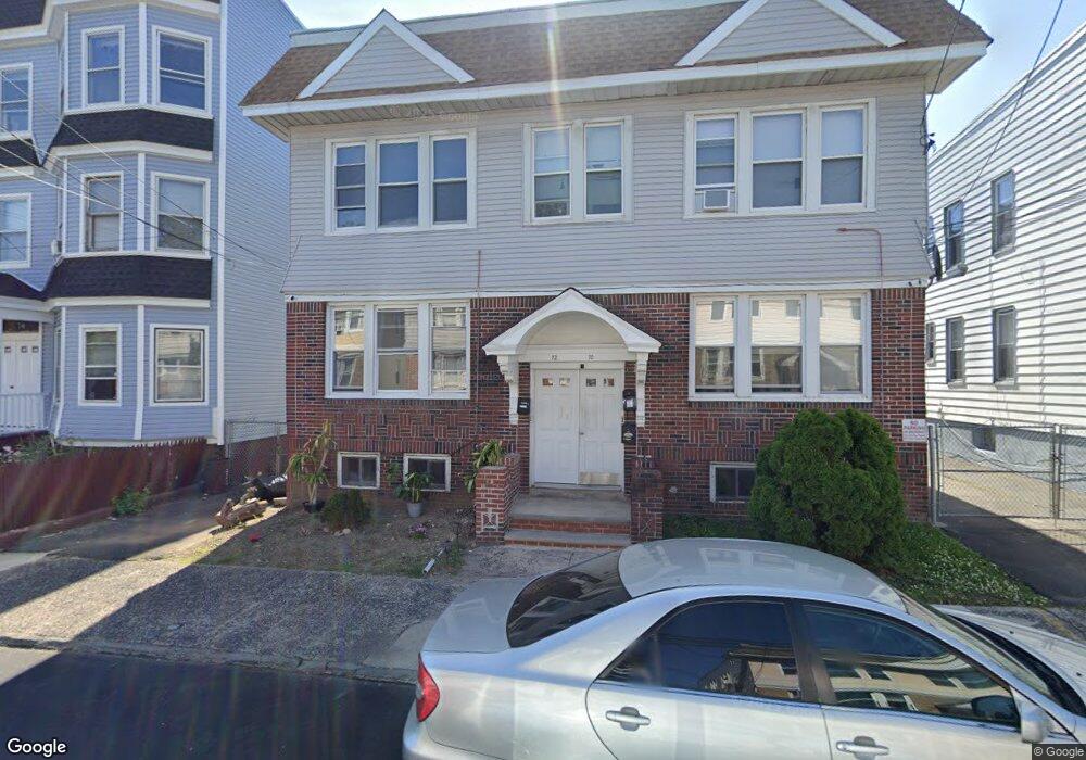
70 Halstead St Unit 72 Newark, NJ 07106
Upper Vailsburg NeighborhoodEstimated Value: $706,478 - $852,000
Studio
--
Bath
3,960
Sq Ft
$204/Sq Ft
Est. Value
About This Home
This home is located at 70 Halstead St Unit 72, Newark, NJ 07106 and is currently estimated at $807,370, approximately $203 per square foot. 70 Halstead St Unit 72 is a home located in Essex County with nearby schools including Lincoln Elementary School, Mt. Vernon School, and Hawthorne Avenue Elementary School.
Ownership History
Date
Name
Owned For
Owner Type
Purchase Details
Closed on
Mar 8, 2019
Sold by
Coote Wesley
Bought by
Roman Selvis and Basantes-De-Roman Olga B
Current Estimated Value
Purchase Details
Closed on
Jun 30, 2005
Sold by
Mcallister Walter
Bought by
Coote Wesley
Home Financials for this Owner
Home Financials are based on the most recent Mortgage that was taken out on this home.
Original Mortgage
$293,550
Interest Rate
5.81%
Create a Home Valuation Report for This Property
The Home Valuation Report is an in-depth analysis detailing your home's value as well as a comparison with similar homes in the area
Home Values in the Area
Average Home Value in this Area
Purchase History
| Date | Buyer | Sale Price | Title Company |
|---|---|---|---|
| Roman Selvis | $410,000 | First American Title | |
| Coote Wesley | $309,000 | -- |
Source: Public Records
Mortgage History
| Date | Status | Borrower | Loan Amount |
|---|---|---|---|
| Previous Owner | Coote Wesley | $293,550 |
Source: Public Records
Tax History
| Year | Tax Paid | Tax Assessment Tax Assessment Total Assessment is a certain percentage of the fair market value that is determined by local assessors to be the total taxable value of land and additions on the property. | Land | Improvement |
|---|---|---|---|---|
| 2025 | $8,192 | $215,400 | $19,400 | $196,000 |
| 2024 | $8,030 | $215,400 | $19,400 | $196,000 |
| 2022 | $8,047 | $215,400 | $19,400 | $196,000 |
| 2021 | $8,043 | $215,400 | $19,400 | $196,000 |
| 2020 | $8,185 | $215,400 | $19,400 | $196,000 |
| 2019 | $8,101 | $215,400 | $19,400 | $196,000 |
| 2018 | $7,955 | $215,400 | $19,400 | $196,000 |
| 2017 | $7,668 | $215,400 | $19,400 | $196,000 |
| 2016 | $7,410 | $215,400 | $19,400 | $196,000 |
| 2015 | $7,128 | $215,400 | $19,400 | $196,000 |
| 2014 | $6,680 | $215,400 | $19,400 | $196,000 |
Source: Public Records
Map
Nearby Homes
- 85 Smith St
- 491 Norwood St
- 31 Halstead St
- 82 Palm St
- 106 Halstead St Unit 110
- 510 Halsted St
- 465 Norwood St Unit 2
- 552 Norwood St
- 459 Norwood St
- 32 Palm St
- 129 Brookwood St
- 129 Brookwood St Unit 2
- 143 Smith St
- 149 Smith St
- 132 Brookwood St Unit 2
- 132 Brookwood St
- 63 Sunnyside Terrace
- 23 Kenmore Ave
- 441 S Clinton St
- 39 Brookdale Ave
- 74 Halstead St
- 76 Halstead St Unit 2
- 76 Halstead St Unit 78
- 66 Halstead St Unit 2
- 66 Halstead St Unit 68
- 66 Halstead St
- 66 Halsted St
- 33 Norwood Place
- 62 Halstead St Unit 64
- 62 Halstead St Unit 1R
- 31 Norwood Place
- 67 Halstead St Unit 69
- 67 Halstead St Unit 1R
- 29 Norwood Place
- 58 Halstead St Unit 60
- 58 Halstead St
- 82 Halstead St Unit 86
- 71 Halstead St Unit 73
- 71-73 Halsted St
- 71 Halsted St
Your Personal Tour Guide
Ask me questions while you tour the home.