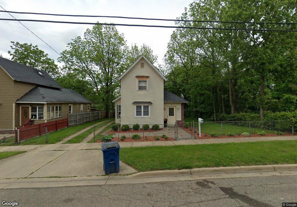
70 High St Battle Creek, MI 49014
Post Franklin NeighborhoodEstimated Value: $65,000 - $102,000
4
Beds
1
Bath
1,208
Sq Ft
$71/Sq Ft
Est. Value
About This Home
This home is located at 70 High St, Battle Creek, MI 49014 and is currently estimated at $86,155, approximately $71 per square foot. 70 High St is a home located in Calhoun County with nearby schools including Post-Franklin Elementary School, Springfield Middle School, and Battle Creek Central High School.
Ownership History
Date
Name
Owned For
Owner Type
Purchase Details
Closed on
Oct 30, 2023
Sold by
Rodriguez Mercedes P and Melgar Ruber Andoni
Bought by
Perez Rodriguez Mercedes
Current Estimated Value
Purchase Details
Closed on
Feb 14, 2023
Sold by
Castaneda Ramon
Bought by
Perez Rodriguez Merecedes and Melgar Meiga Ruber
Purchase Details
Closed on
Jun 1, 1998
Bought by
Torres
Purchase Details
Closed on
May 31, 1996
Bought by
Deskins
Create a Home Valuation Report for This Property
The Home Valuation Report is an in-depth analysis detailing your home's value as well as a comparison with similar homes in the area
Home Values in the Area
Average Home Value in this Area
Purchase History
| Date | Buyer | Sale Price | Title Company |
|---|---|---|---|
| Perez Rodriguez Mercedes | -- | None Listed On Document | |
| Perez Rodriguez Merecedes | -- | -- | |
| Torres | -- | -- | |
| Deskins | -- | -- |
Source: Public Records
Tax History Compared to Growth
Tax History
| Year | Tax Paid | Tax Assessment Tax Assessment Total Assessment is a certain percentage of the fair market value that is determined by local assessors to be the total taxable value of land and additions on the property. | Land | Improvement |
|---|---|---|---|---|
| 2025 | -- | $32,700 | $0 | $0 |
| 2024 | $1,281 | $27,178 | $0 | $0 |
| 2023 | $870 | $22,702 | $0 | $0 |
| 2022 | $618 | $18,741 | $0 | $0 |
| 2021 | $827 | $17,120 | $0 | $0 |
| 2020 | $940 | $16,910 | $0 | $0 |
| 2019 | $1,065 | $14,153 | $0 | $0 |
| 2018 | $1,065 | $12,040 | $660 | $11,380 |
| 2017 | $1,025 | $16,862 | $0 | $0 |
| 2016 | $1,023 | $15,940 | $0 | $0 |
| 2015 | $765 | $18,733 | $3,275 | $15,458 |
| 2014 | $765 | $14,328 | $3,275 | $11,053 |
Source: Public Records
Map
Nearby Homes
- 76 Taft St
- 51 Pauline Ave
- 50 Douglas St
- 418 Main St
- 130 Cliff St
- 390 E Michigan Ave
- 47 Alden Ave W
- 100 Illinois St
- 66 Cleveland St
- 136 Jericho Rd
- 57 Euclid St
- 501 Michigan Ave E
- 519 S Shore Dr
- 507 Michigan Ave E
- 503 S Shore Dr
- 232 Cliff St
- 180 Grenville St
- 174 Cherry St
- 118 Nelson St
- 17 Tennyson Ave