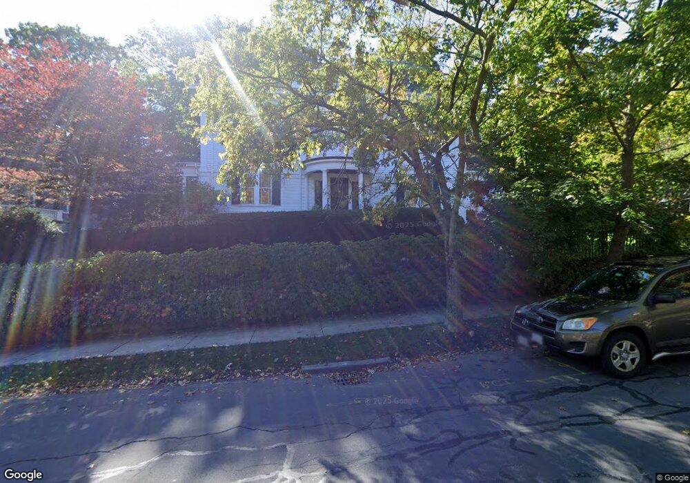
70 Hyslop Rd Brookline, MA 02445
Brookline Village NeighborhoodEstimated Value: $3,540,000 - $5,126,000
7
Beds
6
Baths
5,181
Sq Ft
$844/Sq Ft
Est. Value
About This Home
This home is located at 70 Hyslop Rd, Brookline, MA 02445 and is currently estimated at $4,370,600, approximately $843 per square foot. 70 Hyslop Rd is a home located in Norfolk County with nearby schools including John D. Runkle School, Torah Academy, and Maimonides School.
Ownership History
Date
Name
Owned For
Owner Type
Purchase Details
Closed on
Jan 10, 2007
Sold by
Sandra E Marcus Ret
Bought by
Marcus Sandra E and Oneill Charles T
Current Estimated Value
Purchase Details
Closed on
Sep 25, 1996
Sold by
Falk Alfred F Est and Falk Ex
Bought by
Marcus Robert L and Marcus Sandra E
Home Financials for this Owner
Home Financials are based on the most recent Mortgage that was taken out on this home.
Original Mortgage
$644,225
Interest Rate
7.83%
Mortgage Type
Purchase Money Mortgage
Create a Home Valuation Report for This Property
The Home Valuation Report is an in-depth analysis detailing your home's value as well as a comparison with similar homes in the area
Home Values in the Area
Average Home Value in this Area
Purchase History
| Date | Buyer | Sale Price | Title Company |
|---|---|---|---|
| Marcus Sandra E | -- | -- | |
| Marcus Robert L | -- | -- | |
| Marcus Robert L | -- | -- | |
| Marcus Robert L | $715,000 | -- |
Source: Public Records
Mortgage History
| Date | Status | Borrower | Loan Amount |
|---|---|---|---|
| Previous Owner | Marcus Robert L | $170,000 | |
| Previous Owner | Marcus Robert L | $644,225 |
Source: Public Records
Tax History Compared to Growth
Tax History
| Year | Tax Paid | Tax Assessment Tax Assessment Total Assessment is a certain percentage of the fair market value that is determined by local assessors to be the total taxable value of land and additions on the property. | Land | Improvement |
|---|---|---|---|---|
| 2025 | $43,452 | $4,402,400 | $1,803,600 | $2,598,800 |
| 2024 | $41,475 | $4,245,100 | $1,734,200 | $2,510,900 |
| 2023 | $36,404 | $3,651,400 | $1,239,000 | $2,412,400 |
| 2022 | $35,437 | $3,477,600 | $1,180,000 | $2,297,600 |
| 2021 | $32,769 | $3,343,800 | $1,134,600 | $2,209,200 |
| 2020 | $30,361 | $3,212,800 | $1,031,400 | $2,181,400 |
| 2019 | $28,670 | $3,059,800 | $982,300 | $2,077,500 |
| 2018 | $28,519 | $3,014,700 | $1,000,100 | $2,014,600 |
| 2017 | $27,844 | $2,818,200 | $943,500 | $1,874,700 |
| 2016 | $27,444 | $2,633,800 | $881,800 | $1,752,000 |
| 2015 | $26,289 | $2,461,500 | $824,100 | $1,637,400 |
| 2014 | $27,325 | $2,399,000 | $749,200 | $1,649,800 |
Source: Public Records
Map
Nearby Homes
- 540 Chestnut Hill Ave
- 120 Seaver St Unit A103
- 120 Seaver St Unit C-102
- 9 Willard Rd
- 333 Clark Rd
- 8 Strathmore Rd Unit G
- 94 Beaconsfield Rd Unit 201
- 30 Ackers Ave
- 135 Beaconsfield Rd Unit 1
- 17 Strathmore Rd Unit 2
- 55 Leicester St
- 141 Beaconsfield Rd Unit 6
- 1763 Beacon St Unit A
- 675 Chestnut Hill Ave
- 324 Tappan St Unit 1
- 324 Tappan St Unit 2
- 3 Englewood Ave Unit 9
- 59 Ackers Ave Unit 1
- 255 Tappan St
- 1856 Beacon St Unit 2C