Estimated Value: $84,151 - $220,000
--
Bed
1
Bath
1,512
Sq Ft
$103/Sq Ft
Est. Value
About This Home
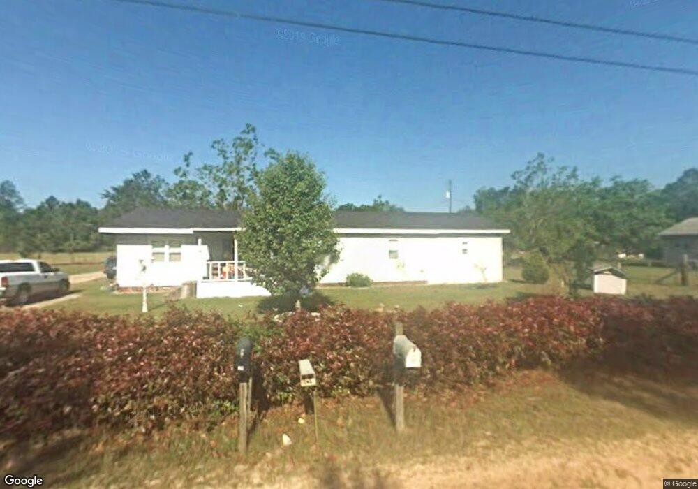
This home is located at 70 Kentucky Rd, Jesup, GA 31545 and is currently estimated at $156,038, approximately $103 per square foot. 70 Kentucky Rd is a home located in Wayne County with nearby schools including Bacon Elementary School, Martha Puckett Middle School, and Wayne County High School.
Ownership History
Date
Name
Owned For
Owner Type
Purchase Details
Closed on
Oct 29, 2007
Sold by
Sands Kenneth A
Bought by
Sands Keith A
Current Estimated Value
Home Financials for this Owner
Home Financials are based on the most recent Mortgage that was taken out on this home.
Original Mortgage
$77,300
Outstanding Balance
$48,883
Interest Rate
6.37%
Mortgage Type
New Conventional
Estimated Equity
$107,155
Purchase Details
Closed on
May 25, 2007
Sold by
Sands Jessie Mae
Bought by
Sands Keith A
Purchase Details
Closed on
Mar 1, 2003
Purchase Details
Closed on
Mar 1, 1990
Purchase Details
Closed on
Jan 1, 1990
Create a Home Valuation Report for This Property
The Home Valuation Report is an in-depth analysis detailing your home's value as well as a comparison with similar homes in the area
Home Values in the Area
Average Home Value in this Area
Purchase History
| Date | Buyer | Sale Price | Title Company |
|---|---|---|---|
| Sands Keith A | $77,300 | -- | |
| Sands Keith A | -- | -- | |
| -- | -- | -- | |
| -- | -- | -- | |
| -- | $19,500 | -- |
Source: Public Records
Mortgage History
| Date | Status | Borrower | Loan Amount |
|---|---|---|---|
| Open | Sands Keith A | $77,300 |
Source: Public Records
Tax History Compared to Growth
Tax History
| Year | Tax Paid | Tax Assessment Tax Assessment Total Assessment is a certain percentage of the fair market value that is determined by local assessors to be the total taxable value of land and additions on the property. | Land | Improvement |
|---|---|---|---|---|
| 2024 | $592 | $27,350 | $1,240 | $26,110 |
| 2023 | $695 | $23,160 | $310 | $22,850 |
| 2022 | $365 | $16,585 | $310 | $16,275 |
| 2021 | $391 | $16,585 | $310 | $16,275 |
| 2020 | $404 | $16,585 | $310 | $16,275 |
| 2019 | $416 | $16,585 | $310 | $16,275 |
| 2018 | $416 | $16,585 | $310 | $16,275 |
| 2017 | $358 | $16,585 | $310 | $16,275 |
| 2016 | $347 | $16,585 | $310 | $16,275 |
| 2014 | $348 | $16,585 | $310 | $16,275 |
| 2013 | -- | $16,584 | $310 | $16,274 |
Source: Public Records
Map
Nearby Homes
- 0000 Spring Grove Rd
- na Georgia 169
- 695 Lanes Bridge Rd
- 695 Lanes Bridge
- 308 Cowboy Rd
- 440 Oak Island Estates Rd
- 10235 Lanes Bridge Rd
- 0 Bay Acres Rd Unit 159302
- 0 Bay Acres Rd Unit 10457722
- 0 Bay Acres Rd Unit 1651861
- 15 Paris Dr
- 721 Cowboy Rd
- 000 Hamburg St
- 177 Bunion Rd
- 705 S 11th St
- 155 Persimmon St
- 100 Morgan Dr
- 1276 Spring Grove Rd
- 113 Tift St
- 118 Charlton St
- 78 Kentucky Rd
- 34 Kentucky Rd
- 100 Kentucky Rd
- 50 Kentucky Rd
- 145 Sewell Rd
- 125 Sewell Rd
- 140 Kentucky Rd
- 181 Sewell Rd
- 178 Kentucky Rd
- 131 Horseshoe Dr
- 115 Horseshoe Dr
- 95 Horseshoe Dr
- 215 Sewell Rd
- 161 Horseshoe Dr
- 69 Horseshoe Dr
- 901 Lanes Bridge Rd
- 33 Sewell Rd
- 120 Horseshoe Dr
- 82 Horseshoe Dr
- 175 Horseshoe Dr