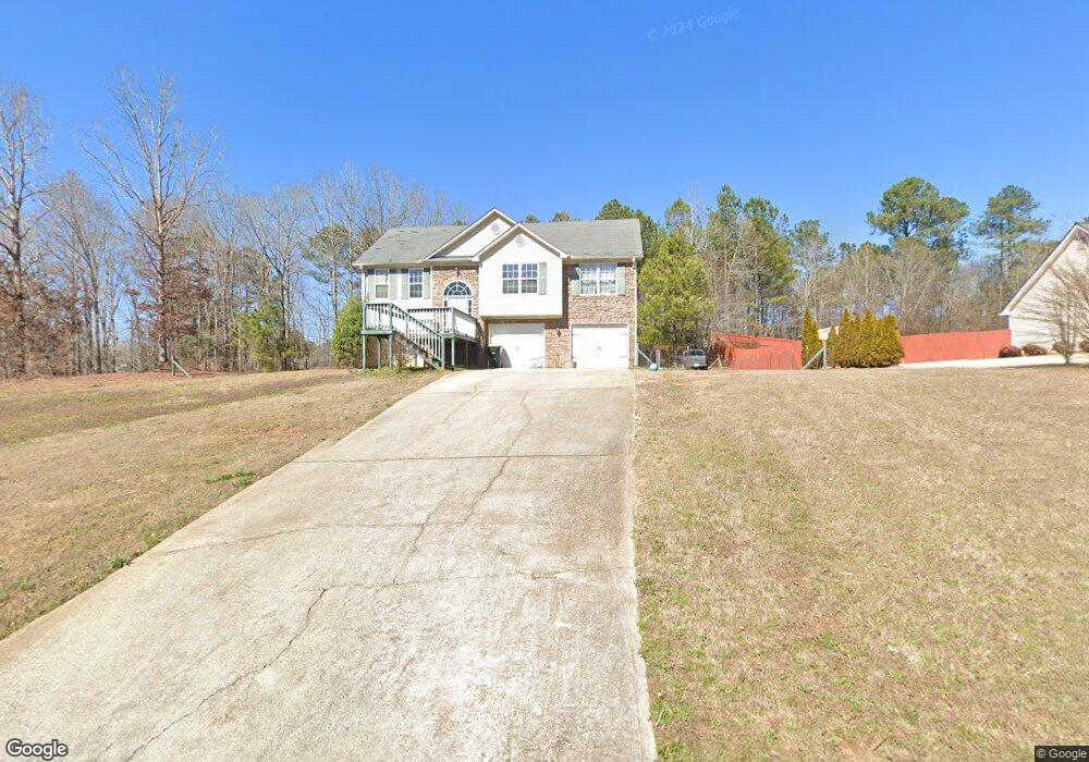
70 Lamar Ln Covington, GA 30016
Estimated Value: $253,000 - $280,000
5
Beds
3
Baths
1,275
Sq Ft
$210/Sq Ft
Est. Value
About This Home
This home is located at 70 Lamar Ln, Covington, GA 30016 and is currently estimated at $267,118, approximately $209 per square foot. 70 Lamar Ln is a home located in Newton County with nearby schools including Livingston Elementary School, Indian Creek Middle School, and Alcovy High School.
Ownership History
Date
Name
Owned For
Owner Type
Purchase Details
Closed on
Jan 13, 2017
Sold by
Martin Robin
Bought by
Greer Anthony
Current Estimated Value
Purchase Details
Closed on
Jan 9, 2009
Sold by
Federal National Mortgage Association
Bought by
Martin Robin
Home Financials for this Owner
Home Financials are based on the most recent Mortgage that was taken out on this home.
Original Mortgage
$62,400
Interest Rate
5.48%
Mortgage Type
New Conventional
Purchase Details
Closed on
Nov 4, 2008
Sold by
Everhome Mortgage
Bought by
Federal National Mortgage Association
Purchase Details
Closed on
Apr 6, 2006
Sold by
Maldonado Vilma
Bought by
Maldonado Vilma and Maldonado Brauilo D P
Home Financials for this Owner
Home Financials are based on the most recent Mortgage that was taken out on this home.
Original Mortgage
$151,000
Interest Rate
6.2%
Mortgage Type
New Conventional
Create a Home Valuation Report for This Property
The Home Valuation Report is an in-depth analysis detailing your home's value as well as a comparison with similar homes in the area
Home Values in the Area
Average Home Value in this Area
Purchase History
| Date | Buyer | Sale Price | Title Company |
|---|---|---|---|
| Greer Anthony | -- | -- | |
| Martin Robin | -- | -- | |
| Federal National Mortgage Association | -- | -- | |
| Everhome Mortgage Co | $126,835 | -- | |
| Maldonado Vilma | -- | -- | |
| Maldonado Vilma | $151,000 | -- |
Source: Public Records
Mortgage History
| Date | Status | Borrower | Loan Amount |
|---|---|---|---|
| Previous Owner | Martin Robin | $62,400 | |
| Previous Owner | Maldonado Vilma | $151,000 |
Source: Public Records
Tax History Compared to Growth
Tax History
| Year | Tax Paid | Tax Assessment Tax Assessment Total Assessment is a certain percentage of the fair market value that is determined by local assessors to be the total taxable value of land and additions on the property. | Land | Improvement |
|---|---|---|---|---|
| 2025 | $2,424 | $98,640 | $15,600 | $83,040 |
| 2024 | $2,671 | $106,720 | $18,800 | $87,920 |
| 2023 | $2,610 | $97,640 | $10,000 | $87,640 |
| 2022 | $2,033 | $76,360 | $7,800 | $68,560 |
| 2021 | $2,005 | $67,840 | $10,000 | $57,840 |
| 2020 | $2,231 | $64,520 | $6,800 | $57,720 |
| 2019 | $2,236 | $63,680 | $6,800 | $56,880 |
| 2018 | $2,169 | $61,320 | $6,800 | $54,520 |
| 2017 | $1,804 | $50,680 | $6,800 | $43,880 |
| 2016 | $1,658 | $46,440 | $4,800 | $41,640 |
| 2015 | $1,450 | $40,400 | $4,800 | $35,600 |
| 2014 | $1,180 | $32,640 | $0 | $0 |
Source: Public Records
Map
Nearby Homes
- 1752 Highway 162
- 105 Heyman Dr Unit 79
- 0 Chestnut Rd Unit 10616695
- 70 Mountainside Ln
- 20 Mountainview Ct Unit 2
- 115 Mountainview Dr
- 25 Shady Oaks Trail
- 125 Shelby Oaks Trail
- 225 Long Creek Dr
- 190 Harville Rd
- 230 Barcelona Dr
- 0 Highway 81 S Unit 7670352
- 66 Ellis Trail
- 0 Tempie Ln
- 15 Granville Ln
- 1599 Lower River Rd
- 000 Lower River Rd
- 3807 Mote Rd
- 240 Huntington St
- 402 Rocky Plains Rd