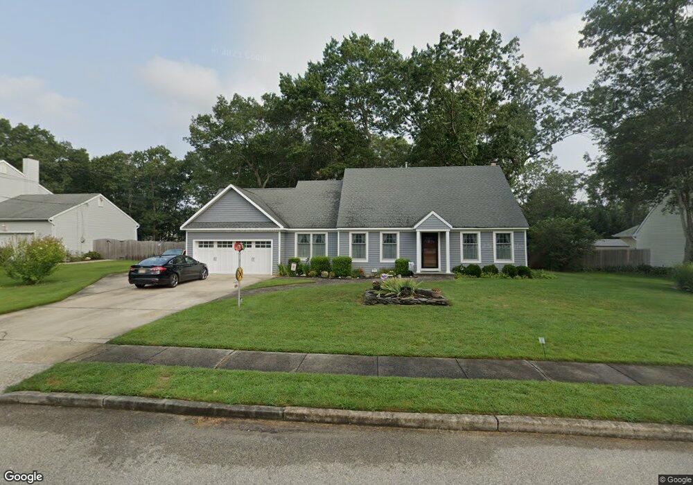
70 Maxim Dr Forked River, NJ 08731
Lacey Township NeighborhoodEstimated Value: $654,000 - $758,000
3
Beds
2
Baths
2,720
Sq Ft
$259/Sq Ft
Est. Value
About This Home
This home is located at 70 Maxim Dr, Forked River, NJ 08731 and is currently estimated at $703,138, approximately $258 per square foot. 70 Maxim Dr is a home located in Ocean County with nearby schools including Lacey Township High School.
Ownership History
Date
Name
Owned For
Owner Type
Purchase Details
Closed on
Apr 12, 2002
Sold by
Davis Nancy
Bought by
Trisko Christopher and Trisko Eileen
Current Estimated Value
Home Financials for this Owner
Home Financials are based on the most recent Mortgage that was taken out on this home.
Original Mortgage
$130,000
Outstanding Balance
$55,120
Interest Rate
7.13%
Estimated Equity
$648,018
Purchase Details
Closed on
Apr 28, 1999
Sold by
Decataldo George and Decataldo Jeanette
Bought by
Davis Raymond J and Davis Nancy B
Home Financials for this Owner
Home Financials are based on the most recent Mortgage that was taken out on this home.
Original Mortgage
$120,000
Interest Rate
6.92%
Create a Home Valuation Report for This Property
The Home Valuation Report is an in-depth analysis detailing your home's value as well as a comparison with similar homes in the area
Home Values in the Area
Average Home Value in this Area
Purchase History
| Date | Buyer | Sale Price | Title Company |
|---|---|---|---|
| Trisko Christopher | $295,000 | -- | |
| Davis Raymond J | $222,000 | -- |
Source: Public Records
Mortgage History
| Date | Status | Borrower | Loan Amount |
|---|---|---|---|
| Open | Trisko Christopher | $130,000 | |
| Previous Owner | Davis Raymond J | $120,000 |
Source: Public Records
Tax History Compared to Growth
Tax History
| Year | Tax Paid | Tax Assessment Tax Assessment Total Assessment is a certain percentage of the fair market value that is determined by local assessors to be the total taxable value of land and additions on the property. | Land | Improvement |
|---|---|---|---|---|
| 2025 | $10,354 | $408,600 | $126,000 | $282,600 |
| 2024 | $9,680 | $408,600 | $126,000 | $282,600 |
| 2023 | $9,247 | $408,600 | $126,000 | $282,600 |
| 2022 | $9,247 | $408,600 | $126,000 | $282,600 |
| 2021 | $9,091 | $408,600 | $126,000 | $282,600 |
| 2020 | $8,801 | $408,600 | $126,000 | $282,600 |
| 2019 | $8,646 | $408,600 | $126,000 | $282,600 |
| 2018 | $8,544 | $408,600 | $126,000 | $282,600 |
| 2017 | $8,348 | $408,600 | $126,000 | $282,600 |
| 2016 | $8,315 | $408,600 | $126,000 | $282,600 |
| 2015 | $7,943 | $408,600 | $126,000 | $282,600 |
| 2014 | $6,898 | $415,600 | $136,000 | $279,600 |
Source: Public Records
Map
Nearby Homes
- 147 Foxhollow Dr
- 534 Holmes Ave N
- 109 Foxhollow Dr
- 711 Chelsea St
- 650 Chelsea St
- 421 Carr St
- 635 Chelsea St
- 551 Rosewood Dr
- 551 Rosewood Dr Unit 551 R
- 747 Hill St
- 809 Clifton St
- 459 Steuben Ave
- 738 Oxford Rd
- 707 Cambridge Rd
- 424 Continental St
- 3 Easy St
- 910 Alpine St
- 705 Princeton Rd
- 855 Harrison Ave
- 533 Chelsea St
- 72 Maxim Dr
- 68 Maxim Dr Unit 1
- 68 Maxim Dr
- 74 Maxim Dr
- 101 Manchester Ave
- 73 Maxim Dr
- 71 Maxim Dr
- 76 Maxim Dr
- 77 Maxim Dr
- 103 Manchester Ave
- 99 Manchester Ave
- 69 Maxim Dr
- 66 Maxim Dr
- 73 Manchester Ave
- 73 Manchester Ave Unit 1
- 73 Manchester Ave Unit 2
- 79 Maxim Dr
- 105 Manchester Ave
- 71 Manchester Ave
- 78 Maxim Dr