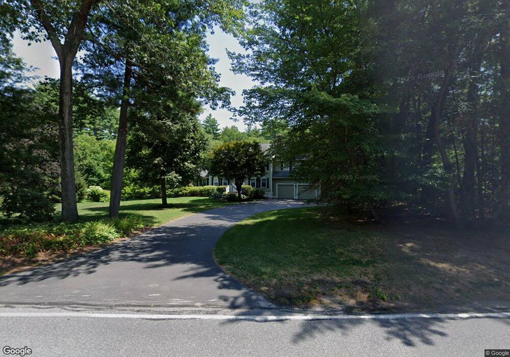
70 Pantry Rd Sudbury, MA 01776
Estimated Value: $1,291,807 - $1,450,000
4
Beds
4
Baths
2,800
Sq Ft
$494/Sq Ft
Est. Value
About This Home
This home is located at 70 Pantry Rd, Sudbury, MA 01776 and is currently estimated at $1,383,702, approximately $494 per square foot. 70 Pantry Rd is a home located in Middlesex County with nearby schools including Josiah Haynes Elementary School, Ephraim Curtis Middle School, and Lincoln-Sudbury Regional High School.
Ownership History
Date
Name
Owned For
Owner Type
Purchase Details
Closed on
Jul 7, 2004
Sold by
Ayer Deborah and Ayer John B
Bought by
Marcoux J Paul and Marcoux Joanne H
Current Estimated Value
Home Financials for this Owner
Home Financials are based on the most recent Mortgage that was taken out on this home.
Original Mortgage
$599,200
Outstanding Balance
$301,308
Interest Rate
6.32%
Mortgage Type
Purchase Money Mortgage
Estimated Equity
$1,082,394
Purchase Details
Closed on
Aug 13, 1993
Sold by
First Colonial Dev
Bought by
Ayer John B and Ayer Deborah
Home Financials for this Owner
Home Financials are based on the most recent Mortgage that was taken out on this home.
Original Mortgage
$342,900
Interest Rate
7.16%
Mortgage Type
Purchase Money Mortgage
Create a Home Valuation Report for This Property
The Home Valuation Report is an in-depth analysis detailing your home's value as well as a comparison with similar homes in the area
Home Values in the Area
Average Home Value in this Area
Purchase History
| Date | Buyer | Sale Price | Title Company |
|---|---|---|---|
| Marcoux J Paul | $749,000 | -- | |
| Ayer John B | $381,000 | -- |
Source: Public Records
Mortgage History
| Date | Status | Borrower | Loan Amount |
|---|---|---|---|
| Open | Marcoux J Paul | $599,200 | |
| Previous Owner | Ayer John B | $50,000 | |
| Previous Owner | Ayer John B | $342,900 |
Source: Public Records
Tax History Compared to Growth
Tax History
| Year | Tax Paid | Tax Assessment Tax Assessment Total Assessment is a certain percentage of the fair market value that is determined by local assessors to be the total taxable value of land and additions on the property. | Land | Improvement |
|---|---|---|---|---|
| 2025 | $17,306 | $1,182,100 | $439,300 | $742,800 |
| 2024 | $16,641 | $1,139,000 | $426,500 | $712,500 |
| 2023 | $15,679 | $994,200 | $394,900 | $599,300 |
| 2022 | $15,393 | $852,800 | $362,500 | $490,300 |
| 2021 | $14,663 | $778,700 | $362,500 | $416,200 |
| 2020 | $14,367 | $778,700 | $362,500 | $416,200 |
| 2019 | $13,938 | $778,200 | $362,500 | $415,700 |
| 2018 | $13,779 | $768,500 | $386,500 | $382,000 |
| 2017 | $13,239 | $746,300 | $367,700 | $378,600 |
| 2016 | $12,834 | $721,000 | $353,700 | $367,300 |
| 2015 | $12,332 | $700,700 | $340,100 | $360,600 |
| 2014 | $12,331 | $683,900 | $330,100 | $353,800 |
Source: Public Records
Map
Nearby Homes
- 14 Frost Ln
- 42 Dakin Rd
- 16 Blacksmith Dr
- 63 Canterbury Dr
- 401 Emery Ln Unit 104
- 121 White Pond Way Unit 121
- 941 Concord Rd
- 24 Rookery Ln Unit 6
- 56 Rookery Ln Unit 4
- Lot 5 Sailaway Ln
- 45 N Crescent Cir
- Lot 4 Sailaway Ln
- 2 Betts Way
- 8 Mina Way
- 0 Elm Unit 73282184
- Lot 9 Sailaway Ln
- 4 Betts Way
- 122 Sand Gully Rd N Unit B
- 40 Rookery Ln Unit 5
- 72 Rookery Ln Unit 3