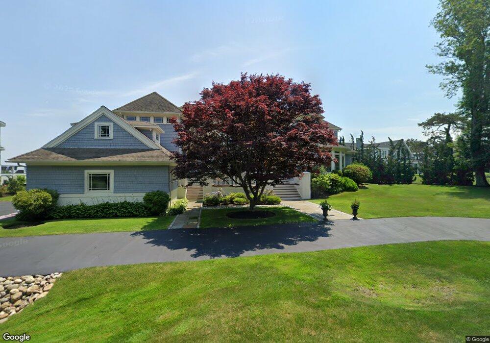
70 Phillips Beach Ave Swampscott, MA 01907
Estimated Value: $2,434,000 - $4,086,560
4
Beds
5
Baths
4,143
Sq Ft
$829/Sq Ft
Est. Value
About This Home
This home is located at 70 Phillips Beach Ave, Swampscott, MA 01907 and is currently estimated at $3,434,187, approximately $828 per square foot. 70 Phillips Beach Ave is a home located in Essex County with nearby schools including Swampscott Middle School, Swampscott High School, and Epstein Hillel School.
Ownership History
Date
Name
Owned For
Owner Type
Purchase Details
Closed on
Apr 16, 1999
Sold by
Assoc Preston Beach Lp
Bought by
Lachenauer Edkhard and Lachenauer Marlene
Current Estimated Value
Purchase Details
Closed on
Feb 2, 1995
Sold by
Stahl Arlene
Bought by
Assoc Preston Beach Lp
Create a Home Valuation Report for This Property
The Home Valuation Report is an in-depth analysis detailing your home's value as well as a comparison with similar homes in the area
Home Values in the Area
Average Home Value in this Area
Purchase History
| Date | Buyer | Sale Price | Title Company |
|---|---|---|---|
| Lachenauer Edkhard | $1,795,000 | -- | |
| Lachenauer Edkhard | $1,795,000 | -- | |
| Assoc Preston Beach Lp | $420,000 | -- | |
| Ferragamo Paul | $420,000 | -- | |
| Assoc Preston Beach Lp | $420,000 | -- |
Source: Public Records
Mortgage History
| Date | Status | Borrower | Loan Amount |
|---|---|---|---|
| Open | Assoc Preston Beach Lp | $300,000 | |
| Open | Assoc Preston Beach Lp | $1,125,000 |
Source: Public Records
Tax History Compared to Growth
Tax History
| Year | Tax Paid | Tax Assessment Tax Assessment Total Assessment is a certain percentage of the fair market value that is determined by local assessors to be the total taxable value of land and additions on the property. | Land | Improvement |
|---|---|---|---|---|
| 2025 | $47,532 | $4,144,000 | $2,145,200 | $1,998,800 |
| 2024 | $45,525 | $3,962,100 | $2,043,200 | $1,918,900 |
| 2023 | $44,674 | $3,805,300 | $2,043,100 | $1,762,200 |
| 2022 | $44,149 | $3,441,100 | $1,957,900 | $1,483,200 |
| 2021 | $44,384 | $3,216,200 | $1,787,900 | $1,428,300 |
| 2020 | $44,976 | $3,145,200 | $1,787,900 | $1,357,300 |
| 2019 | $42,399 | $2,789,400 | $1,617,900 | $1,171,500 |
| 2018 | $43,270 | $2,704,400 | $1,532,900 | $1,171,500 |
| 2017 | $45,775 | $2,623,200 | $1,532,900 | $1,090,300 |
| 2016 | $45,460 | $2,623,200 | $1,532,900 | $1,090,300 |
| 2015 | $44,988 | $2,623,200 | $1,532,900 | $1,090,300 |
| 2014 | $48,113 | $2,572,900 | $1,192,900 | $1,380,000 |
Source: Public Records
Map
Nearby Homes
- 35 Littles Point Rd Unit S201
- 35 Alden Rd
- 24 Orchard Cir
- 110 Galloupes Point Rd
- 25 Manton Rd
- 179 Beach Bluff Ave
- 8 Ocean View Rd
- 48 Bellevue Rd
- 37 Stanley Rd
- 21 Bay View Dr
- 71 Walnut Rd
- 75 Bay View Dr
- 13 Cedar Hill Terrace Unit 2
- 212 Humphrey St Unit 205
- 71 Greenwood Ave Unit 207
- 201 Humphrey St Unit 2
- 309 Paradise Rd
- 19 Elmwood Rd
- 306 Paradise Rd
- 9 Tedesco Pond Place Unit 9
- 76 Phillips Beach Ave
- 68 Phillips Beach Ave
- 80 Phillips Beach Ave
- 52 Phillips Beach Ave
- 75 Phillips Beach Ave
- 86 Phillips Beach Ave
- 61 Phillips Beach Ave
- 61 Phillips Beach Ave Unit 1
- 48 Phillips Beach Ave
- 48 Phillips Beach Ave
- 85 Phillips Beach Ave
- 85 Phillips Beach Ave Unit 1
- 53 Phillips Beach Ave
- 92 Phillips Beach Ave
- 1 Stonecleave Ln
- 44 Phillips Beach Ave
- 100 Phillips Beach Ave
- 45 Phillips Beachavenue
- 45 Phillips Beach Ave
- 45 Phillips Beach Ave