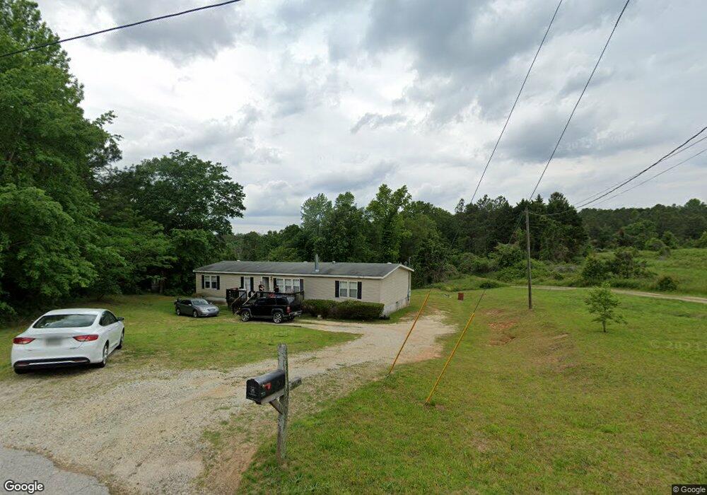
70 Pressley Rd Eastanollee, GA 30538
Estimated Value: $68,372 - $226,000
--
Bed
--
Bath
--
Sq Ft
2.94
Acres
About This Home
This home is located at 70 Pressley Rd, Eastanollee, GA 30538 and is currently estimated at $147,343. 70 Pressley Rd is a home with nearby schools including Stephens County High School.
Ownership History
Date
Name
Owned For
Owner Type
Purchase Details
Closed on
Oct 1, 2013
Sold by
Pressley Windy A
Bought by
Bank Of America
Current Estimated Value
Purchase Details
Closed on
Nov 14, 2007
Sold by
Not Provided
Bought by
Pressley Jonthan Brian and Pressley Windy A
Home Financials for this Owner
Home Financials are based on the most recent Mortgage that was taken out on this home.
Original Mortgage
$106,575
Interest Rate
6.36%
Mortgage Type
New Conventional
Purchase Details
Closed on
Oct 25, 2004
Bought by
<Buyer Info Not Present>
Purchase Details
Closed on
Dec 1, 1995
Bought by
<Buyer Info Not Present>
Create a Home Valuation Report for This Property
The Home Valuation Report is an in-depth analysis detailing your home's value as well as a comparison with similar homes in the area
Home Values in the Area
Average Home Value in this Area
Purchase History
| Date | Buyer | Sale Price | Title Company |
|---|---|---|---|
| Bank Of America | -- | -- | |
| Pressley Jonthan Brian | -- | -- | |
| Pressley Windy A | -- | -- | |
| <Buyer Info Not Present> | -- | -- | |
| <Buyer Info Not Present> | -- | -- |
Source: Public Records
Mortgage History
| Date | Status | Borrower | Loan Amount |
|---|---|---|---|
| Previous Owner | Pressley Windy A | $106,575 |
Source: Public Records
Tax History Compared to Growth
Tax History
| Year | Tax Paid | Tax Assessment Tax Assessment Total Assessment is a certain percentage of the fair market value that is determined by local assessors to be the total taxable value of land and additions on the property. | Land | Improvement |
|---|---|---|---|---|
| 2024 | $181 | $5,950 | $5,463 | $487 |
| 2023 | $181 | $5,950 | $5,463 | $487 |
| 2022 | $163 | $5,475 | $4,988 | $487 |
| 2021 | $176 | $5,620 | $4,988 | $632 |
| 2020 | $178 | $5,620 | $4,988 | $632 |
| 2019 | $169 | $5,330 | $4,698 | $632 |
| 2018 | $169 | $5,330 | $4,698 | $632 |
| 2016 | $169 | $5,330 | $4,698 | $632 |
Source: Public Records
Map
Nearby Homes
- 160 Buena Vista Dr
- 770 Buena Vista Dr
- 218 Jefferson Place
- 33 Jefferson Place
- 3953 Liberty Hill Rd
- 0 Switchback Run Unit 10437289
- 275 Southern Trace
- 255 Southern Trace
- 215 Old Mize Rd
- 184 Scott Cir
- 160 Oak Way Dr
- 140 Julia Ct
- 136 Julia Ct
- 303 Oak Way Dr
- 232 Oak Way Dr
- 271 Oak Way Dr
- 189 Julia Ln
- 3089 Georgia 17 Alternate
- 3013 Hwy 17 A
- 290 Indian Dr
- 2384 Liberty Hill Rd
- 0 Liberty Hill Rd Unit LOT 5 10510485
- 0 Liberty Hill Rd Unit LOT 6 10510519
- 0 Liberty Hill Rd Unit LOT 7 10510525
- 0 Liberty Hill Rd Unit 10510525
- 0 Liberty Hill Rd Unit 10505041
- 0 Liberty Hill Rd Unit 8451633
- 0 Liberty Hill Rd Unit 7404740
- 0 Liberty Hill Rd Unit 8829696
- 0 Liberty Hill Rd Unit 8855242
- 0 Liberty Hill Rd Unit 8919128
- 0 Liberty Hill Rd Unit 3282274
- 0 Liberty Hill Rd Unit 7105265
- 0 Liberty Hill Rd Unit 7315374
- 0 Liberty Hill Rd Unit 7323187
- 0 Liberty Hill Rd Unit 7343874
- 0 Liberty Hill Rd
- 2570 Liberty Hill Rd
- 149 Pressley Rd
- 2382 Highway 145