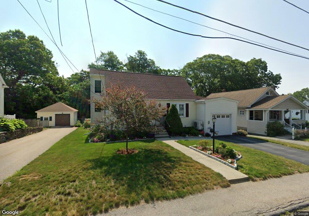
70 Rockland Rd Auburn, MA 01501
Stoneville NeighborhoodEstimated Value: $431,000 - $482,000
2
Beds
3
Baths
1,304
Sq Ft
$351/Sq Ft
Est. Value
About This Home
This home is located at 70 Rockland Rd, Auburn, MA 01501 and is currently estimated at $457,870, approximately $351 per square foot. 70 Rockland Rd is a home located in Worcester County with nearby schools including Auburn Senior High School and Shrewsbury Montessori School - Auburn Campus.
Ownership History
Date
Name
Owned For
Owner Type
Purchase Details
Closed on
Jul 30, 2003
Sold by
Rice Stephanie and Rice Thomas
Bought by
Dufresne Bruce A and Wells-Dufresne Kimberly A
Current Estimated Value
Home Financials for this Owner
Home Financials are based on the most recent Mortgage that was taken out on this home.
Original Mortgage
$202,000
Interest Rate
5.28%
Mortgage Type
VA
Purchase Details
Closed on
Jul 6, 2001
Sold by
Durling Margaret R
Bought by
Rice Thomas and Rice Stephanie
Home Financials for this Owner
Home Financials are based on the most recent Mortgage that was taken out on this home.
Original Mortgage
$138,800
Interest Rate
7.21%
Mortgage Type
Purchase Money Mortgage
Create a Home Valuation Report for This Property
The Home Valuation Report is an in-depth analysis detailing your home's value as well as a comparison with similar homes in the area
Home Values in the Area
Average Home Value in this Area
Purchase History
| Date | Buyer | Sale Price | Title Company |
|---|---|---|---|
| Dufresne Bruce A | $215,000 | -- | |
| Rice Thomas | $144,500 | -- |
Source: Public Records
Mortgage History
| Date | Status | Borrower | Loan Amount |
|---|---|---|---|
| Open | Rice Thomas | $166,198 | |
| Closed | Dufresne Bruce A | $202,000 | |
| Previous Owner | Rice Thomas | $141,000 | |
| Previous Owner | Rice Thomas | $138,800 | |
| Previous Owner | Rice Thomas | $50,000 |
Source: Public Records
Tax History Compared to Growth
Tax History
| Year | Tax Paid | Tax Assessment Tax Assessment Total Assessment is a certain percentage of the fair market value that is determined by local assessors to be the total taxable value of land and additions on the property. | Land | Improvement |
|---|---|---|---|---|
| 2025 | $58 | $405,700 | $126,900 | $278,800 |
| 2024 | $5,623 | $376,600 | $121,100 | $255,500 |
| 2023 | $5,228 | $329,200 | $110,100 | $219,100 |
| 2022 | $4,893 | $290,900 | $110,100 | $180,800 |
| 2021 | $6,889 | $250,500 | $97,200 | $153,300 |
| 2020 | $6,144 | $244,500 | $97,200 | $147,300 |
| 2019 | $4,108 | $223,000 | $96,300 | $126,700 |
| 2018 | $3,834 | $207,900 | $90,000 | $117,900 |
| 2017 | $3,582 | $195,300 | $81,600 | $113,700 |
| 2016 | $3,428 | $189,500 | $85,200 | $104,300 |
| 2015 | $3,152 | $182,600 | $85,200 | $97,400 |
| 2014 | $3,067 | $177,400 | $81,000 | $96,400 |
Source: Public Records
Map
Nearby Homes
- 25 Vinal St Unit 26
- 25 Vinal St Unit 29
- 25 Vinal St Unit 30
- 34 Rockland Rd
- 5 Commonwealth Ave
- 177 Boyce St
- 8 Shirley St
- 177 Oxford St N
- 33 Walsh Ave
- 31-33 Walsh Ave
- 31 Walsh Ave
- 19-20 Williams St
- 7 Carroll St
- 35 Pinehurst Ave
- 20 Alpine Trail
- 326 Pakachoag St
- 19 Forest Dr
- 52 Harrison Ave
- 4 S Edlin St
- 16 Dixon Ave
- 68 Rockland Rd
- 72 Rockland Rd
- 66 Rockland Rd
- 74 Rockland Rd
- 71 Rockland Rd
- 69 Rockland Rd
- 67 Rockland Rd
- 64 Rockland Rd
- 76 Rockland Rd
- 1 Rockland Road Ct
- 65 Rockland Rd
- 5 Rockland Road Ct
- 78 Rockland Rd
- 60 Rockland Rd
- 11 Rockland Road Ct
- 80 Rockland Rd
- 8 Rockland Road Ct
- 4 Rockland Road Ct
- 58 Rockland Rd
- 10 Rockland Road Ct