Estimated Value: $405,000 - $555,000
2
Beds
1
Bath
1,050
Sq Ft
$456/Sq Ft
Est. Value
About This Home
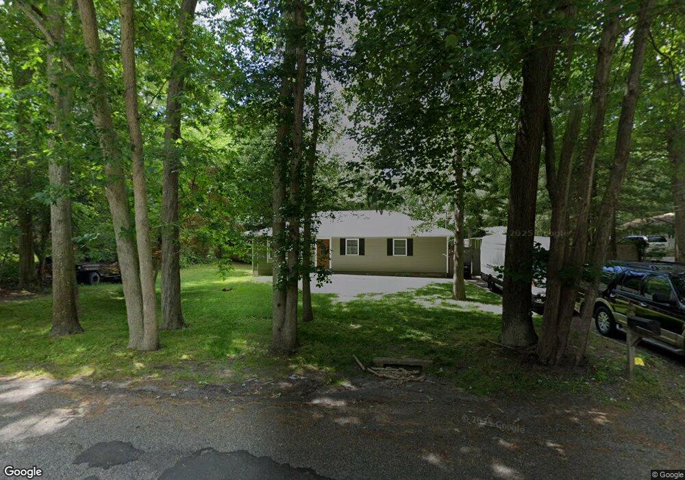
This home is located at 70 Sally Ln, Ridge, NY 11961 and is currently estimated at $478,563, approximately $455 per square foot. 70 Sally Ln is a home located in Suffolk County with nearby schools including Longwood Junior High School, Longwood Middle School, and Longwood Senior High School.
Ownership History
Date
Name
Owned For
Owner Type
Purchase Details
Closed on
Jan 12, 2024
Sold by
Auciello Daniel P
Bought by
D P & Joanne Auciello Irt and Auciello
Current Estimated Value
Purchase Details
Closed on
Jan 9, 2024
Sold by
Auciello Daniel P
Bought by
D P & Joanne Auciello Irt and Auciello
Purchase Details
Closed on
Jul 12, 2016
Sold by
Wells Fargo Bank N A
Bought by
Auciello Daniel Paul
Purchase Details
Closed on
Oct 28, 2015
Sold by
Referee Of Suffolk County and Mcelhone
Bought by
Wells Fargo Bank Na
Create a Home Valuation Report for This Property
The Home Valuation Report is an in-depth analysis detailing your home's value as well as a comparison with similar homes in the area
Home Values in the Area
Average Home Value in this Area
Purchase History
| Date | Buyer | Sale Price | Title Company |
|---|---|---|---|
| D P & Joanne Auciello Irt | -- | None Available | |
| D P & Joanne Auciello Irt | -- | None Available | |
| D P & Joanne Auciello Irt | -- | None Available | |
| D P & Joanne Auciello Irt | -- | None Available | |
| Auciello Daniel Paul | $132,500 | Safe Harbor Title Agency Ltd | |
| Auciello Daniel Paul | $132,500 | Safe Harbor Title Agency Ltd | |
| Wells Fargo Bank Na | $134,000 | Web Title Agency | |
| Wells Fargo Bank Na | $134,000 | Web Title Agency |
Source: Public Records
Mortgage History
| Date | Status | Borrower | Loan Amount |
|---|---|---|---|
| Closed | Wells Fargo Bank Na | $0 |
Source: Public Records
Tax History Compared to Growth
Tax History
| Year | Tax Paid | Tax Assessment Tax Assessment Total Assessment is a certain percentage of the fair market value that is determined by local assessors to be the total taxable value of land and additions on the property. | Land | Improvement |
|---|---|---|---|---|
| 2024 | $10,495 | $2,350 | $350 | $2,000 |
| 2023 | $10,495 | $2,350 | $350 | $2,000 |
| 2022 | $9,732 | $2,350 | $350 | $2,000 |
| 2021 | $9,732 | $2,350 | $350 | $2,000 |
| 2020 | $9,912 | $2,350 | $350 | $2,000 |
| 2019 | $9,912 | $0 | $0 | $0 |
| 2018 | $9,337 | $2,350 | $350 | $2,000 |
| 2017 | $9,337 | $2,350 | $350 | $2,000 |
| 2016 | $9,229 | $2,350 | $350 | $2,000 |
| 2015 | -- | $2,350 | $350 | $2,000 |
| 2014 | -- | $2,350 | $350 | $2,000 |
Source: Public Records
Map
Nearby Homes
- 64 Sally Ln
- Lot #6 Cardinal Ct
- 20 Ruth Ln
- 37 Pond Ln
- 10 Sally Ln
- 2405 (Lot 5) Brickyard Rd
- 11 Wildwood Rd
- Lot 39 Fox Run Ct
- 0 Elizabeth Way Unit KEY803253
- 28 Francis Mooney Dr
- 30 Elizabeth Way
- 2D Valley Forge Ct
- 85 Smith Rd
- 8 Marc Dr
- 3 Farmhouse Dr
- 11 Patrick Ln
- 70 Gull Dip Rd
- 33 Highview Ln
- 15 Bellaire Dr
- 36 Fox Run Ct
- 68 Sally Ln
- 73 Sally Ln
- 69 Sally Ln
- 76 Sally Ln
- 75 Sally Ln
- 78 Sally Ln
- 80 Sally Ln
- 67 Sally Ln
- 2009 William Floyd Pkwy
- 24 Cornfield Rd
- 83 Sally Ln
- 1991 William Floyd Pkwy
- 2011 William Floyd Pkwy
- 63 Sally Ln
- 24 Old Orchard Ln
- 1989 William Floyd Pkwy
- 61 Sally Ln
- 87 Sally Ln
- 1987 William Floyd Pkwy
- 20 Old Orchard Ln