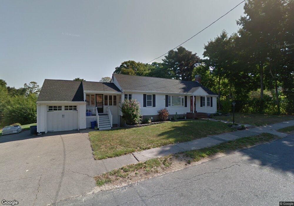
70 Sassamon Ave Milton, MA 02186
Hillside Street NeighborhoodEstimated Value: $840,744 - $935,000
2
Beds
2
Baths
1,214
Sq Ft
$722/Sq Ft
Est. Value
About This Home
This home is located at 70 Sassamon Ave, Milton, MA 02186 and is currently estimated at $876,436, approximately $721 per square foot. 70 Sassamon Ave is a home located in Norfolk County with nearby schools including Milton High School, St. Mary of the Hills School, and Milton Academy.
Ownership History
Date
Name
Owned For
Owner Type
Purchase Details
Closed on
Oct 19, 2012
Sold by
Decaro Camille A
Bought by
Decaro Camille A and Decaro Jamie
Current Estimated Value
Purchase Details
Closed on
Oct 5, 2010
Sold by
Decaro Camille A and Fahey Erin C
Bought by
Decaro Camille A
Home Financials for this Owner
Home Financials are based on the most recent Mortgage that was taken out on this home.
Original Mortgage
$285,500
Interest Rate
4.44%
Purchase Details
Closed on
Jun 28, 2007
Sold by
Collinson Gail A and Fedele Louis F
Bought by
Decaro Camille A and Fahey Erin C
Home Financials for this Owner
Home Financials are based on the most recent Mortgage that was taken out on this home.
Original Mortgage
$296,000
Interest Rate
6.24%
Mortgage Type
Purchase Money Mortgage
Purchase Details
Closed on
Dec 17, 2004
Sold by
Hannigan John W and Hannigan Marian
Bought by
Collinson Gail A and Fedele Louis F
Create a Home Valuation Report for This Property
The Home Valuation Report is an in-depth analysis detailing your home's value as well as a comparison with similar homes in the area
Home Values in the Area
Average Home Value in this Area
Purchase History
| Date | Buyer | Sale Price | Title Company |
|---|---|---|---|
| Decaro Camille A | -- | -- | |
| Decaro Camille A | -- | -- | |
| Decaro Camille A | $375,000 | -- | |
| Collinson Gail A | $390,000 | -- |
Source: Public Records
Mortgage History
| Date | Status | Borrower | Loan Amount |
|---|---|---|---|
| Previous Owner | Decaro Camille A | $285,500 | |
| Previous Owner | Decaro Camille A | $296,000 |
Source: Public Records
Tax History Compared to Growth
Tax History
| Year | Tax Paid | Tax Assessment Tax Assessment Total Assessment is a certain percentage of the fair market value that is determined by local assessors to be the total taxable value of land and additions on the property. | Land | Improvement |
|---|---|---|---|---|
| 2025 | $7,784 | $701,900 | $453,500 | $248,400 |
| 2024 | $7,280 | $666,700 | $432,000 | $234,700 |
| 2023 | $7,218 | $633,200 | $411,600 | $221,600 |
| 2022 | $7,282 | $584,000 | $411,600 | $172,400 |
| 2021 | $7,007 | $533,700 | $369,500 | $164,200 |
| 2020 | $7,443 | $567,300 | $398,200 | $169,100 |
| 2019 | $7,260 | $550,800 | $386,600 | $164,200 |
| 2018 | $6,550 | $474,300 | $317,000 | $157,300 |
| 2017 | $6,133 | $452,300 | $301,900 | $150,400 |
| 2016 | $5,684 | $421,000 | $273,200 | $147,800 |
| 2015 | $5,556 | $398,600 | $251,600 | $147,000 |
Source: Public Records
Map
Nearby Homes
- 73 Sassamon Ave
- 6 Brewster Rd
- 161 Sassamon Ave
- 79 Hillside St
- 80 Brierbrook St
- 407 Highland St
- 540 Harland St
- 675 Randolph Ave
- 50 Marine Rd
- 403405 Reedsdale Rd
- 111-113 Pleasant St
- 40 Lyman Rd
- 29 Maitland St
- 7 Preacher Rd
- 651 Canton Ave
- 418 Pleasant St
- 375 Atherton St
- 54 Elm St
- 3 Stone Bridge Ln
- 111 Shawmut St
- 60 Sassamon Ave
- 69 Sassamon Ave
- 77 Sassamon Ave
- 79 Nahanton Ave
- 83 Sassamon Ave
- 65 Sassamon Ave
- 65 Sassamon Ave Unit 65
- 65 Sassamon Ave Unit 1
- 87 Sassamon Ave
- 61 Sassamon Ave
- 71 Nahanton Ave
- 97 Nahanton Ave
- 52 Hilltop St
- 55 Sassamon Ave
- 50 Sassamon Ave
- 50 Sassamon Ave
- 55 Harbor View Park
- 86 Nahanton Ave
- 44 Hilltop St
- 78 Nahanton Ave