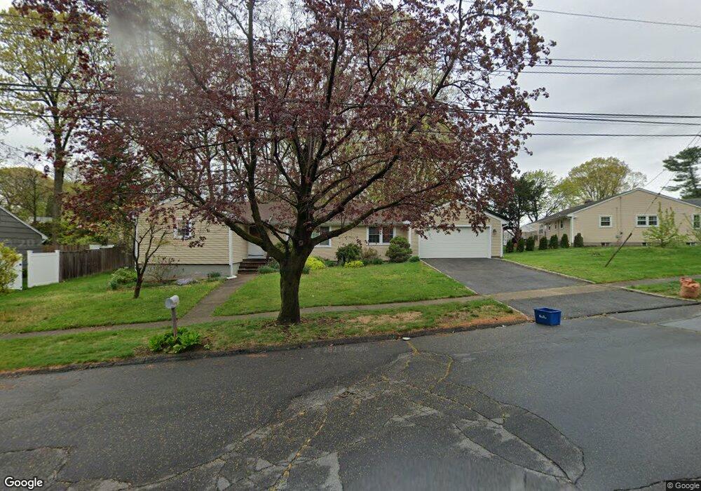
70 Sherbrook Rd Stratford, CT 06614
Estimated Value: $483,000 - $525,000
3
Beds
2
Baths
1,472
Sq Ft
$345/Sq Ft
Est. Value
About This Home
This home is located at 70 Sherbrook Rd, Stratford, CT 06614 and is currently estimated at $508,065, approximately $345 per square foot. 70 Sherbrook Rd is a home located in Fairfield County with nearby schools including Second Hill Lane Elementary School, Harry B. Flood Middle School, and Bunnell High School.
Ownership History
Date
Name
Owned For
Owner Type
Purchase Details
Closed on
Jul 24, 2015
Sold by
Bradley-Lecky Laura
Bought by
Bradley-Lecky Laura
Current Estimated Value
Purchase Details
Closed on
Oct 30, 2008
Sold by
Taylor Harold and Taylor Barbara
Bought by
Lecky Laura and Bradley Dorothy
Purchase Details
Closed on
Mar 25, 1993
Sold by
White Linda
Bought by
Taylor Harold and Morgan Barbara
Home Financials for this Owner
Home Financials are based on the most recent Mortgage that was taken out on this home.
Original Mortgage
$100,000
Interest Rate
7.73%
Mortgage Type
Unknown
Create a Home Valuation Report for This Property
The Home Valuation Report is an in-depth analysis detailing your home's value as well as a comparison with similar homes in the area
Home Values in the Area
Average Home Value in this Area
Purchase History
| Date | Buyer | Sale Price | Title Company |
|---|---|---|---|
| Bradley-Lecky Laura | -- | -- | |
| Bradley-Lecky Laura | -- | -- | |
| Bradley-Lecky Laura | -- | -- | |
| Bradley-Lecky Laura | -- | -- | |
| Bradley-Lecky Laura | -- | -- | |
| Bradley-Lecky Laura | -- | -- | |
| Bradley-Lecky Laura | -- | -- | |
| Bradley-Lecky Laura | -- | -- | |
| Lecky Laura | $316,000 | -- | |
| Taylor Harold | $172,000 | -- |
Source: Public Records
Mortgage History
| Date | Status | Borrower | Loan Amount |
|---|---|---|---|
| Previous Owner | Taylor Harold | $100,000 |
Source: Public Records
Tax History Compared to Growth
Tax History
| Year | Tax Paid | Tax Assessment Tax Assessment Total Assessment is a certain percentage of the fair market value that is determined by local assessors to be the total taxable value of land and additions on the property. | Land | Improvement |
|---|---|---|---|---|
| 2025 | $7,088 | $176,330 | $98,840 | $77,490 |
| 2024 | $7,088 | $176,330 | $98,840 | $77,490 |
| 2023 | $7,088 | $176,330 | $98,840 | $77,490 |
| 2022 | $6,958 | $176,330 | $98,840 | $77,490 |
| 2021 | $6,960 | $176,330 | $98,840 | $77,490 |
| 2020 | $6,990 | $176,330 | $98,840 | $77,490 |
| 2019 | $6,720 | $168,560 | $85,260 | $83,300 |
| 2018 | $6,726 | $168,560 | $85,260 | $83,300 |
| 2017 | $6,737 | $168,560 | $85,260 | $83,300 |
| 2016 | $6,572 | $168,560 | $85,260 | $83,300 |
| 2015 | $6,233 | $168,560 | $85,260 | $83,300 |
| 2014 | -- | $180,040 | $91,840 | $88,200 |
Source: Public Records
Map
Nearby Homes
- 175 Post Oak Rd
- 80 Sheffield Cir
- 410 Seabreeze Dr
- 135 Wigwam Ln
- 165 Douglas St
- 80 Wilbrook Rd
- 1250 Huntington Rd
- 75 Tucci Dr
- 80 Daniel Dr
- 450 Emerald Place
- 30 Bulmer Dr
- 1618 Nichols Ave
- 735 Chickadee Ln
- 181 Islandview Rd
- 2921 Nichols Ave
- 375 Silver St
- 145 Dahl Ave
- 244 Rockland Ave
- 246 Delaware Dr
- 290 Hollywood Ave
- 90 Sherbrook Rd
- 315 Fox Hill Rd
- 305 Fox Hill Rd
- 65 Sherbrook Rd
- 380 Wilbar Dr
- 40 Peacock Dr
- 295 Fox Hill Rd
- 35 Peacock Dr
- 395 Wilbar Dr
- 35 Sherbrook Rd
- 360 Wilbar Dr
- 375 Wilbar Dr
- 355 Wilbar Dr
- 60 Peacock Dr
- 450 Overland Dr
- 320 Fox Hill Rd
- 300 Fox Hill Rd
- 285 Fox Hill Rd
- 310 Fox Hill Rd
- 410 Overland Dr