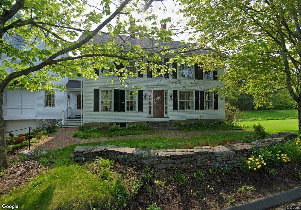
70 South St Freeport, ME 04032
Estimated Value: $885,000 - $1,443,000
6
Beds
6
Baths
3,942
Sq Ft
$323/Sq Ft
Est. Value
About This Home
This home is located at 70 South St, Freeport, ME 04032 and is currently estimated at $1,274,510, approximately $323 per square foot. 70 South St is a home with nearby schools including Morse Street School, Mast Landing School, and Freeport Middle School.
Create a Home Valuation Report for This Property
The Home Valuation Report is an in-depth analysis detailing your home's value as well as a comparison with similar homes in the area
Home Values in the Area
Average Home Value in this Area
Tax History Compared to Growth
Tax History
| Year | Tax Paid | Tax Assessment Tax Assessment Total Assessment is a certain percentage of the fair market value that is determined by local assessors to be the total taxable value of land and additions on the property. | Land | Improvement |
|---|---|---|---|---|
| 2024 | $13,831 | $1,036,000 | $344,900 | $691,100 |
| 2023 | $12,440 | $904,700 | $313,400 | $591,300 |
| 2022 | $11,930 | $874,000 | $282,700 | $591,300 |
| 2021 | $11,773 | $881,900 | $290,500 | $591,400 |
| 2020 | $11,432 | $816,600 | $269,200 | $547,400 |
| 2019 | $10,919 | $763,600 | $254,000 | $509,600 |
| 2018 | $10,856 | $721,300 | $249,500 | $471,800 |
| 2017 | $10,378 | $694,200 | $243,800 | $450,400 |
| 2016 | $9,930 | $628,500 | $216,400 | $412,100 |
| 2015 | $9,631 | $573,300 | $205,100 | $368,200 |
| 2014 | $9,058 | $573,300 | $205,100 | $368,200 |
| 2013 | $9,033 | $569,900 | $200,900 | $369,000 |
Source: Public Records
Map
Nearby Homes
- 1612 U S Route 1
- 26 Harvest Ridge Rd Unit 24
- 212 Main St
- 11 Orchard Hill Rd
- 10 Durham Rd
- 42 Durham Rd
- 304 Pownal Rd
- 15 Tinkers Way
- 1260 Us Route 1
- 8 Statler Ln
- 31 Sequoia Dr
- 71 Merganser Way
- 34 Newfield Rd
- 15 Sequoia Dr
- 0 Prout Rd
- 143 Bragdon Rd
- 4 Harper's Trail
- 31 Allen Range Rd
- 137 Durham Rd
- 162 Merrill Rd