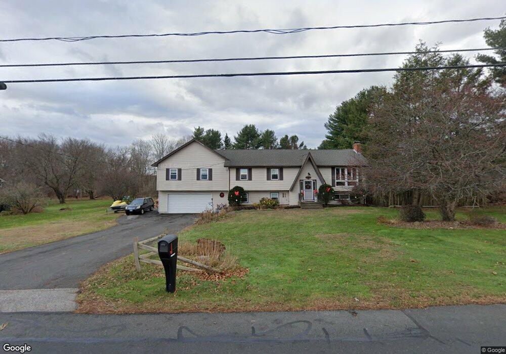
70 Swamp Rd Coventry, CT 06238
Estimated Value: $414,730 - $471,000
3
Beds
2
Baths
1,991
Sq Ft
$219/Sq Ft
Est. Value
About This Home
This home is located at 70 Swamp Rd, Coventry, CT 06238 and is currently estimated at $436,183, approximately $219 per square foot. 70 Swamp Rd is a home located in Tolland County with nearby schools including Coventry Grammar School, George Hersey Robertson School, and Capt. Nathan Hale School.
Ownership History
Date
Name
Owned For
Owner Type
Purchase Details
Closed on
Jun 1, 1992
Sold by
Holmes Scott
Bought by
Chasse Daniel and Chasse Jean
Current Estimated Value
Home Financials for this Owner
Home Financials are based on the most recent Mortgage that was taken out on this home.
Original Mortgage
$128,630
Interest Rate
8.7%
Mortgage Type
Unknown
Purchase Details
Closed on
Dec 7, 1989
Sold by
Bousquet Thomas
Bought by
Holmes Scott
Create a Home Valuation Report for This Property
The Home Valuation Report is an in-depth analysis detailing your home's value as well as a comparison with similar homes in the area
Home Values in the Area
Average Home Value in this Area
Purchase History
| Date | Buyer | Sale Price | Title Company |
|---|---|---|---|
| Chasse Daniel | $135,400 | -- | |
| Chasse Daniel | $135,400 | -- | |
| Holmes Scott | $156,000 | -- |
Source: Public Records
Mortgage History
| Date | Status | Borrower | Loan Amount |
|---|---|---|---|
| Open | Holmes Scott | $104,700 | |
| Closed | Holmes Scott | $125,000 | |
| Closed | Holmes Scott | $104,000 | |
| Closed | Holmes Scott | $128,630 |
Source: Public Records
Tax History Compared to Growth
Tax History
| Year | Tax Paid | Tax Assessment Tax Assessment Total Assessment is a certain percentage of the fair market value that is determined by local assessors to be the total taxable value of land and additions on the property. | Land | Improvement |
|---|---|---|---|---|
| 2025 | $7,007 | $294,900 | $47,900 | $247,000 |
| 2024 | $5,923 | $177,800 | $41,700 | $136,100 |
| 2023 | $5,643 | $177,800 | $41,700 | $136,100 |
| 2022 | $5,538 | $177,800 | $41,700 | $136,100 |
| 2021 | $5,538 | $177,800 | $41,700 | $136,100 |
| 2020 | $5,542 | $177,800 | $41,700 | $136,100 |
| 2019 | $5,725 | $177,800 | $41,700 | $136,100 |
| 2018 | $5,377 | $167,000 | $41,700 | $125,300 |
| 2017 | $5,344 | $167,000 | $41,700 | $125,300 |
| 2016 | $5,210 | $167,000 | $41,700 | $125,300 |
| 2015 | $5,398 | $173,000 | $41,700 | $131,300 |
| 2014 | $5,298 | $186,100 | $51,600 | $134,500 |
Source: Public Records
Map
Nearby Homes
- 0 Boston Turnpike Unit 24128587
- 125 Brewster St
- 54 Wolf Hill Rd Unit TBB
- 54 Wolf Hill (Lot#49) Rd
- 37 Wolf Hill Rd Unit Lot 40
- 37 Wolf Hill Lot (#40) Rd
- 395 Grant Hill (Mill Race Drive) Lot #21 Rd
- 395 Grant Hill Rd Unit Lot21
- 1230 Boston Turnpike
- 30 Tolland Rd
- 3224 South St
- 10 Lakeside Ln
- 0 Rr 6 Route Unit 24064143
- 53 Stonecroft Ln
- 0 Skinner Hill Rd Unit 24077239
- 141 Broad Way
- 676 Bolton Rd
- 864 Boston Turnpike
- 16 Pine Ridge Dr
- 1107 N River Rd
- 90 Swamp Rd
- 52 Swamp Rd
- 59 Northfield Rd
- 79 Northfield Rd
- 71 Swamp Rd
- 106 Swamp Rd
- 39 Northfield Rd
- 91 Northfield Rd
- 41 Swamp Rd
- 40 Swamp Rd
- 109 Northfield Rd
- 50 Northfield Rd
- 120 Swamp Rd
- 64 Northfield Rd
- 16 Swamp Rd
- 96 Northfield Rd
- 2229 Boston Turnpike
- 125 Northfield Rd
- 134 Swamp Rd
- 2255 Boston Turnpike