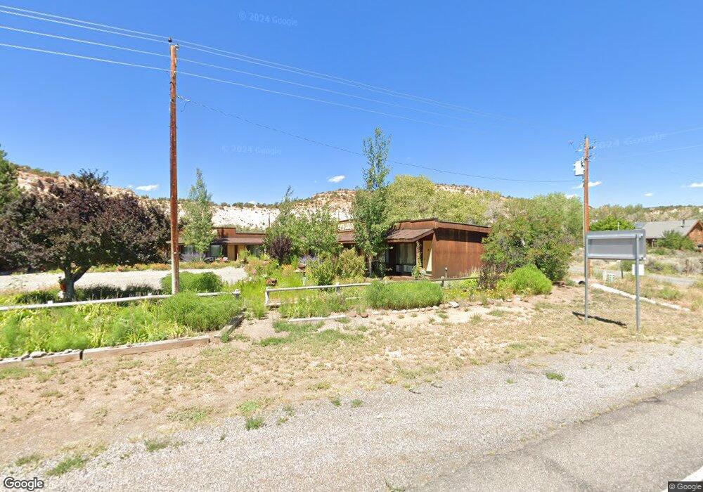
70 W 500 N Boulder, UT 84716
Estimated Value: $259,477 - $1,058,000
--
Bed
--
Bath
801
Sq Ft
$798/Sq Ft
Est. Value
About This Home
This home is located at 70 W 500 N, Boulder, UT 84716 and is currently estimated at $639,369, approximately $798 per square foot. 70 W 500 N is a home.
Create a Home Valuation Report for This Property
The Home Valuation Report is an in-depth analysis detailing your home's value as well as a comparison with similar homes in the area
Home Values in the Area
Average Home Value in this Area
Tax History Compared to Growth
Tax History
| Year | Tax Paid | Tax Assessment Tax Assessment Total Assessment is a certain percentage of the fair market value that is determined by local assessors to be the total taxable value of land and additions on the property. | Land | Improvement |
|---|---|---|---|---|
| 2025 | $959 | $140,555 | $33,450 | $107,105 |
| 2024 | $1,144 | $176,653 | $27,505 | $149,148 |
| 2023 | $735 | $96,682 | $23,814 | $72,868 |
| 2022 | $738 | $92,078 | $22,680 | $69,398 |
| 2021 | $798 | $92,078 | $22,680 | $69,398 |
| 2020 | $751 | $92,078 | $22,680 | $69,398 |
| 2019 | $757 | $92,078 | $22,680 | $69,398 |
| 2018 | $838 | $92,078 | $0 | $0 |
| 2017 | $598 | $72,609 | $0 | $0 |
| 2016 | $598 | $72,609 | $0 | $0 |
| 2015 | $490 | $57,610 | $0 | $0 |
| 2012 | $490 | $57,610 | $0 | $0 |
Source: Public Records
Map
Nearby Homes
- 30 N 400 E
- 1049 Utah 12
- 301 E 1600 S
- 2405 S Lower Boulder Rd
- 2606 S Lower Boulder Rd
- 2277 E Broken Branch West Dr Unit 28
- 1690 S Lower Boulder Rd
- 1345 S 1070 E
- 316 N Pinion Branch Dr N Unit 12B
- 1061 E Heritage Ln
- 416 E Main St
- 355 Utah 12
- 385 N 200 W
- 0 Parcel 11-002-0189 Highway 12
- 340 E 200 S
- 0 Parcel 11-0024-0189 Unit 25-264542
- 135 N 100 W
- 533 W 325 N
- 20 S 200 W
- 370 W 100 N
- 525 N Highway 12
- 585 N Highway 12
- 125 W 500 N
- 465 N Highway 12
- 425 N Highway 12
- 420 N Highway 12
- 375 N Highway 12
- 185 E 400 N
- 360 N 100 E
- 115 E 300 N
- 285 N Highway 12
- 110 W Schoolhouse Ledge Rd
- 225 E 400 N
- 120 E 300 N
- 732 N Boulder Creek Canyon Ln
- 90 W 200 N
- 225 N Highway 12
- 110 W 200 N
- 205 N Highway 12
- 235 N 200 E