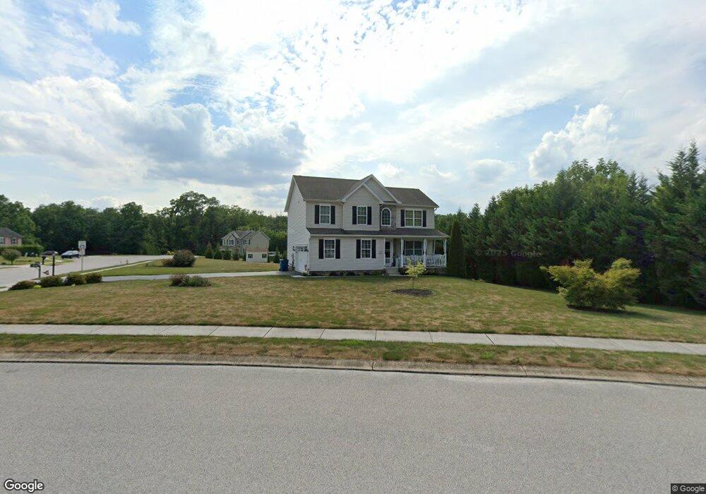
70 Wheat Dr Unit 46 Abbottstown, PA 17301
Estimated Value: $360,000 - $410,000
4
Beds
3
Baths
1,894
Sq Ft
$204/Sq Ft
Est. Value
About This Home
This home is located at 70 Wheat Dr Unit 46, Abbottstown, PA 17301 and is currently estimated at $386,650, approximately $204 per square foot. 70 Wheat Dr Unit 46 is a home located in York County with nearby schools including Spring Grove Area Middle School, Spring Grove Area High School, and Paradise School.
Ownership History
Date
Name
Owned For
Owner Type
Purchase Details
Closed on
Dec 16, 2024
Sold by
Templin Scott E and Templin Brenda K
Bought by
Templin Primary Residence And Asset Protector and Templin
Current Estimated Value
Purchase Details
Closed on
Apr 24, 2014
Sold by
Tg Meadows Lp
Bought by
Templin Scott E and Templin Brenda K
Home Financials for this Owner
Home Financials are based on the most recent Mortgage that was taken out on this home.
Original Mortgage
$183,480
Interest Rate
3.76%
Mortgage Type
Adjustable Rate Mortgage/ARM
Create a Home Valuation Report for This Property
The Home Valuation Report is an in-depth analysis detailing your home's value as well as a comparison with similar homes in the area
Home Values in the Area
Average Home Value in this Area
Purchase History
| Date | Buyer | Sale Price | Title Company |
|---|---|---|---|
| Templin Primary Residence And Asset Protector | -- | None Listed On Document | |
| Templin Primary Residence And Asset Protector | -- | None Listed On Document | |
| Templin Scott E | $229,351 | None Available |
Source: Public Records
Mortgage History
| Date | Status | Borrower | Loan Amount |
|---|---|---|---|
| Previous Owner | Templin Scott E | $183,480 |
Source: Public Records
Tax History
| Year | Tax Paid | Tax Assessment Tax Assessment Total Assessment is a certain percentage of the fair market value that is determined by local assessors to be the total taxable value of land and additions on the property. | Land | Improvement |
|---|---|---|---|---|
| 2025 | $7,134 | $213,900 | $51,430 | $162,470 |
| 2024 | $7,057 | $213,900 | $51,430 | $162,470 |
| 2023 | $6,818 | $206,670 | $51,430 | $155,240 |
| 2022 | $6,818 | $206,670 | $51,430 | $155,240 |
| 2021 | $6,524 | $206,670 | $51,430 | $155,240 |
| 2020 | $6,503 | $206,670 | $51,430 | $155,240 |
| 2019 | $6,363 | $206,670 | $51,430 | $155,240 |
| 2018 | $6,278 | $206,670 | $51,430 | $155,240 |
| 2017 | $6,133 | $206,670 | $51,430 | $155,240 |
| 2016 | $0 | $206,130 | $51,430 | $154,700 |
| 2015 | -- | $206,130 | $51,430 | $154,700 |
| 2014 | -- | $38,470 | $38,470 | $0 |
Source: Public Records
Map
Nearby Homes
- 104 Clover Run
- 7467 Saint Patrick Ct
- 7465 Saint Patrick Ct
- 7477 Saint Patrick Ct
- 7479 Saint Patrick Ct
- 7461 Saint Patrick Ct
- 7463 Saint Patrick Ct
- 7457 Saint Patrick Ct
- 7459 Saint Patrick Ct
- 206 Moulstown Rd
- 425 Ardmore Ln
- 51 Abbotts Dr Unit 50
- 334 Rolling Ln Unit 2
- 6152 Pigeon Hill Rd
- 201 Kinneman Rd Unit 25
- 221 Kinneman Rd Unit 28
- 267 Runaway Rd
- 290 Woods Rd Unit 1
- 278 Runaway Rd
- 5738 Pigeon Hill Rd
- 70 Wheat Dr
- 68 Wheat Dr Unit 50
- 71 Wheat Dr
- 76 Wheat Dr
- 76 Wheat Dr Unit 47
- 57 Wheat Dr
- 65 Wheat Dr Unit 73
- 65 Wheat Dr
- 78 Wheat Dr
- 78 Wheat Dr Unit 48
- 68 Wheat Dr
- 69 Wheat Dr
- 69 Wheat Dr Unit 74
- 7518 Lincoln Hwy
- 53 Wheat Dr Unit 71
- 53 Wheat Dr
- 74 Clover Run
- 51 Wheat Dr Unit 70
- 51 Wheat Dr
- 0 Lincoln Hwy
Your Personal Tour Guide
Ask me questions while you tour the home.