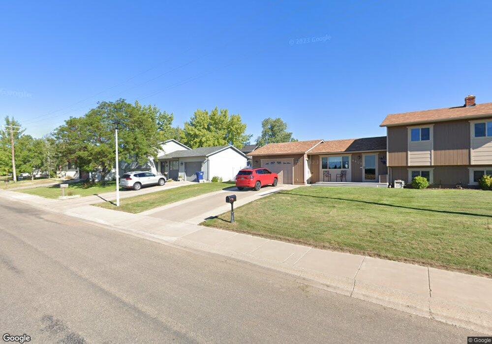
700 44th St N Great Falls, MT 59405
Estimated Value: $337,000 - $412,804
3
Beds
2
Baths
2,248
Sq Ft
$165/Sq Ft
Est. Value
About This Home
This home is located at 700 44th St N, Great Falls, MT 59405 and is currently estimated at $371,951, approximately $165 per square foot. 700 44th St N is a home located in Cascade County with nearby schools including Morningside School, East Middle School, and Great Falls High School.
Ownership History
Date
Name
Owned For
Owner Type
Purchase Details
Closed on
Jun 30, 2022
Sold by
Rand Tony E
Bought by
Whitmore William and Barnicoat Jami
Current Estimated Value
Purchase Details
Closed on
Feb 24, 2021
Sold by
Duncan Matthew G and Estate Of Leslie Duncan
Bought by
Rand Tony E and Rand Joan D
Home Financials for this Owner
Home Financials are based on the most recent Mortgage that was taken out on this home.
Original Mortgage
$146,000
Interest Rate
2.7%
Mortgage Type
Credit Line Revolving
Purchase Details
Closed on
Aug 1, 2005
Sold by
Steinmetz Irvin G and Steinmetz Cheri L
Bought by
Rand Tony E and Rand Joan D
Home Financials for this Owner
Home Financials are based on the most recent Mortgage that was taken out on this home.
Original Mortgage
$188,006
Interest Rate
5.48%
Mortgage Type
VA
Create a Home Valuation Report for This Property
The Home Valuation Report is an in-depth analysis detailing your home's value as well as a comparison with similar homes in the area
Home Values in the Area
Average Home Value in this Area
Purchase History
| Date | Buyer | Sale Price | Title Company |
|---|---|---|---|
| Whitmore William | -- | First American Title | |
| Rand Tony E | -- | Chicago Title | |
| Rand Tony E | -- | First American Title Company |
Source: Public Records
Mortgage History
| Date | Status | Borrower | Loan Amount |
|---|---|---|---|
| Previous Owner | Rand Tony E | $146,000 | |
| Previous Owner | Rand Tony E | $188,006 |
Source: Public Records
Tax History Compared to Growth
Tax History
| Year | Tax Paid | Tax Assessment Tax Assessment Total Assessment is a certain percentage of the fair market value that is determined by local assessors to be the total taxable value of land and additions on the property. | Land | Improvement |
|---|---|---|---|---|
| 2025 | $1,992 | $377,400 | $0 | $0 |
| 2024 | $3,537 | $333,500 | $0 | $0 |
| 2023 | $3,468 | $333,500 | $0 | $0 |
| 2022 | $3,766 | $330,200 | $0 | $0 |
| 2021 | $3,741 | $330,200 | $0 | $0 |
| 2020 | $3,323 | $280,400 | $0 | $0 |
| 2019 | $3,168 | $280,400 | $0 | $0 |
| 2018 | $3,069 | $267,100 | $0 | $0 |
| 2017 | $2,902 | $267,100 | $0 | $0 |
| 2016 | $2,382 | $228,400 | $0 | $0 |
| 2015 | $2,195 | $228,400 | $0 | $0 |
| 2014 | $2,289 | $113,155 | $0 | $0 |
Source: Public Records
Map
Nearby Homes
- 704 43rd St N
- 700 42a St N
- 4246 Morningside Cir
- 4158 Highwood Dr
- 4206 Morningside Cir
- 4112 6th Ave N
- 413 Beaverhead Ct
- 4901 7th Ave N
- 637 Pineridge Ct
- 415 Columbine Ct
- 3825 Vigilante Dr
- 3408 Vigilante Dr
- 5114 Silverwood Ct
- 3716 Fairway Dr
- 2108 52nd St N
- 3304 7th Ave N
- 4000 3rd Ave S
- 310 Carol Dr
- 5701 18th Ave N
- 4001 4th Ave S
