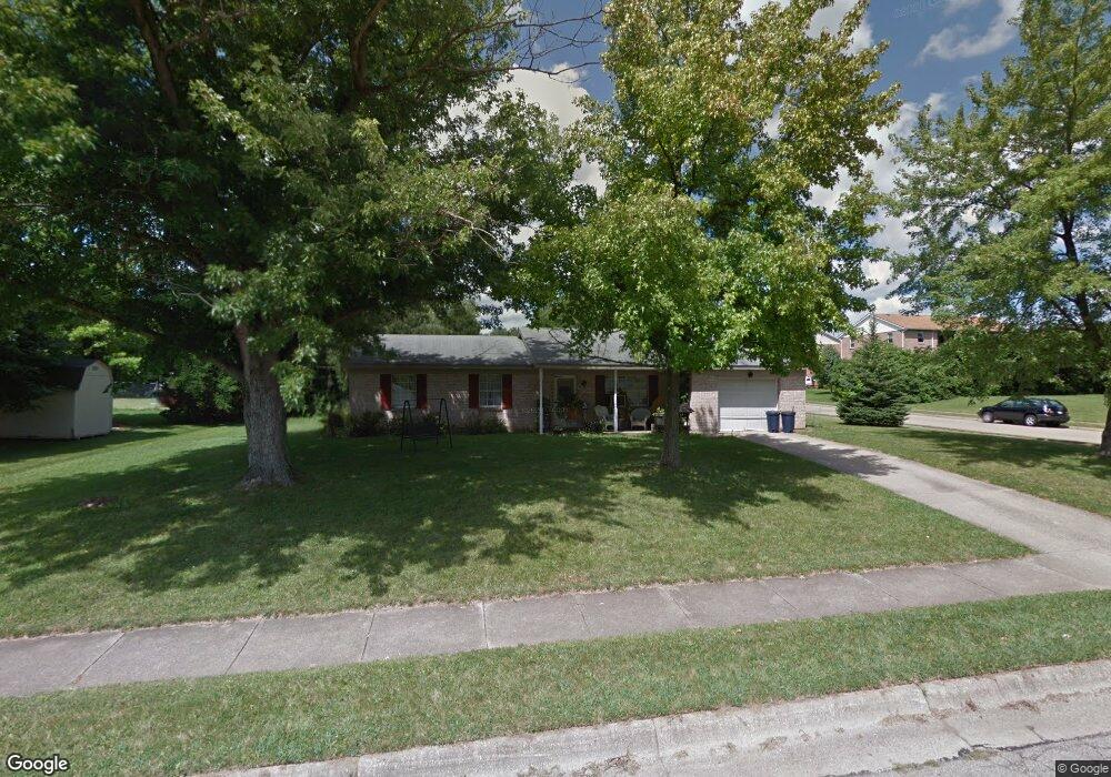
700 McGuffey Ave Oxford, OH 45056
Estimated Value: $233,000 - $270,000
3
Beds
2
Baths
1,422
Sq Ft
$173/Sq Ft
Est. Value
About This Home
This home is located at 700 McGuffey Ave, Oxford, OH 45056 and is currently estimated at $246,032, approximately $173 per square foot. 700 McGuffey Ave is a home located in Butler County with nearby schools including Talawanda Middle School, Talawanda High School, and Mcguffey Montessori School.
Ownership History
Date
Name
Owned For
Owner Type
Purchase Details
Closed on
Nov 23, 1998
Sold by
Franke Matthew D
Bought by
Franke Matthew D and Franke Dolores A
Current Estimated Value
Home Financials for this Owner
Home Financials are based on the most recent Mortgage that was taken out on this home.
Original Mortgage
$60,000
Interest Rate
6.8%
Mortgage Type
Purchase Money Mortgage
Create a Home Valuation Report for This Property
The Home Valuation Report is an in-depth analysis detailing your home's value as well as a comparison with similar homes in the area
Home Values in the Area
Average Home Value in this Area
Purchase History
| Date | Buyer | Sale Price | Title Company |
|---|---|---|---|
| Franke Matthew D | -- | -- |
Source: Public Records
Mortgage History
| Date | Status | Borrower | Loan Amount |
|---|---|---|---|
| Closed | Franke Matthew D | $60,000 |
Source: Public Records
Tax History Compared to Growth
Tax History
| Year | Tax Paid | Tax Assessment Tax Assessment Total Assessment is a certain percentage of the fair market value that is determined by local assessors to be the total taxable value of land and additions on the property. | Land | Improvement |
|---|---|---|---|---|
| 2024 | $2,353 | $62,250 | $12,690 | $49,560 |
| 2023 | $2,260 | $62,330 | $12,690 | $49,640 |
| 2022 | $1,913 | $48,020 | $12,690 | $35,330 |
| 2021 | $1,822 | $48,020 | $12,690 | $35,330 |
| 2020 | $1,906 | $48,020 | $12,690 | $35,330 |
| 2019 | $3,152 | $41,730 | $12,520 | $29,210 |
| 2018 | $1,746 | $41,730 | $12,520 | $29,210 |
| 2017 | $1,573 | $41,730 | $12,520 | $29,210 |
| 2016 | $1,522 | $39,080 | $12,520 | $26,560 |
| 2015 | $1,549 | $39,080 | $12,520 | $26,560 |
| 2014 | $1,724 | $39,080 | $12,520 | $26,560 |
| 2013 | $1,724 | $42,720 | $12,520 | $30,200 |
Source: Public Records
Map
Nearby Homes
- 616 Brill Dr
- 620 Brill Dr
- 446 Emerald Woods Dr
- 40 Charleston Dr Unit 4
- 715 W Chestnut St
- 6135 Fairfield Rd
- 1020 Tollgate Dr
- 108 Linwood Ln
- 6101 Contreras Rd
- 7 Robin Ct
- 509 White Oak Dr
- 114 Ardmore Dr
- 0 Dana Dr Unit 1860017
- 4215 Kehr Rd
- 215 N College Ave
- 1024 Arrowhead Dr
- 29 Gardenia Dr
- 812 Winding Brook Dr
- 108 W Vine St
- 6 Autumn Dr
- 607 Brill Dr
- 600 Brookview Ct
- 611 Brill Dr
- 604 Brookview Ct
- 701 McGuffey Ave
- 650 McGuffey Ave
- 717 McGuffey Ave
- 0 McGuffey Ave Unit 1489908
- 615 Brill Dr
- 608 Brookview Ct
- 612 Brookview Ct
- 619 Brill Dr
- 518 Brookview Ct
- 601 Brookview Ct
- 605 Brookview Ct
- 606 McGuffey Ave
- 801 McGuffey Ave Unit 801
- 616 Brookview Ct
- 604 McGuffey Ave
- 609 Brookview Ct